
Distance: 18.5 mi.
Elevation Gain: 5600 ft.
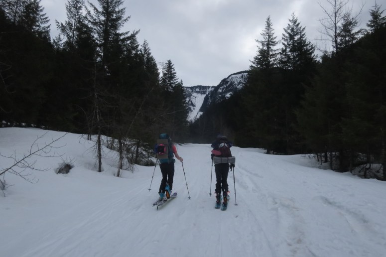
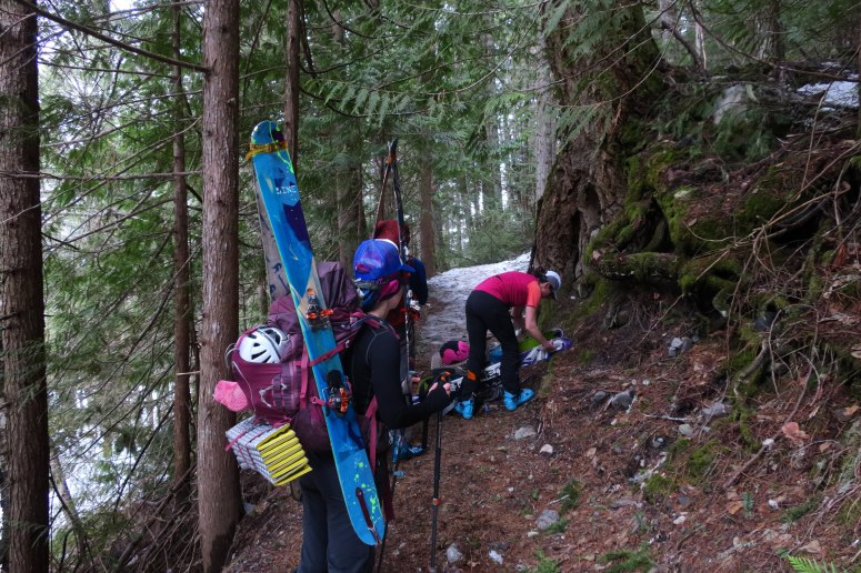
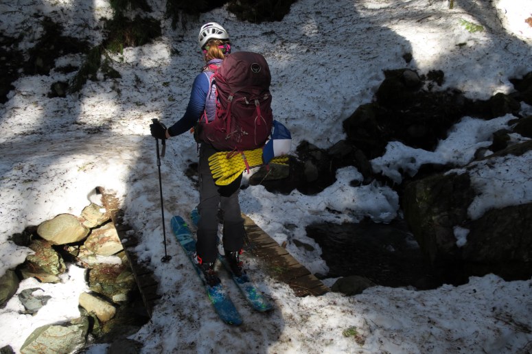
Our original plans to attempt the Garibaldi Neve Traverse were thwarted by a faulty phone alarm, but we still wanted to take advantage of the low avy danger in coastal British Columbia this weekend. First we called BC Parks for our backcountry permits ($10 per person + fees). We arrived at the Rubble Creek Parking lot around 11 AM and after some parking shenanigans in the snow, we started skinning up just before 12. Unfortunately we had about 2 km extra of skinning because a rental car was left abandoned in the middle of the road. (Why???) When we reached the trailhead, we realized that the snow had melted out at the bottom of the trail, so the skis went onto our backs for the next kilometer.
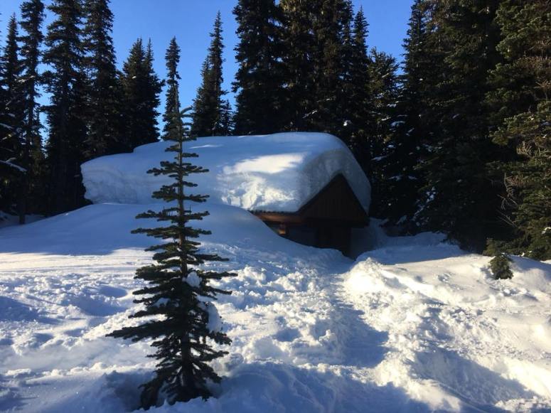
It was a rigorous uphill to Taylor Meadows at 4,500 feet over 8 miles. We were tickled pink by the cute little cabin at the campsite. Both the cabin and privy had just been shoveled out by the park rangers. Canadian hospitality at its best! We set up our tents in two areas that had recently been dug out, then made dinner and hot cocoa in the spacious cabin.
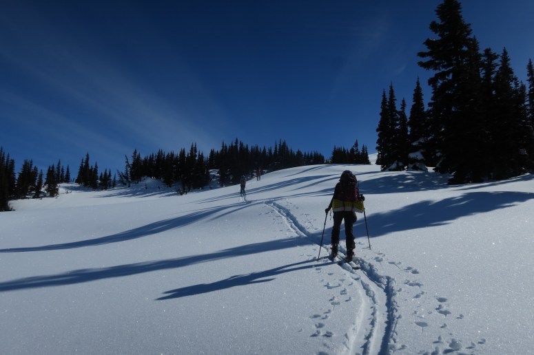
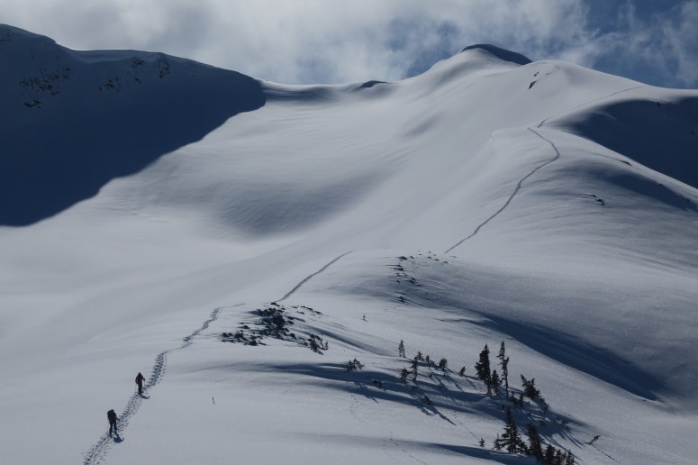
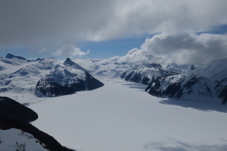
In the morning we recollected in the cabin, then started out for a ski tour at about 9 AM. We were able to follow a good boot track toward Garibaldi Lake but then broke off to the north to make our approach to Panorama Ridge. We took a really wide berth around the base of the ridge due to the cornices above, then curled east and then back south up the ridge. We reached our high point after 1500 ft of climbing at about 12:30 PM. The views from the ridge were absolutely spectacular. Garibaldi Lake covered in snow is a sight to see.
We chose a different route for our descent, heading south-southwest along some gentle slopes and then open trees. The snow was buttery soft while it lasted, but soon we had to skin up again in order to grab our gear at the Taylor Meadows campsite. We skinned for another 1 km below Taylor Meadows, and then took off skins when the trail steepened. We started our descent by going through the trees rather than along the trail, but it was crusty, brushy, side-slippy excitement, so when we met back up with the trail after cutting off a large switchback, we decided to continue down the trail itself the rest of the way. There wasn’t too much traffic on the trail, and it was thankfully wider than we had remembered. That said, it was stiff, chunky, and switchback-tastic. We of course had to carry our skis again at the bottom of the trail, but we had a smooth ride back down the road to the cars. We finished our day at 4:30 PM. By the way, the random rental car was gone!
(Download the free Gaia GPS app on your phone to view tracks and then get a Gaia GPS membership if you want offline access. Discount below!)

Recommended Brew: Howe Sound Megadestroyer Imperial Licorice Stout
Gear Used:
- Avalanche beacon/shovel/probe
- Backcountry boots/skis/skins
- Four-season tent
- Glacier glasses
- GPS
- Helmet
- Sleeping pad
- Stove
- Trekking poles
- Water drops/filter
- Whippet
- Winter sleeping bag
Post may contain affiliated links