
Guadalupe Peak
Distance: 8.4 mi.
Elevation Gain: 3,000 ft.
Carlsbad Caverns Loop
Distance: 1.3 mi.
Elevation Gain: negligible
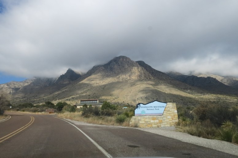
I had to travel to Amarillo, TX for work so I decided to fly to El Paso and make a quick trip to two southwest national parks I have been wanting to check out for a while. I ended up taking a Saturday night red eye to Houston and then getting an early morning flight to El Paso. Unfortunately this flight got delayed due to morning fog and it was about 10 AM before I was on the ground and got my rental car. I was finally at the trailhead for Guadalupe Peak around 11:45 AM, later than I was hoping if I was going to see both parks.
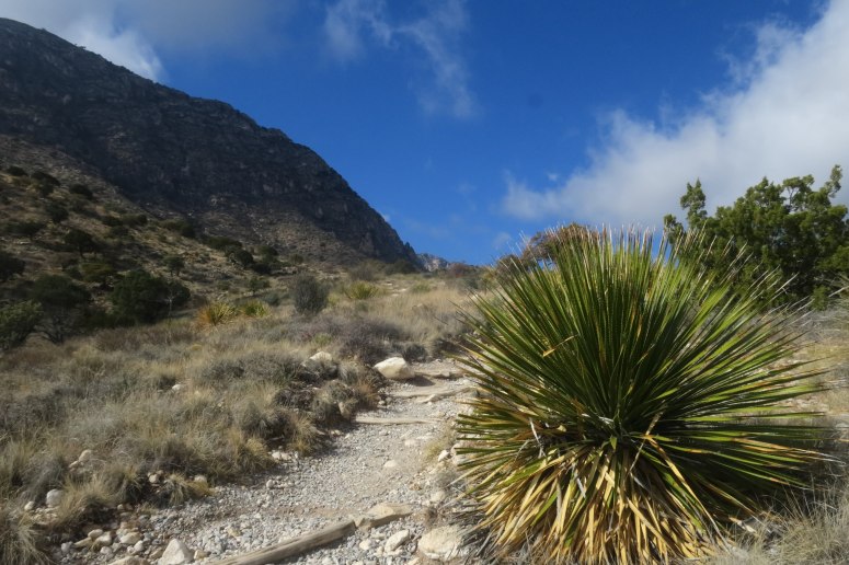
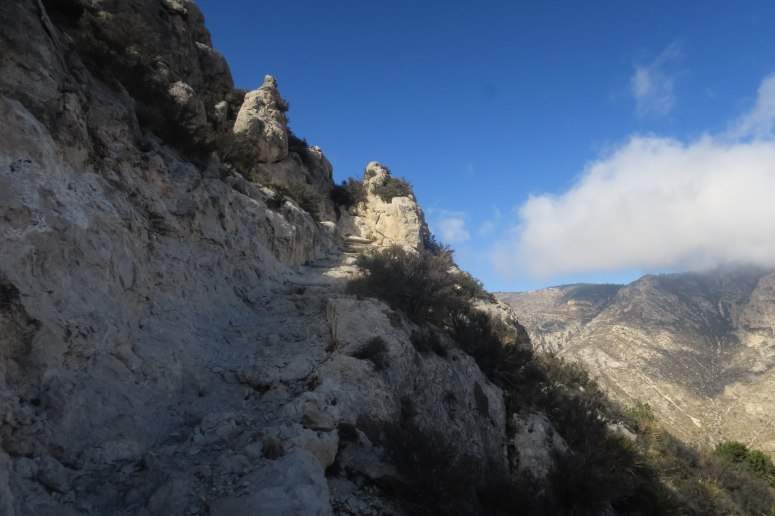
The weather was cool but comfortable; it was cloudy over the peaks but it was mostly sunny. I walked up the trail at a brisk pace, occasionally passing others as I made my way to the top. The hiker-only trail starts up at a pretty steep grade until it meets up with the stock trail again. It was still a pretty decent grade until crossing a steep area of trail cut into the hillside and then turning a corner before reaching the top of the east ridge.
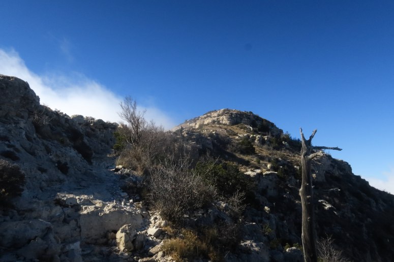
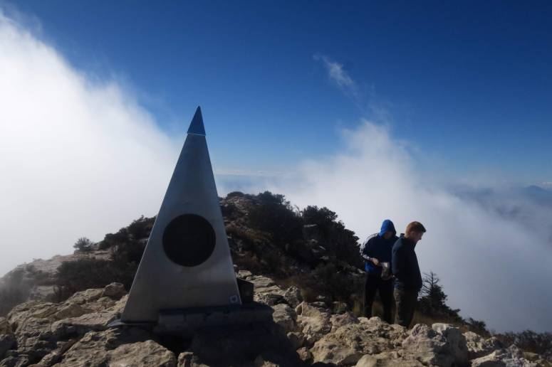
Around 8,000′ the trail emerges into a treed flattish area where there is a spur trail for the Guadalupe Peak campsite. The trail then traverses around a small sub peak and then descends slightly across the top of some cliffs before meeting the ridge again at a notch. From the notch the trail makes some switchbacks on both the north and south side of the ridge on its way to the summit. From here I was kind of in a cloud on the south side and in the clear on the north. I emerged at the top at 1:10 PM and took a lot of photos before sitting down to eat some snacks and chat with two guys from Virginia.
Final view up the ridge
The summit obelisk. Highest point in Texas.I then realized what time it was and realized I had to rush down the trail to get to Carlsbad Caverns in time to get access. From Sept. 4 to May 24 the visitor center is open until 5 PM but the last ticket for admission to the cave is sold at 3:15 PM (this year at least). I started down from the summit at 1:25 PM and made it back to the trailhead around 2:30. I drove possibly a little too fast to make it in time.
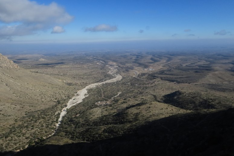
View to the East when heading back down.
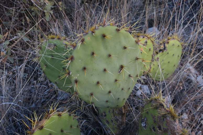
We don’t see these in Washington!I managed to get into the Carlsbad Caverns visitor center by 3:05 PM, just in time to get my ticket. The nice thing about showing up this late is that there were very few people still left in the caves. However, I wouldn’t get to hike the longer route all the way down from the surface entrance.
A park ranger gave me the safety instructions and sent me into an elevator. It felt weird to ride it down by myself and have it open into what looked like an empty cavern. I decided to just hike the main loop around the main cavern which is listed at 1.3 miles. The cavern is lighted in places but it is generally easy to see where you are stepping. There are slight inclines here and there but the overall grades are negligible.
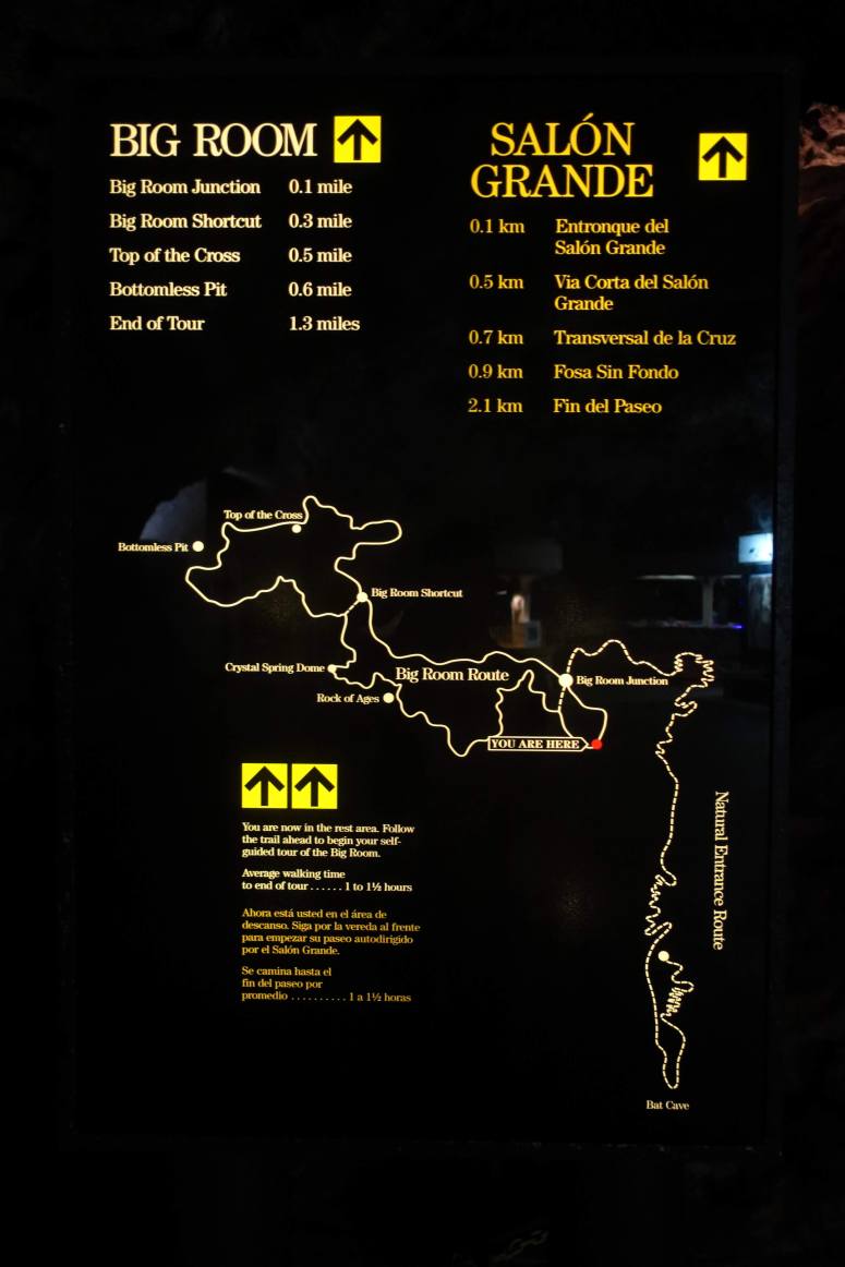
Carlsbad Caverns map
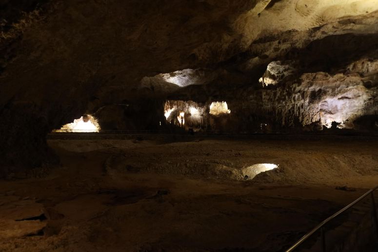
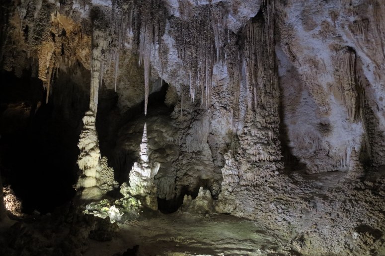
The Big Room!The train winds around the Big Room, the 5th largest cave chamber in North America and the 28th largest in the world. The limestone features are pretty amazing and there are many informative signs along the way. Staring into the Bottomless Pit (actually it is 140 feet deep) and the many giant stalactites in the main room.
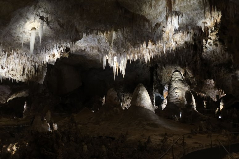
My favorite part of the Big Room
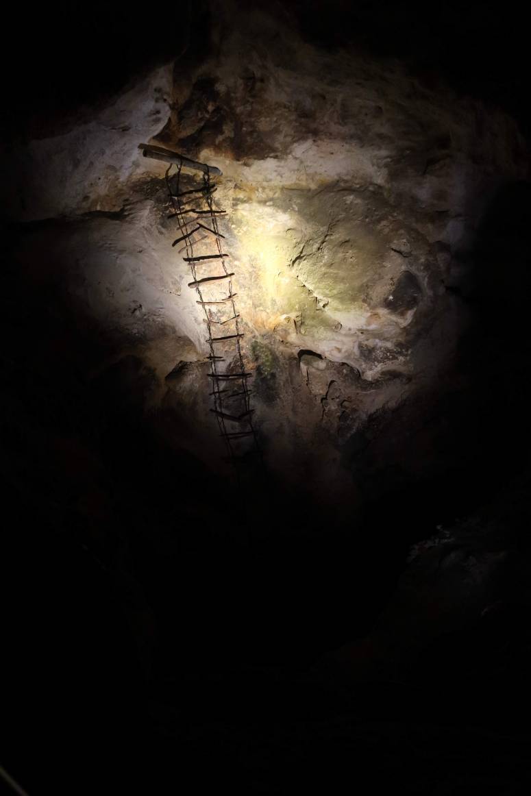
A historic ladder that descends to the lower caverns. The lower caves are not open to the public and are generally only accessed by researchers. I don’t think I would trust that ladder.
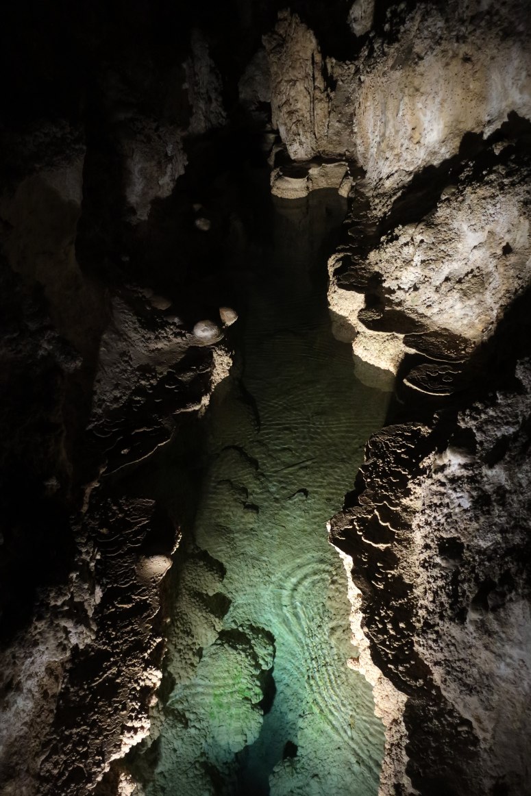
Some pretty mineral pools.
I spent about 45 minutes wandering around the Big Room before heading back to the surface. It was well worth the brief exploration. I would love to return to explore the rest of the caves and to see the bats flying out of the cave. I needed to drive on however and find a place to sleep on my journey to Amarillo. I made it to Roswell, NM and found a hotel. I managed not to get abducted by aliens and even enjoyed the evening chatting with the owners of the first brewery in town. A long but very entertaining day.
(Download the free Gaia GPS app on your phone to view tracks and then get a Gaia GPS membership if you want offline access. Discount below!)

Recommended brew: Black Cock Brewery American Blonde Ale
Gear Used:
- GPS
- Trail runners
Post may contain affiliated links