
Distance: 18.7 mi.
Elevation Gain: 10,200 ft.
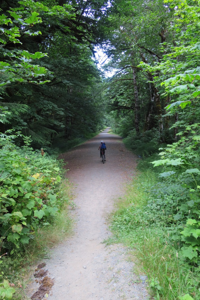
Due to the road washout we brought mountain bikes and walked/biked the 4.5 miles to the trailhead. We started biking at about 12 PM and reached the trailhead and stashed our bikes at 1:30 PM.
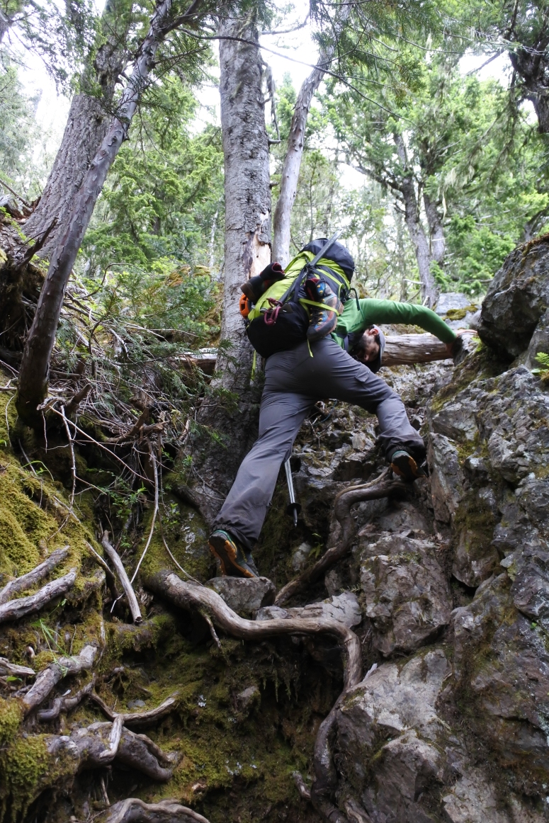
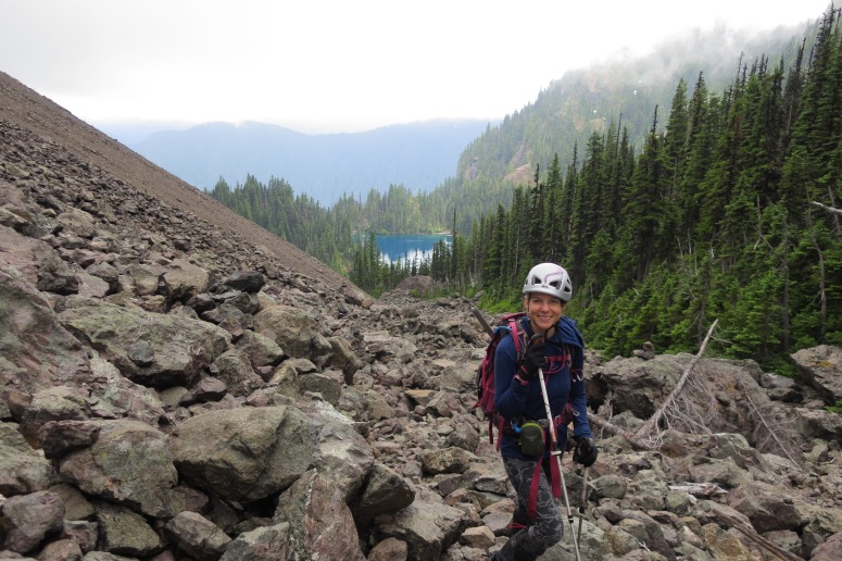
This trail is no joke! Over 3,000 feet gained in 2 miles. It reminded me a lot of southern Maine along the Appalachian Trail – lots of grabbing on roots and dirty rocks to pull yourself up on near-vertical trail. Mild scrambling required with high consequences if you were to fall. There were lots of downed trees, ripe berries, beautiful cascading waterfalls, and a few blooming wildflowers. The trail was challenging but filled me with a sense of adventure. Just don’t plan to move quickly.
We reached Lake Constance at 4:30 PM. The lake was snow-free and a breathtaking spot for camping, fishing, and relaxing. Bugs were a little annoying near the trailhead but nonexistent on the trail and at the lake.

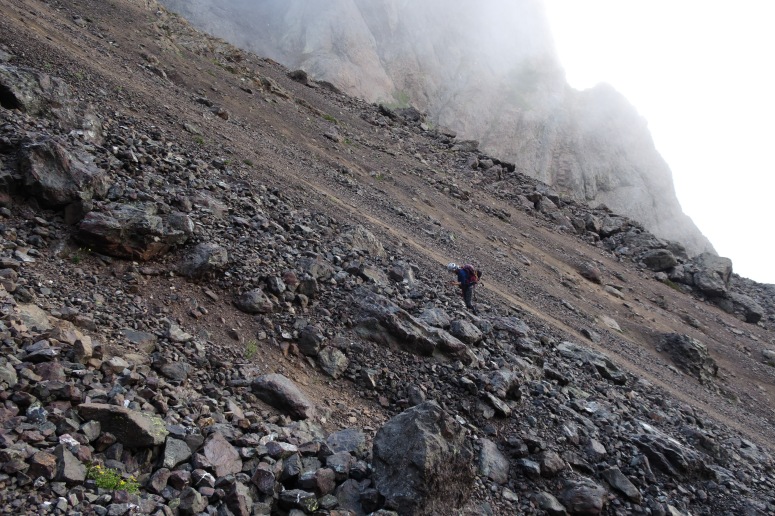
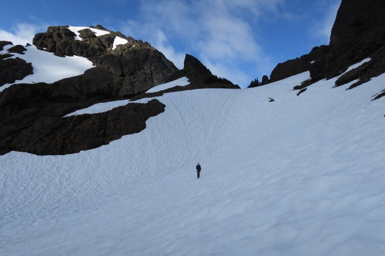
We knew we had a big day on day 2, so we got started at 6 AM. The morning was foggy but we were able to follow a faint boot path toward the summit. The trail started climber’s left (west) of the giant scree field above Lake Constance. We headed right (east) from Avalanche Canyon when we saw “Cats Ears” on the right. There wasn’t any good way up the steep scree slope, but we managed to slowly work our way to the notch above (one step forward, half step back the whole way). We reached the top of South Gully at 8:30 AM.
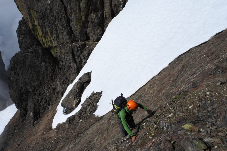
From here we put on crampons and traversed north around a buttress to the left. We followed cairns which took us up another scree slope. When we reached the notch, we put crampons back on to climb down a snow finger to continue north on the east side of the ridge.
Snow finger to continue north on the east side of the ridge
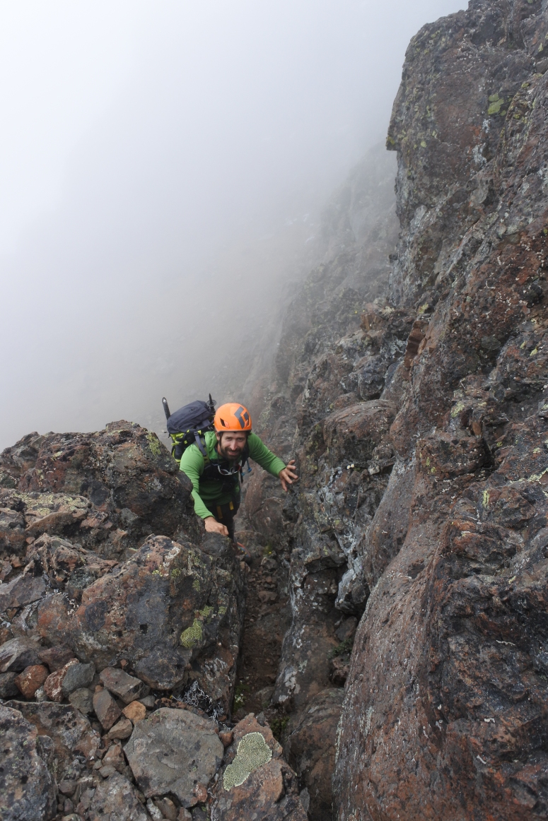
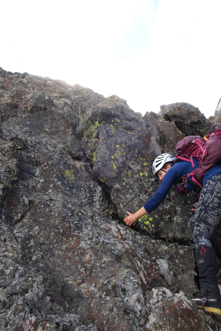
Next we got back on rock with a sketchy slab scramble.
Then back on snow to traverse a large snow bowl on the east side of the ridge, then (you guessed it) back on rock. We decided to skip the Finger Traverse on the east side of the ridge (which was half-covered in snow) and instead did the 3rd class scramble on the west side of the ridge.

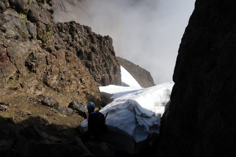
We crossed a final snow slope back on the east side of the ridge and then reached Key Ledge on the final ascent to the summit.
There was one more scree slope to climb, and then the boot path curled north, then west, then south to reach the actual summit block, which required a short 4th class scramble.
The summit was pretty small and the clouds started to roll in, so we didn’t stay long. We followed our same scree > snow field > 3rd class climb behind the Finger Traverse > snow field > slab scramble > snow field > scree > snow field > scree > Avalanche Canyon path back toward Lake Constance, where we had left our overnight gear. I’ve never taken crampons on and off so many times in my life. We reached Lake Constance at 4 PM.
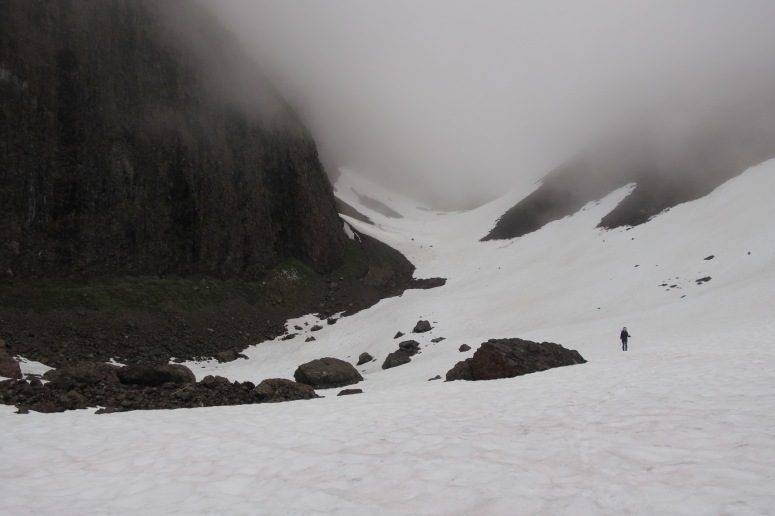
Lake Constance below
From here, we hiked back down to the trailhead which we reached by 7:30 PM, and then of course had the bike ride back out to the road. At least the ride out was a gentle downhill roll almost the whole way! We finished our day around 8:30 PM, taking full advantage of this long sunlight day.
(Download the free Gaia GPS app on your phone to view tracks and then get a Gaia GPS membership if you want offline access. Discount below!)

Recommended Brew: Duchesse de Bourgogne by Brouwerij Verhaeghe (enjoyed at Tizley’s Europub in Poulsbo)
Gear Used:
- Backpacking tent
- Fishing pole
- Gaiters
- Glacier glasses
- GPS
- Helmet
- Mountain bike
- Mountaineering boots
- Sleeping pad
- Steel crampons
- Steel ice axe
- Summer sleeping bag
- Stove
- Trekking poles
- Water drops/filter
Post may contain affiliated links