
Distance: 10.6 mi.
Elevation Gain: 4622 ft.
I had previously been up Mt. McLoughlin in Southern Oregon twice, once in June with lots of snow and once in November with almost no snow. The first time, in June, I didn’t even know how to ski but ascended the peak in what would have been amazing ski conditions, and the second occasion, in November, I had my skis in the car and really wanted to use them despite the fact there was no snow. These previous two ascents had me pining to return and complete the ski descent of the beautiful volcano.
I talked Rodrigo into making the long trip with me and we worked out how we could both leave mid-day on Friday, with me participating in a work meeting on my iPad as we drove through Portland. We of course had to deal with some traffic but made decent time on our way to Medford, where we stopped at Opposition Brewing for some beers and some tri tip from the food truck that evening. We stopped at a local grocery store and grabbed some terrible breakfast and energy/coffee drinks for the morning and drove up to the snopark (we grabbed a snopark pass for $4 in Medford too). The drive up there felt so short and easy compared to anything that approaches the mountains in Washington. We arrived to see the area generally snowless and did a little scouting up the trail before sleeping in the back of Rodrigo’s car.
We woke up at 5:00 and were heading up the bare trail with skis on our backs at 5:30. We followed the PCT up from the snow park for probably a mile and a half before we were able to transition to skis and skin over a thin layer of snow for another half mile or so where we eventually followed some skin tracks off of the trail to the northwest. We followed various ridges toward the mountain until we reached the east ridge.
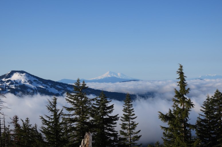
Morning views of Mt. Shasta were quite good
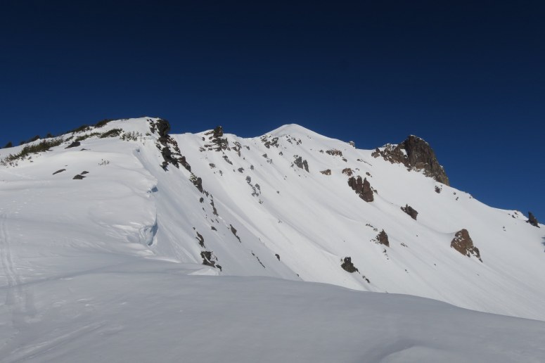
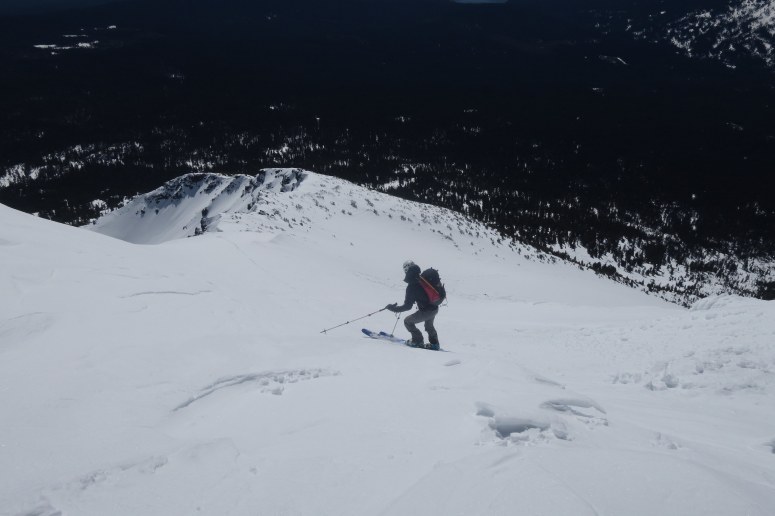
View to the summit from the East Ridge
We continued skinning up the ridge, but it was quite icy and we had to make a track that was less steep than the existing skin tracks we were following. We made it to about 9,000′ before we decided we had to carry the skis again. The snow was softening up a bit but it just wasn’t worth it at this point. At this point we also saw another guy (the only person we saw all day besides two older fellows that started about when we did) skiing off the summit and doing some loud icy sounding turns. It seemed a bit early yet and we were hopeful we would get the goods.
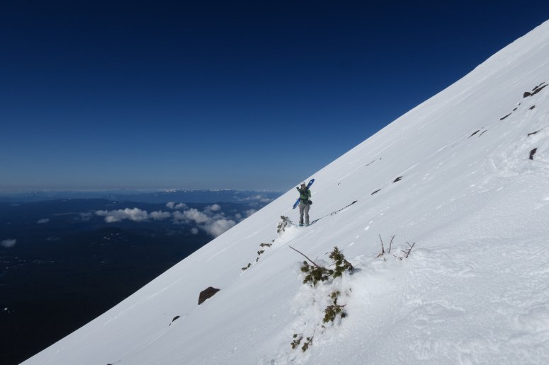
Rodrigo getting ready to carry skis up the final slope
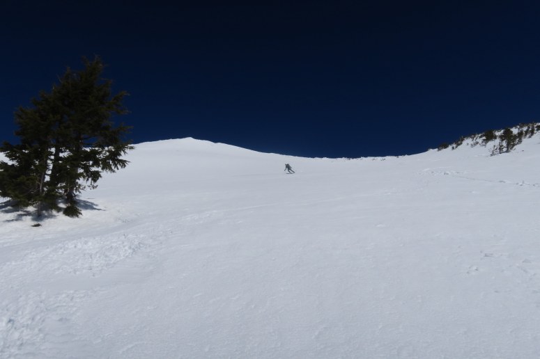
We made our way to the top around 9:45, had some snacks and waited for the corn. By about 10:15 though we decided we were starting to get cold and we should just go down and it would probably be good.
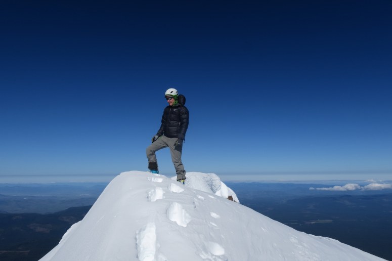
On top!
The first few turns off the top were indeed a bit icy but a few hundred feet down the slope turned into perfect corn. From about 9,200′ to 6,200′ we had a blast zooming down probably the best sustained run I have ever skied. Part way down we had decided that we were going to go down as far as we could on the good stuff and pay the price with whatever bushwhack or ski carry we had to do at the end. It definitely paid off but we definitely also paid that price.
Rodrigo’s first few turns off of the summit
Rodrigo harvesting some sweet corn!
After some tricky skiing through thin snow and downed trees, we ended up having to carry our skis down for about 2 miles through even thinner snow, even more downed trees, and over some loose volcano rocks. It was slow going but we eventually emerged back on highway 140 about a half mile west of the snopark. We made the snow hot hike back to the car and relaxed for a bit.
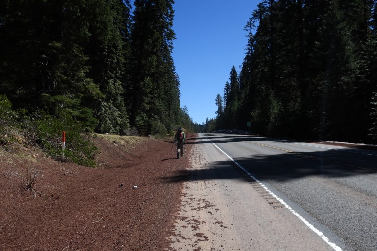
Hiking along Highway 140
We packed up and made our way north to bend to visit lots of breweries to complete the day. We had dinner at Deschutes, headed over to Immersion Brewing for dessert, then to our favorite Crux Fermentation Project for second dinner (just more beer), and then up to Silver Moon for a night cap before retiring at Bend’s finest, the Econo Lodge. A great day out with superfriend and an amazing ski!
(Download the free Gaia GPS app on your phone to view tracks and then get a Gaia GPS membership if you want offline access. Discount below!)

Recommended Brew: Crux In The Pocket
Gear Used:
- Backcountry skis
- Helmet
- Poles
- Avy Gear
- Brought crampons but didn’t need
Post may contain affiliated links