
Distance: 24.8 mi.
Elevation Gain: 11,400 ft.
After waiting for a better forecast and not getting it, I ended up abandoning plans to climb in the north cascades and decided my best shot to enjoy some fine weather in the mountains was to head east to the Wallowa Mountains in northeastern Oregon. This is an area I have wanted to explore for years, but hadn’t yet made it to. On top of that, these are some of the highest peaks in all of Oregon (one of them the Matterhorn!) and I could climb my namesake Craig Mountain.
I managed to work remotely on Friday and slowly worked my way east out of the Seattle area during the day avoiding any traffic. After finishing my work I booked it to the tri-cities where I enjoyed some dinner at Ice Harbor Brewing Company in Kennewick. I then drove the rest of the way along pretty remote roads to arrive at the trailhead around 10:30PM. Having hopped myself up on coffee for the drive, I had some trouble getting to sleep in the back of the car.
I took it easy in the morning, enjoying some donuts and coffee I had purchased for the morning. I eventually started hiking around 7 and quickly made it to the trail split where I stayed right on the Chief Joseph trail, which traverses the hillside at just above 5100′ for a while. I eventually left the trail following the path of someone’s GPS track that I found on peakbagger, but I didn’t like the terrain it was taking me toward so I kept right until I ended up back on the trail. I then followed the trail further until it reached a switchback just below 6,400′, following some other tracks I found on peakbagger. There were lots of little way trails through here but I generally continued southwest until I ended up in an obvious gully with a climbers path that would take me to the east ridge of Chief Joseph Mountain, on generally unpleasant loose rock. I trended to the right when I had options, but it may have been easier to take the most direct route to the ridge, as travel was a little easier once on the ridge.
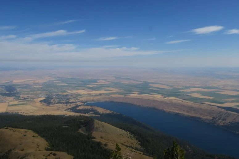
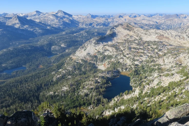
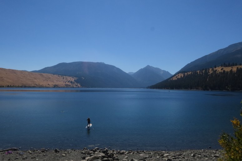
The ridge travel was straightforward but tiring, as I rose above 9000′ and there was some lingering smoke from the southern Oregon fires (which cleared throughout the day). I then made my way up to the peak where I enjoyed views back down to Wallowa Lake and the town of Joseph. I took a good break here as I had done the biggest chunk of elevation for the day. I could see most of my other objectives for the day from here as well.
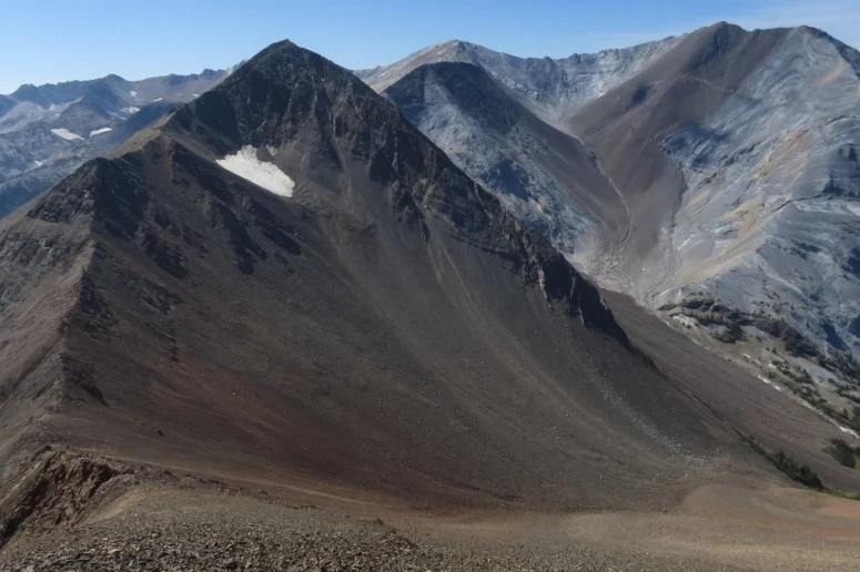
After some snacks, I dropped down the south ridge of Chief Joseph to head toward Hurwal Divide. I had to bypass one small point on pretty steep southwest facing slopes but following different climbers paths got me through with some care. Up and over one other small bump and I was heading up the north ridge of the divide. I saw a few goats here and the views were improving as the smoke moved out. I ate my lunch at the top.
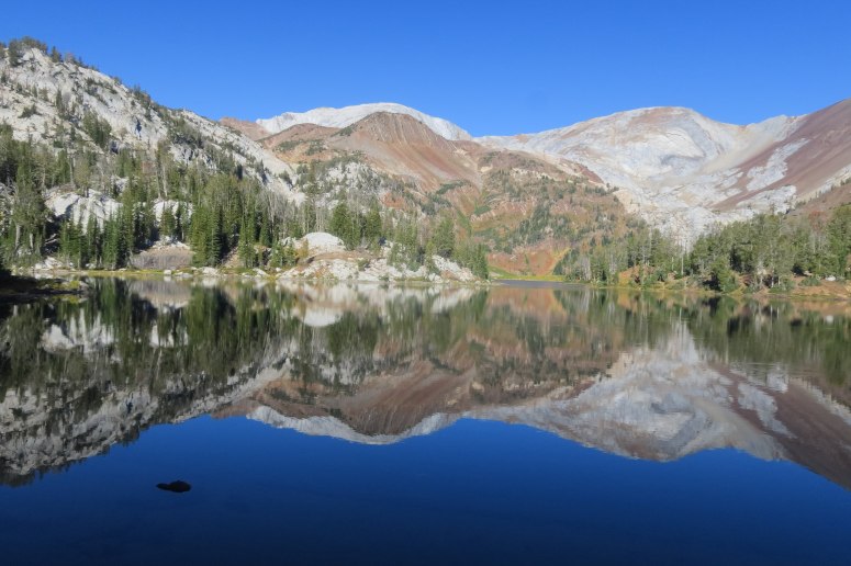
From here I followed a pretty obvious climber path right along the ridge to the south. This peak is an utter pile of garbage rock, but staying on the ridge was not too bad. Eventually however the ridge ends and you have to drop to the southwest to get to what is called Hurwal Divide Southwest. Its the same garbage rock, but the ridge is steeper here. This little subpeak does offer some great views down to Ice Lake however.

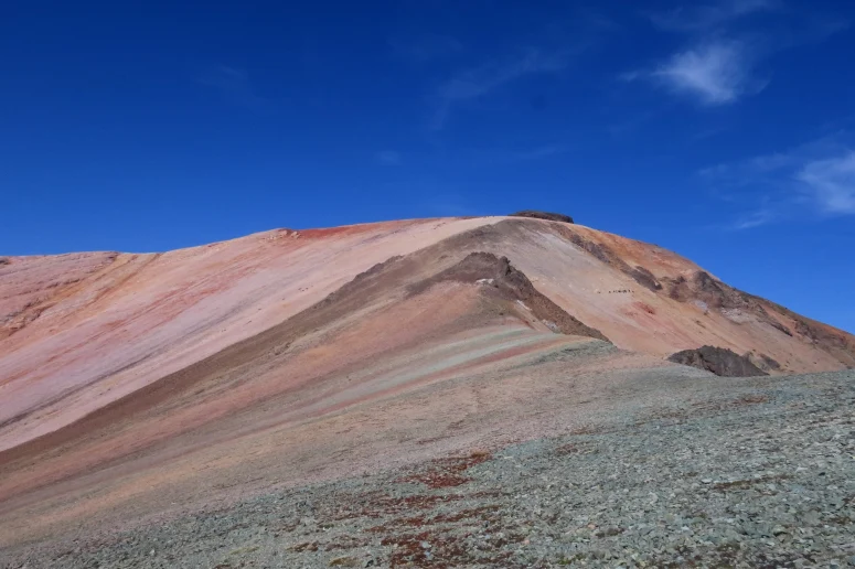
Then I did the gradual descent down to the low point before pt. 9775. This is where the strange slabby marble rock begins. It is surprisingly soft and is piled up like kitty litter in places, but it is very gritty and easy slab walking when not covered in sand.
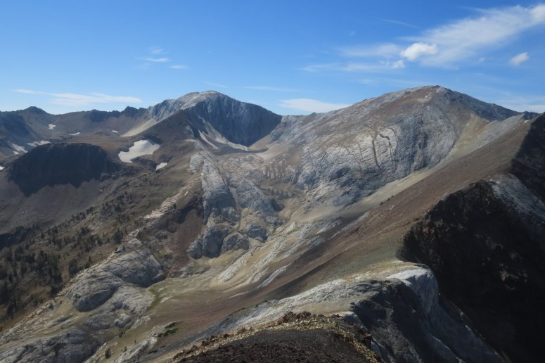
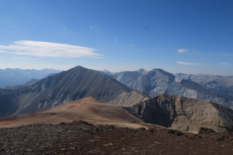
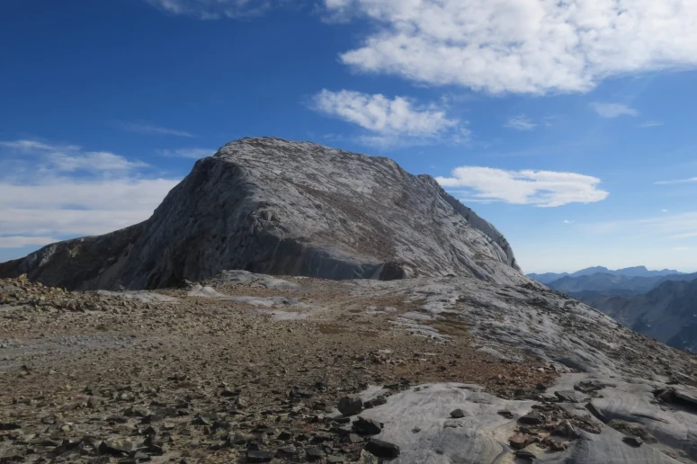
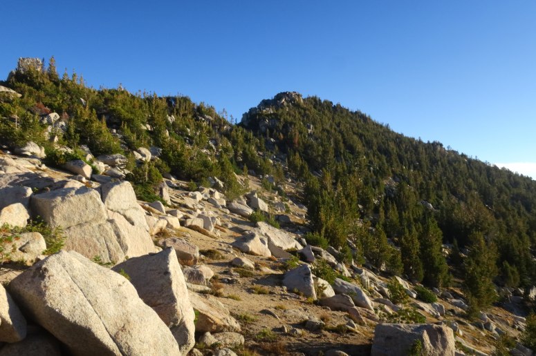
Once on pt. 9775 I could see the whole ridge over to Sacajawea Peak, the high point of the Wallawas. This was the most challenging travel of the trip, as there were several towers and gullies of this strange rock to get across. I generally found that staying as high on the ridge as possible was best, with several traverses along the west side to get around the steepest bits. There were usually some nice ledges to traverse when needed. Eventually you get back onto some of the crappy orange scree and then you are at the summit. I saw another goat here too!
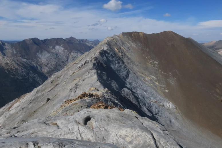
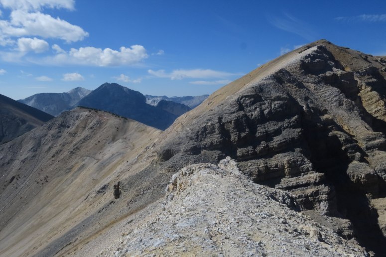
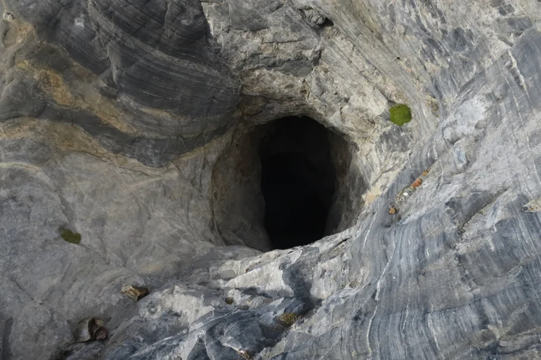
I backtracked along the ridge to pt 9775 and then descended again to get to the Matterhorn. This is pretty much entirely on the slabby gray rock and at the low point of the ridge there was a huge vertical cave that was pretty intimidating to look down. Then I had to slab walk up the ridge to the top. The peak doesn’t really seem like a horn in any way. It probably looks much steeper from the southwest.
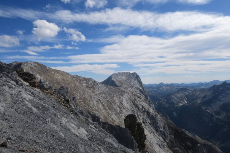
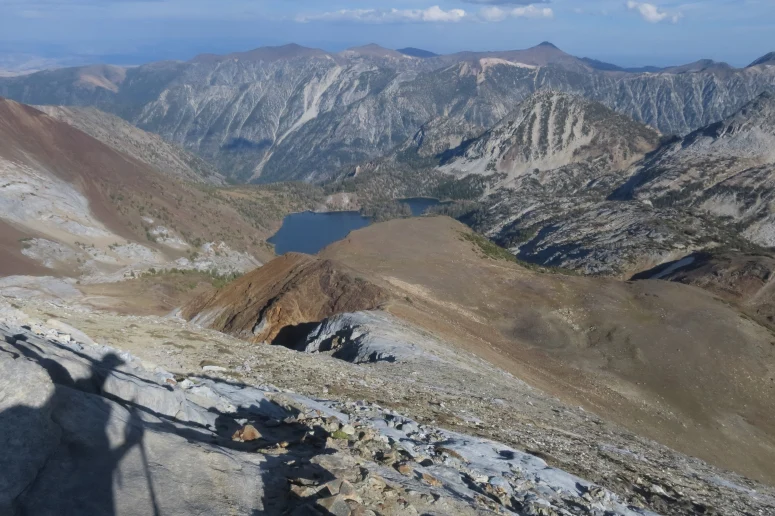
From the summit I followed a climbers trail to the east that descends to Ice Lake, which was pretty easy to follow. I finally made it to the lake at around 5:30 PM. I hadn’t seen a single person until this point and all of a sudden it seemed like they were everywhere.
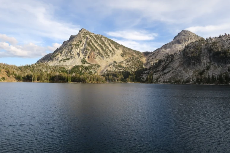
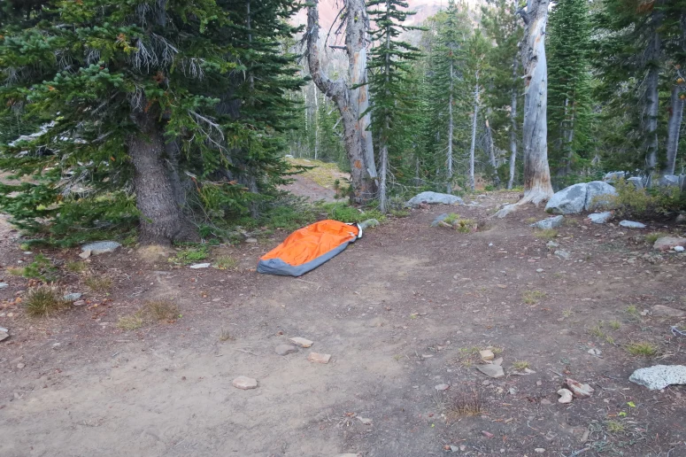
I made my way around the lake and set up camp on the peninsula on the east side of the lake. There are lots of campsites here and probably always lots of people on summer weekends. I washed up a bit in the lake, enjoyed a huge dinner and a beer and passed out. The stars were pretty amazing.
I woke up with first light, since I had already slept 8 hours, and cooked some breakfast. I was ready to summit the mighty Craig Mountain at 6:30 AM. It is really not very far over to the peak. It was interesting to find the rock was mostly granite over here. Quite the contrast to everything I had encountered the day before. I stayed to the left of the creek that goes up to the west of Craig Mt. and then headed straight up the ridge when possible. I eventually realized that I was better off dropping to the south side of the ridge because there were fewer trees. I worked my way up through whatever openings I could find and found myself at the summit in just under an hour from camp.

I quickly backtracked to the pass and decided I had enough time to go up what is called Razzberry Peak on peakbagger, just to the west of Craig Mountain. Razzberry was probably the most enjoyable of all the peaks I ascended on this trip. It is mostly a big pile of large granite boulders and required some real class 3 scrambling. I traversed around it slightly to ascend the north side to the summit, but it looked like you could go several different ways. I backtracked my way back down and then followed the gully between the two peaks back down to the lake. I traversed back around the lake and made it back to camp right at 9 AM. I quickly packed up camp and booked it down the trail in an effort to enjoy the afternoon and do all the driving before dark.
I managed to make it back to the car at about 11:45 AM and drove to the north end of Wallowa Lake, where I took a bit of time to clean up. I wanted to stop at Terminal Gravity Brewing in Enterprise, and it was totally worth the stop as I had some delicious food and beer. After relaxing for a good amount of time I finally hit the road again and made it back to Seattle before dark and without incident. A great trip overall, but I would love to go back and explore the Wallowas more…maybe on skis!
(Download the free Gaia GPS app on your phone to view tracks and then get a Gaia GPS membership if you want offline access. Discount below!)

Recommended brew: Three Magnets Keep It Like Vic Secret
Gear Used:
- Bivy
- GPS
- Helmet
- Sleeping pad
- Summer sleeping bag
- Stove
- Trail runners
- Trekking poles
- Water drops/filter
Post may contain affiliated links
Heading to Eagle Cap Wilderness on Saturday (8-28-21) and want to top the high peaks you mentioned around Ice Lake. Will be staying for 5 nights, so plenty of time for that and more. Last summer, my first visit to the wilderness, I hiked up the ridge from the Raz Lake valley, opposite side you went up to bag Craig Mtn. We may have treaded the same ground along the ridge top. I was hoping to follow it all the way to Matterhorn, but it got progressively tougher and I ran out of time. Still don’t know if it’s a doable non-technical climb. I’ll be hiking from the Hurricane Creek Trailhead to Thorp Creek and up that drainage to access the high country.
I have loved the Wallowas the two times I have been there. I only went as far west as Razzberry Mt. It looks like the next ‘peak’ to the west is unofficially called Rogue Mt. and it looks like the ridge between the two could be narrow and tricky in places. It looks like some places along the south ridge of Matterhorn could be tricky too but I would imagine you could drop off the ridge a little ways and find a traverse that would go. I would love to hear if you could pull it off or if you have any other fun recommendations for whenever I get back there.