
Distance: 5.6 mi.
Elevation Gain: 3500 ft.
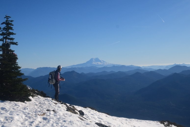
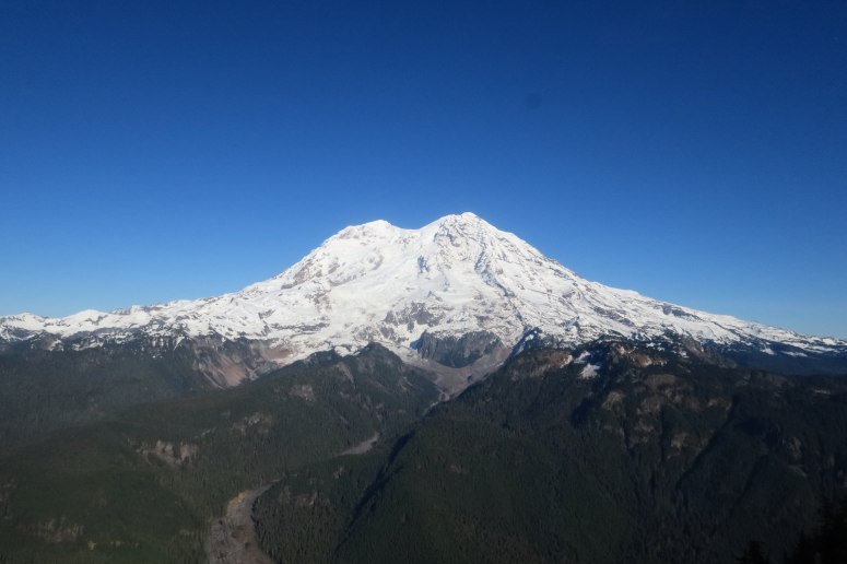
We were pleasantly surprised to learn that November in Washington State was going to deliver a perfect, sunny weekend. We decided to take a trip up Mount Wow, which is equally renowned for its obnoxious bushwhacking and incredible views of Rainier.
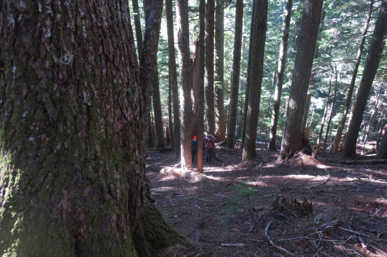
We left Seattle at 7 AM, not too worried about daylight on this sub-6 mile trip. We couldn’t make it all the way to the trailhead due to deep potholes, but only had to walk a little over a half mile or so up the road (we parked right next to a small, mossy cascade). We started walking just before 10 AM. Once we reached the end of the ‘drivable road’ before it crosses the creek, we took a spur road to the left that passes through a rock slide area before entering a tunnel of alder. Nothing too difficult here and we eventually reached what looked like the end of this road and we found some flagging and a small path down to the creek. The creek would have been easy to ford, but we decided to get across using slippery rocks and/or an overhanging log. Both sides of the creek were very brushy (including some devil’s club!), but luckily at this time of year the leaves had fallen off and it was pretty easy to make our way through.
The forest on the east side of Goat Creek was pretty open, but with quite a few slippery downed logs. More than anything, the extremely steep ascent slowed us down. As we reached the ridge, we curled farther left (north). There were several patches of snow starting at 5,000 feet, but mostly avoidable.
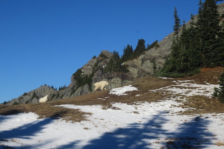
We reached a small rock band that was easy to work through (going up and right), then found the largest cache of goat poop I’ve ever seen in Washington…and that’s saying something. Before long, we figured out why. We saw at least 16 goats in the upper slopes, although they all kept their distance from us.
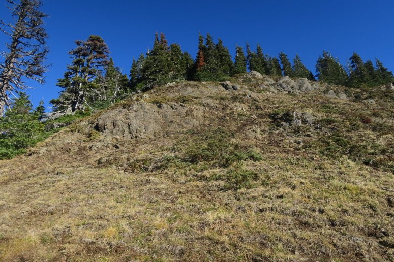
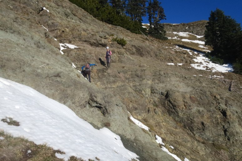
After traversing around the east side of the false summit, we reached a second rock band that we had to scramble traverse to the right. This was a little tricky, especially with scant snow on the rocks. This brought us to a final steep, open grassy slope. The upper half of this slope was fully covered in snow. As advertised, the views in all directions were jaw-dropping from the summit! Thanks to the late season hike, the atmosphere was scrubbed clean besides some of the smoke from California fires we could see to the south by Mount Hood.
We had lunch on top and were in no rush until Craig informed us that it was already 2 PM. It had taken us almost 4 hours to go less than 3 miles and ~3500 feet uphill! We quickly headed back down, going much more quickly downhill. It would be easy to get turned around in this forest, and you’ll probably feel better if you have a track to follow. The duff was steep and slippery on the way down, but no one had a serious tumble. We managed to find a more direct route over the creek and quickly reached the road to find our way back out. We finished at 4 PM.
(Download the free Gaia GPS app on your phone to view tracks and then get a Gaia GPS membership if you want offline access. Discount below!)

Recommended brew: Pizza Port Brewing Sharkbite Red Ale
Gear Used:
- Gaiters
- Glacier glasses
- GPS
- Helmet
- Hiking boots (Rachael and Vanessa)/Mountaineering boots (Craig)
- Microspikes (not used)
- Trekking poles
Post may contain affiliated links