
Distance: 6.0 mi.
Elevation Gain: 3000 ft.
We had stayed at the Mountaineers Baker Lodge the night before ($39-59 pp incl. dinner and breakfast + help with chores) so we were able to get to the trailhead early. Due to recent snow, we couldn’t drive the Honda Fit above the Yellow Aster Butte trailhead (at the privy). So we parked there and hiked the rest of the road on foot.
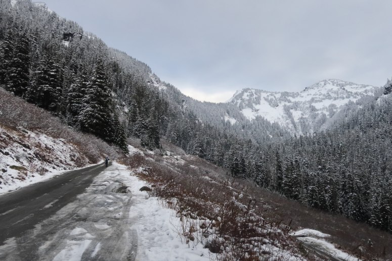
We got started at 9:45 AM. On the way we passed several giant all wheel drive vehicles that also couldn’t make it up the slippery snow, so I think we made a good choice. By about 5,000 feet, we put on our snowshoes since the road was icy. We did see an ATV and a few snowmobiles that successfully made it to the Twin Lakes trailhead.

When we reached Twin Lakes at 11:15 AM, we found ourselves in thigh-deep powder (and wishing we had brought skis). We had lunch and then headed around the southwest side of the lakes toward the outlet stream. We had to downclimb a bit to the stream and rock-hop across, which was easy with low water levels. On the other side of the creek, we climbed up a steep, icy bank that we managed to avoid on the way back by crossing a smidge further south. We were following skin and snowshoe tracks from the previous day, which took us north/northwest up the southern slope of Winchester. The avy conditions were low risk, and this slope was well treed.
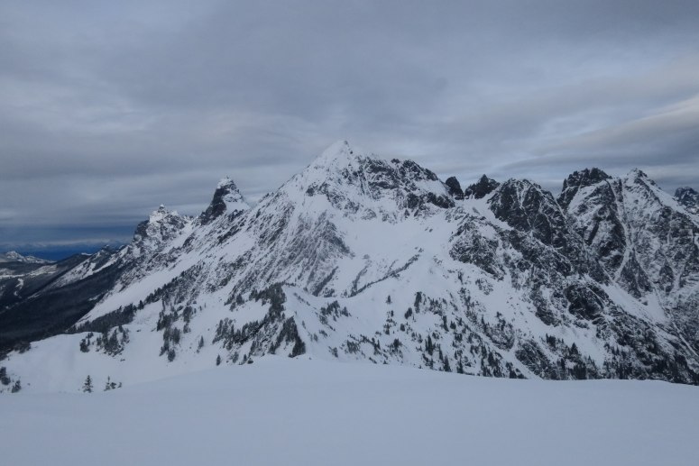
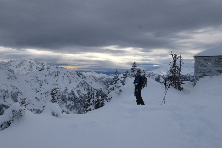
As we ascended, we eventually had to go east or west around some cliffs below the 6200′ south sub peak of Winchester. We traversed north on the west side of this sub-peak, crossing a narrow gully, and then climbing the steep but somewhat treed western slope. We briefly had to cross some open slopes to get to the notch between the two peaks, where the summer trail ascends. From here we had to traverse northward across some more open slopes, but this got us to the west side of the summit, where we were able to follow the ridge to the lookout tower. The tower was closed for the winter, and it was awfully windy up top. There were also multiple storm clouds bearing down on us, so we turned around quickly.
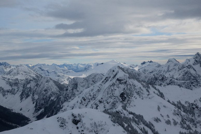
Not wanting to push our luck with the impending storm, we retraced our tracks back out. There were some beautiful ski lines back down the southeast slope. We made it back to Twin Lakes at 1:45 PM and back to the car at 2:40 PM, before the storm arrived.
(Download the free Gaia GPS app on your phone to view tracks and then get a Gaia GPS membership if you want offline access. Discount below!)

Recommended brew: Crux In the Pocket Barrel-Aged Saison
Gear Used:
- Aluminum ice axe (brought but not used)
- Avalanche beacon/shovel/probe
- Gaiters
- Glacier glasses
- GPS
- Helmet
- Hiking boots (Vanessa)
- Mountaineering boots (Craig)
- Snowshoes
- Trekking poles
Post may contain affiliated links