
Distance: 10.9 mi.
Elevation Gain: 5000 ft.
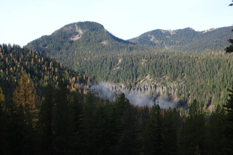
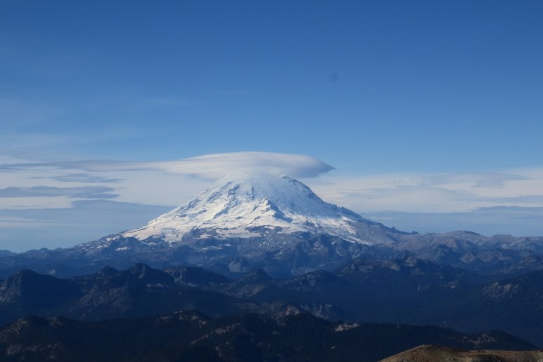
We had to leave Seattle early to beat the rainstorms at this far-fetched destination. Craig has had his eye on this peak for quite some time because it’s the 3rd highest mountain in a long stretch from the Goat Rocks in the south to the Enchantment and Steven’s Pass to the north (Rainier and Daniel are higher). We drove through Chinook Pass, which had lovely alpenglow views of Mount Rainier, and arrived at the Mount Aix trailhead just after 9 AM. We saw about 10 hunters on the drive and immediately realized that we should have worn brighter colors. The climate here was drier than the western Cascades, and we were surprised to find a lot of lower-elevation larches in their prime.
The beginning of the trail was wide and deceptively steep. Farther up trail there were several minor blowdowns and partial washouts, but overall it was in pretty good condition. When we got above treeline, it was windy as heck! We turned right (southeast) at the Nelson Ridge trail split and headed east toward the peak.
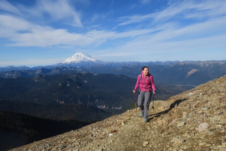
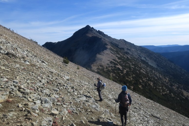
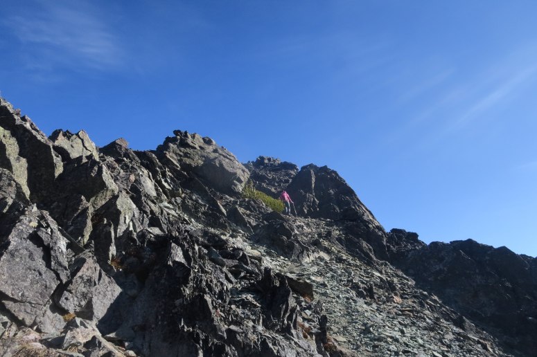
From here we had a few small ups and downs before reaching the climber’s trail to the summit of Mount Aix. There is a hiker’s trail that wraps around the backside of the peak, but we took the much more direct climber’s route. It had some steep scree and 2nd class scrambling.
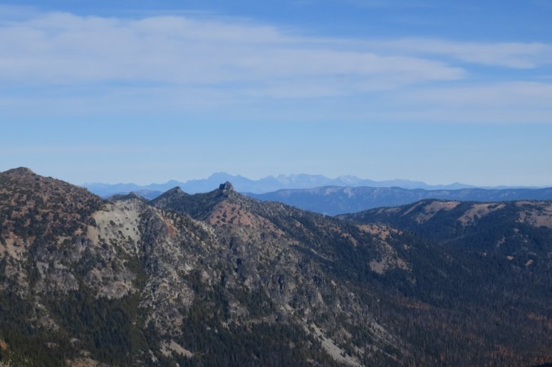
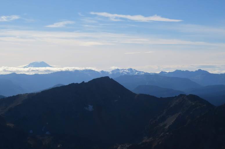
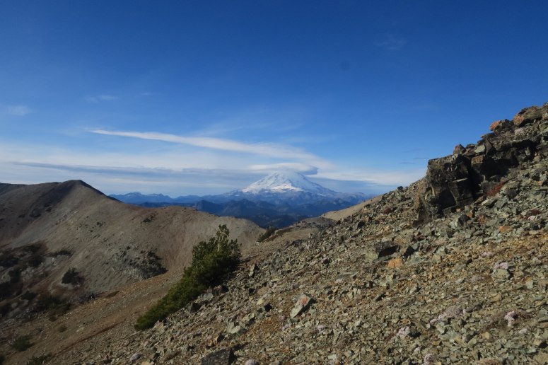
Luckily it was warmer on the summit than the slope below, so we had a long lunch while watching the clouds gather around Mount Rainier (unnervingly quickly, I might add). We decided it was in our best interest not to dilly dally, even though the forecast didn’t call for rain until 5 PM. We reached the trailhead at about 3 PM, and shortly after it started raining…hard. We were patting ourselves on the back for waking up so early, and celebrated with some pub fare at Rainier Bar and Grill in Enumclaw. All in all, it was a great last (?) day of our hiking season!
(Download the free Gaia GPS app on your phone to view tracks and then get a Gaia GPS membership if you want offline access. Discount below!)

Recommended brew: Three Magnets Brewing Kinda Bonkers IPA
Gear Used:
- GPS
- Helmet (didn’t bring but could have come in handy)
- Hiking boots (Craig)
- Microspikes (brought but not used)
- Trail runners (Vanessa, Rachael, Melissa)
- Trekking poles
Post may contain affiliated links