Distance: 18.1 mi.
Elevation Gain: 8650 ft.
We were lucky that our friends Trevor and Brad were able to get to the Marblemount Ranger Station the day before our trip to grab the last available camping permits for Saturday night (highly competitive and can only be obtained via walk-in on the day of or day before your overnight stay). According to the North Cascades NP Wilderness Planning map, this campsite now requires a bear canister for food, though I don’t remember that being a requirement when we did the trip. This is undoubtedly to prevent goats and rodents from being fed, rather than bears. We never left food unattended at camp regardless.
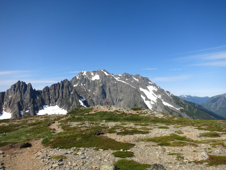
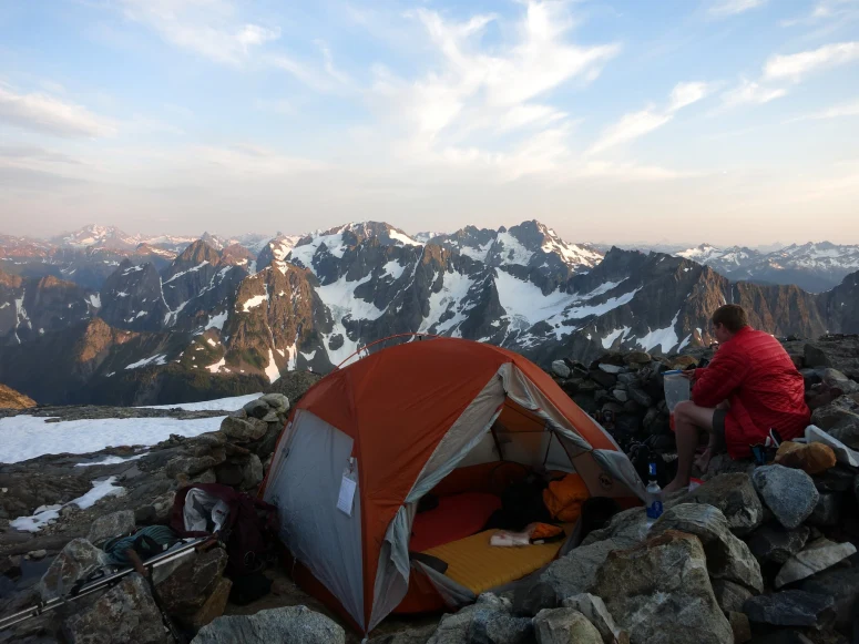
We started from the Cascade Pass trailhead at 6:45 AM and followed countless switchbacks toward Cascade Pass. This is a family friendly hike and we saw some younger kids. The pass itself had some mosquitoes, the only area we were bothered by them on our hike. At the trail split at Cascade Pass we went left (northeast) toward Sahale Arm. We reached the Sahale Glacier Camp at 11 AM and set up tents. Vanessa had a killer headache so she stayed to nap while Trevor, Brad, and I continued on toward Mount Buckner.
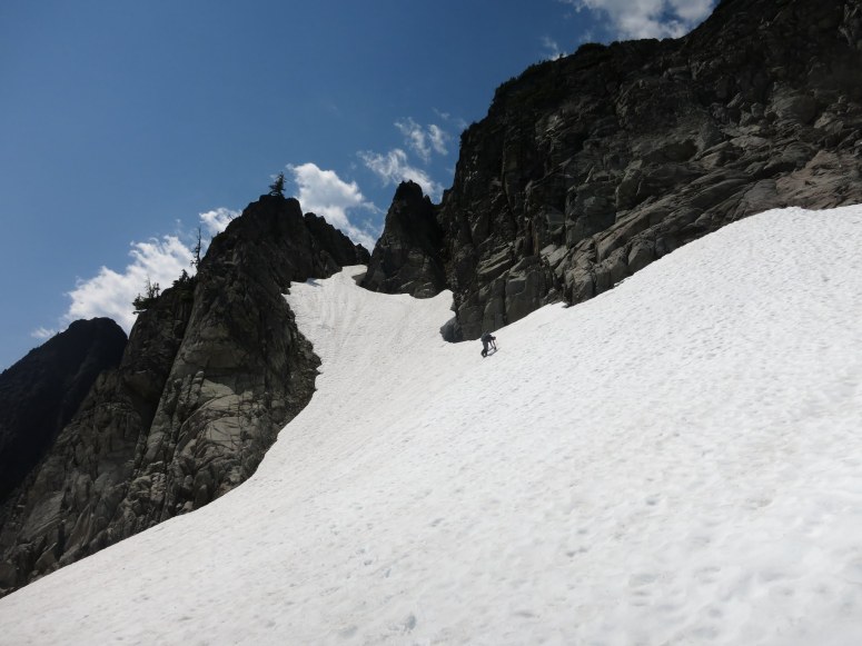
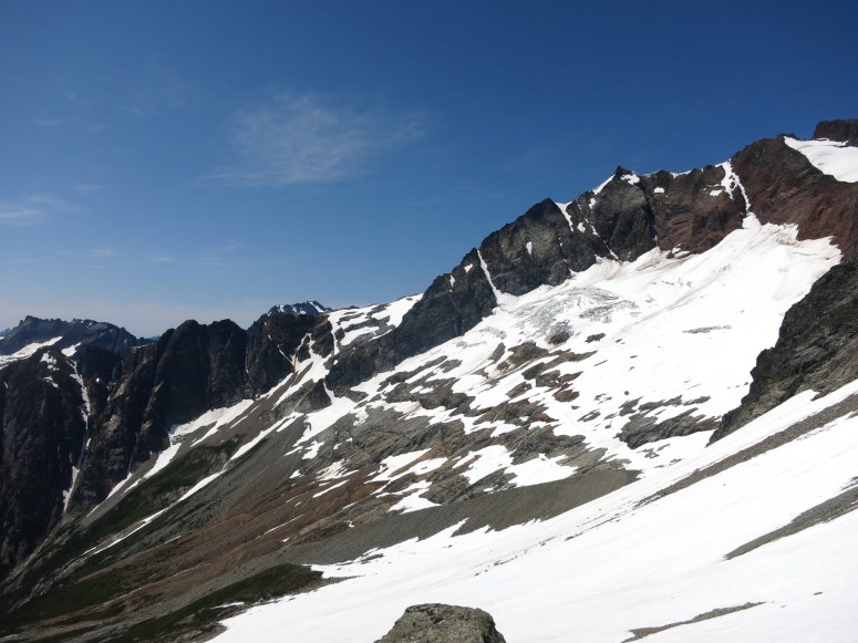
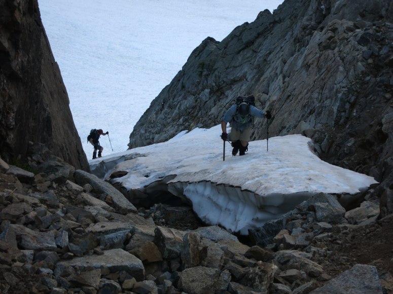
At noon we left camp and headed east until we met the SE ridge of Sahale. We followed snow down this until the ridge became more defined. We did some easy scrambling down the ridge, but eventually things got a little steeper. We had to work our way back and forth down the ridge, but nothing harder than class 3. Eventually we reached a little snow finger on the left that looked easy enough to get down and joined up with the main snowfield in Horseshoe Basin. Later in the year you could likely continue farther down the the ridge to gain easier slopes.
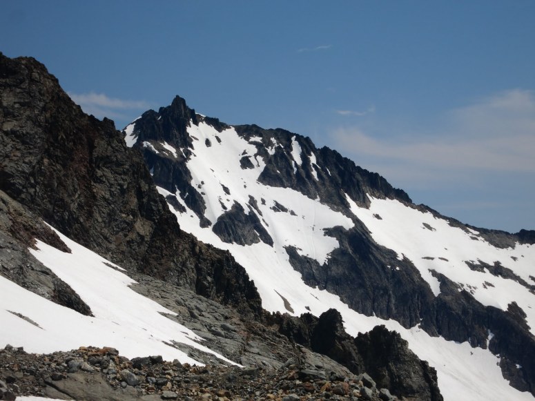
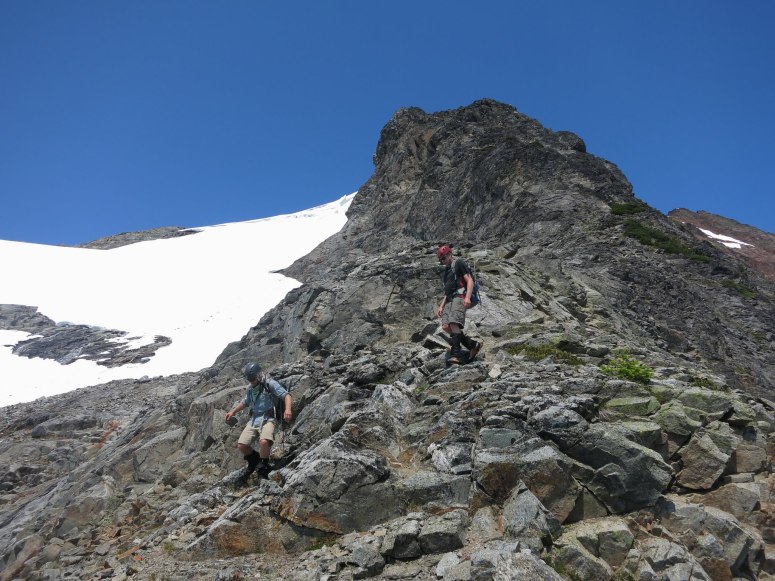
Once in Horseshoe Basin we had pretty easy snow travel. We could see most of the route ahead of us and were able to just aim for the lowest angle snow covered terrain. The slopes gradually steepened but it never got steeper than 35 degrees. We reached the south ridge at the top of the snowfield around 8800′. From there we had to do some easy but loose class 3 scrambling to the top, which we reached around 3 PM.
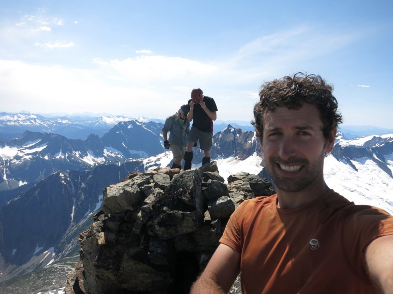
We enjoyed a nice break on the summit and ate some food. Here I had one of my more memorable summit moments as I spent a long time trying to find my Nutella filled tortilla I was eating, only to find out I had somehow sat on it. After realizing my error and finding that most of the Nutella had squished out onto my shorts, I decided to remove them and make sure I consumed those much needed calories. Brad and Trevor found this an amusing version of Bart Simpson’s “Eat My Shorts!”. It was totally worth it.
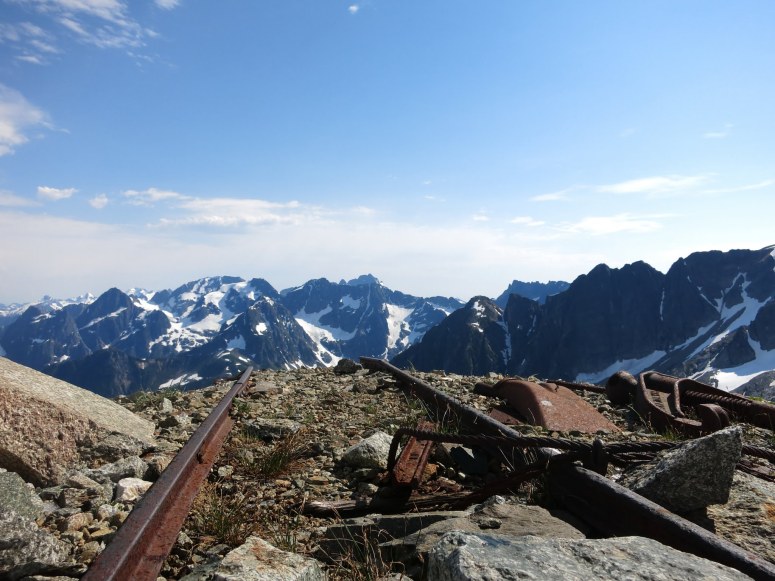
After half an hour on top we decided we should make our way back to camp. We retraced our scramble back to the snowfield and then strategically picked a route down the face to maximize our glissading. We stayed a bit higher on the traverse across the basin to visit some old mine remnants. I had read about some of the mining in the basin and it was pretty easy to spot where they were based on some decent tailing piles.
As a result we did end up staying a bit too high at one point and getting above some slabby wet areas. We did a quick back track to follow our ascent route. We then made it back to the snow finger that took us back to the ridge that would take us to our camp. The final ascent was slow going, as we were quite tired. We made it to camp by about 6:20 PM.
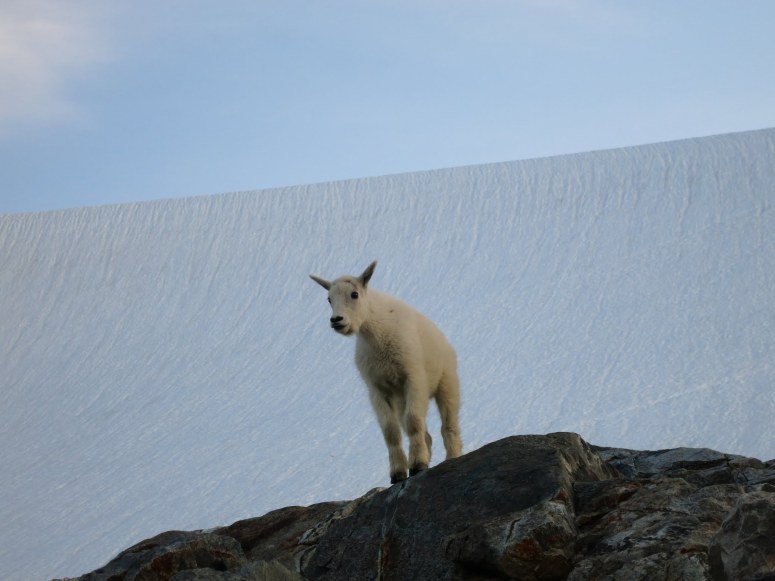
This was one of the best campsites we’ve experienced in Washington State. There were some cool goats hanging around and waiting for us to pee on stuff. And the privy, totally open to air, may have had the best view of all.
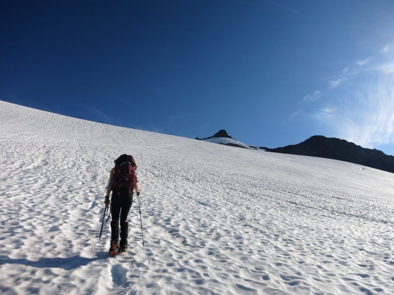
The next morning we weren’t in any rush to get started since we knew none of the other campers we had talked to were planning to go up Sahale Peak that day. We started up Sahale Glacier around 8 AM. There weren’t any obvious crevasses on our route so we elected not to rope up, but that’s a judgement call. I’ve heard that in late season there can actually be some.
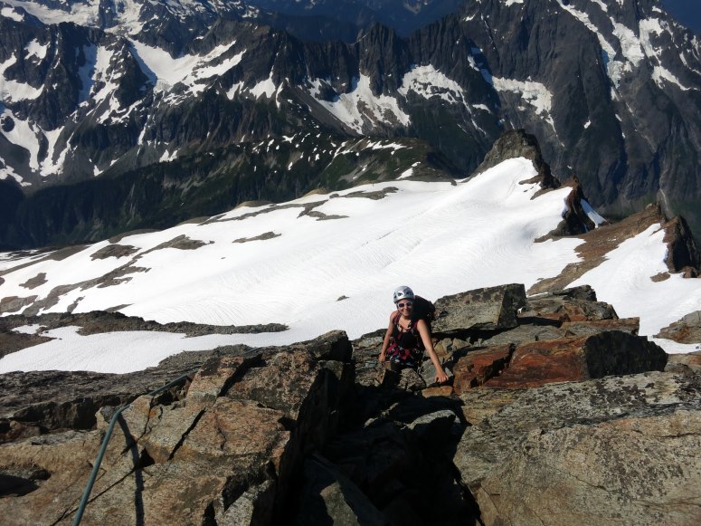
We headed toward the right (east) side of the summit and reached the bottom of the summit block at about 8:30 AM. Trevor, Vanessa, and Brad hung out in a moat while I led a single pitch up to the summit. We kind of awkwardly tied into two half ropes since it is a very easy climb. Just as I was reaching the summit, I heard voices. Egads! Another rope team was coming up from the north. I rushed to the rappel station so that the four of us could quickly rappel down before the ginormous group of Mountaineers I could see hogged up the station. From there I belayed from above with Trevor, Vanessa, and Brad all simul climbing on half ropes. It is a short 3rd/4th class climb so I could ‘second’ everyone up after me on half ropes. I had Vanessa tie into the middle of one rope with Trevor on the end (the lightest two), while Brad climbed up on the other. Vanessa was already on easy terrain and nearly to the belay by the time Trevor needed to climb. It worked out pretty well.
We were all up at the summit by 10:30 AM and then set up to rappel down one by one. The trip back to camp was mostly a very enjoyable glissade. We reached camp at 11 AM, packed up and then headed back down the way we came. The skies became gloomy and we worried that it may even produce lightning before we reached treeline, but luckily no T-storm arrived.
(Download the free Gaia GPS app on your phone to view tracks and then get a Gaia GPS membership if you want offline access. Discount below!)

Recommended brew: Birdsview Brewing SasScotch Ale
Gear Used:
- ATC device
- Backpacking tent
- Crampons
- Gaiters
- Glacier glasses
- GPS
- Harness
- Helmet
- Ice axe
- Mountaineering boots
- Half ropes
- Sleeping pad
- Summer sleeping bag
- Stove
- Trad gear
- Trail runners
- Trekking poles
- Water drops/filter
Post may contain affiliated links