
Distance: 24 mi.
Elevation Gain: 9600 ft.
Our journey up the fourth steepest peak in Washington started by crossing the border into Canada 🇨🇦. (Yea Nexus Pass!) From there we drove to the Skyline II trailhead, which doesn’t require a parking permit, nor was there a backpacking permit for the camp below Hozomeen.
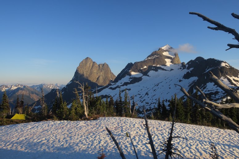
We started hiking around 10:15 AM after the four hour drive and headed leisurely toward camp over the next 7ish hours. We were lucky it was a cool, cloudy day because the climb was pretty grueling, gaining about 5,000 feet with some ups and downs. The mosquitoes were pretty annoying on the climb also, but tended to stay off unless we stopped hiking completely.
We hit a few patches of snow at about 5,750 feet, after turning right at the trail split onto Hozameen Ridge Trail at 2:30 PM. The trail was generally easy to follow despite getting lost beneath snow from time to time. We essentially just followed the ridge. We reached camp just before 5 PM and found a dry area to pitch our tents. There was one other party of four at the campsite, which we were vaguely aware of since we had been following their fresh tracks in the snow.

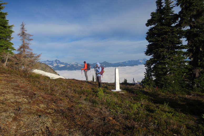
We enjoyed a beautiful sunset and sunrise, with low hanging clouds creating a spectacular effect in the morning. We let the other group leave before us to create some space on the tricky route ahead, and started hiking a bit after 6 AM. Before long we reached the border of Canada and the United States, marked by an obelisk (border monument #74), and walked back into our home country. If you haven’t seen it before, the literal cut in trees between the two countries is pretty fascinating.


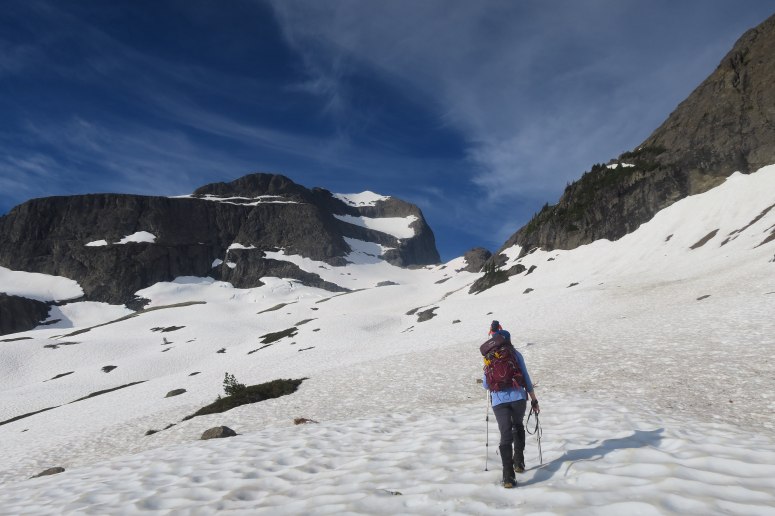
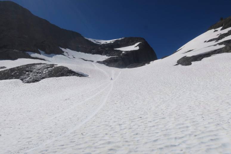
The climber’s trail had intermittent snow and just enough cairns to help us along our way. After descending from point 6,400 that we camped on we had to go over one last bump before being able to access the northeast basin of Hozomeen. We went just past the low point in the ridge and ascended until we found pretty obvious cairns off the left side of the ridge. We were able to follow a faint trail and occasional cairns through trees until we reach the open snowfields below Hozomeen. From here there was continuous snow and we were lucky enough to have kicksteps to follow from the group ahead. We trudged along on this warm, sunny day without need for crampons.
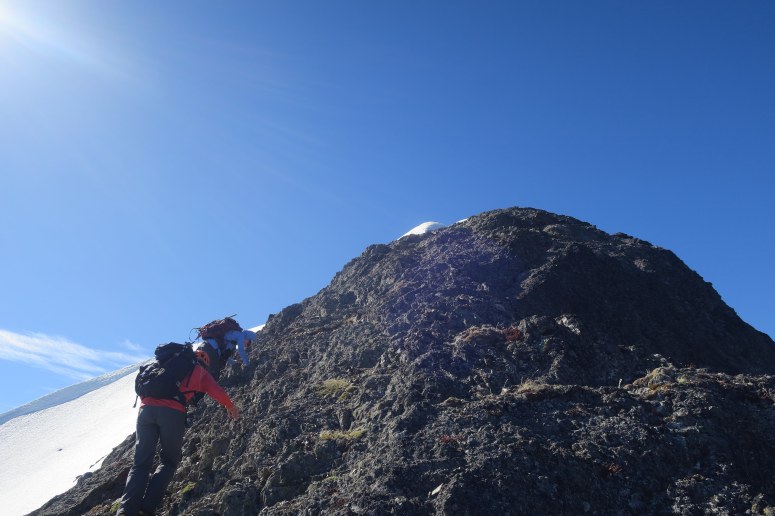
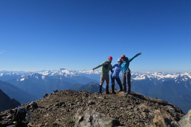
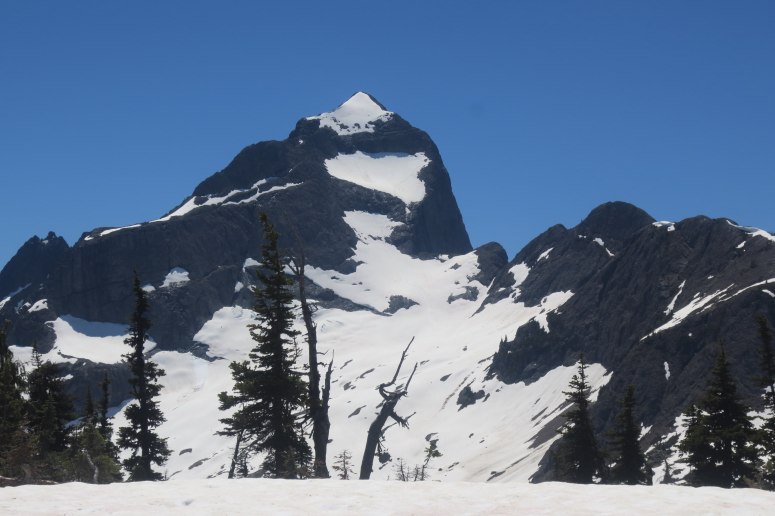
We ascended the lower snowfield up and right, passing through one narrow area between rock until we reached a nice rock ledge where we needed to scramble to get to the next snowfield. The scrambling was pretty low angle but still spicy with the steep snow slope below and not much for handholds. At the top of this brief climb we put on crampons for the steeper snow slope above. We quickly crossed the upper snow slope toward the right (west) until we were on the north ridge of Hozomeen. We scrambled up this ridge one by one with some attention-grabbing 4th class moves on sharp but unfractured rock where falling was definitely not an option. Happily, we all made it to the summit in one piece.

We didn’t stay on top for too long because the winds were pretty strong and brisk. The views, though, were truly amazing. It was cool to see the North Cascades from this perspective.
As much as we cursed the challenging scramble on the way up, it was a lot worse for downclimbing. But we picked our way through with Craig heading down first and helping point out some of the more solid footholds from below.
We downclimbed the upper snowfield facing inward until the slope angle decreased, and then were able to do some good plunge steps. The second downclimb scramble was even less pleasant, in my opinion, because the melty snow was creating running water down half of the slab. We got back on snow and were able to plunge step and glissade the rest of the way to the low point. Here we gathered some watermelon snow for the Living Snow Project (not our first rodeo with citizen science), and then climbed 700 feet back to the campsite in some really, really hot weather.
We packed up camp and then went out the way we came, often plunge stepping down the snow patches rather than trying to find the actual trail. The hike out was much hotter and sunnier than the day before, which was helpful for the mosquitoes but a challenge for our tired bodies. All in all we did about 24 miles and almost 10,000 feet vertical, not to mention crossing the border on foot, over two days.
(Download the free Gaia GPS app on your phone to view tracks and then get a Gaia GPS membership if you want offline access. Discount below!)

Recommended brew: Prairie Artisan Ales Bible Belt
Gear Used:
- Backpacking tent
- Gaiters
- Glacier glasses
- GPS
- Helmet
- Mountaineering boots
- Sleeping pad
- Steel crampons
- Steel ice axe
- Summer sleeping bag
- Stove
- Trail runners
- Trekking poles
- Water drops/filter
Post may contain affiliated links
Good information for the upcoming trip to Hozameen this coming summer. Thanks
Hi Mark. I hope you’re able to get up there; it was a super interesting and beautiful area. I would be interested in hearing your experience. Are you hoping for the border to open (or already in Canada) or planning to get up Ross Lake somehow?