
Distance: 18.4 mi.
Elevation Gain: 12,035 ft.
We called the Mount Rainier Ranger Station (360-569-2211) 2 days before our start date to see if there were any camping spots available on the Emmons Route. The most popular high camp, Camp Sherman, was all full, but we were able to get one of two spots at Camp Curtis @8800 feet, which is about 600 feet lower than Sherman, for $20 total. Then we got our Rainier Climbing permits (different than the camping permits!) for $48 per person.
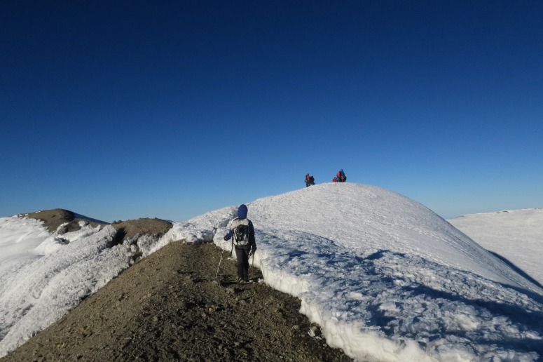
We got off work early on Friday and drove down to the park just before the Ranger Station closed at 5 PM. Then we drove to the White River TH and started hiking a little after 5 PM in order to reach camp at Glacier Basin before dark. We got there at 7 PM. In the morning we hiked to our high camp at Camp Curtis. We set up tents and had lunch there, and then decided to venture to some nearby peaks. We ran up Ruth Mountain and Steamboat Prow before returning to camp and doing some crevasse rescue practice. We were able to peep our route up the glacier from Steamboat Prow, which was helpful to do since we knew we’d be starting in the dark.
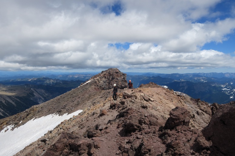
Tanya and Josh on Ruth Mountain
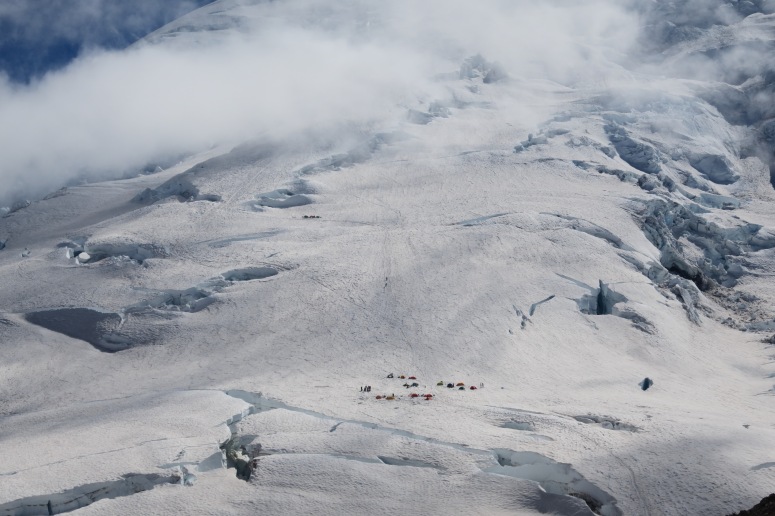
View of Emmons Flats from Steamboat Prow
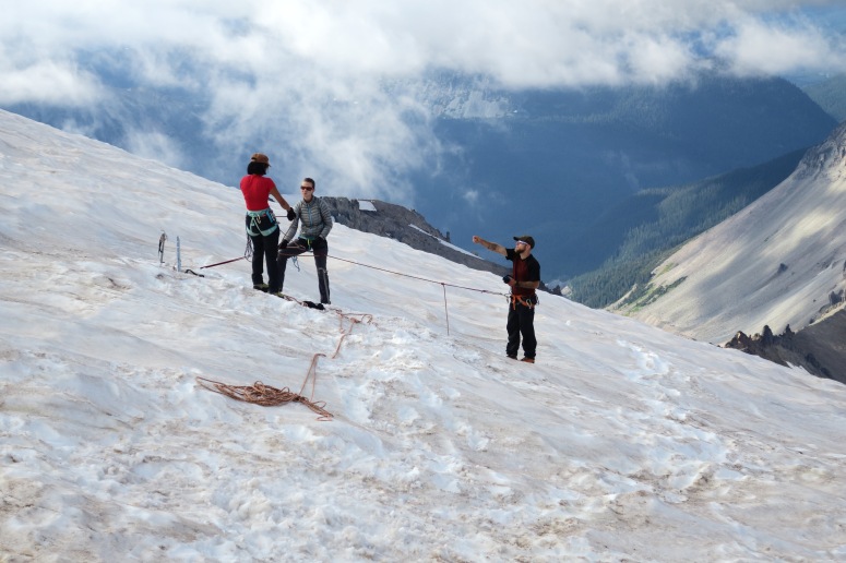
Practicing crevasse rescue at Camp Curtis
We tried to set up our gear properly before going to bed (knots and ropes and boots and such), although we still had some shenanigans in the morning due to sleep deprivation. We got up at midnight – the stars were amazing!! – and started our ascent around 12:45 AM. We scrambled back up toward Steamboat Prow, then dropped in to a bowl on the left (south) along a pretty distinct boot path, albeit harder to follow in the pitch dark. Once we were back on snow, it was easy to follow previous climbers’ tracks. We passed Camp Sherman, where folks were still getting up, and continued on. We kept a very nice pace for the first 4 hours/4,000 feet. Around 5:30 AM the sun starting rising on the horizon, which was amazing to watch from above the clouds.

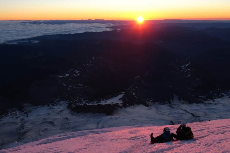
Alpenglow on Mount Rainier
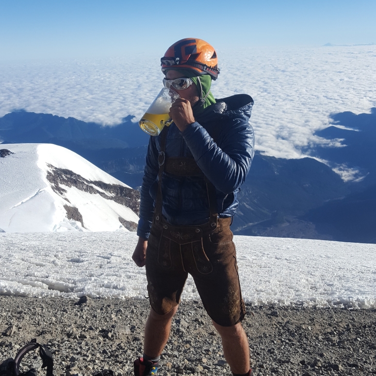
Vanessa and Josh were both getting altitude-related headaches and nausea after 13,000 feet, so the pace slowed down to a crawl. However, we reached the summit just around 7 AM. We found a friend of ours, Brad, who had camped at Sherman the night before. Craig pulled out the glass stein and beer he had been carrying and had a beer in his lederhosen on the top of Rainier, because why not.
The descent was uneventful for the first 2,000 feet.
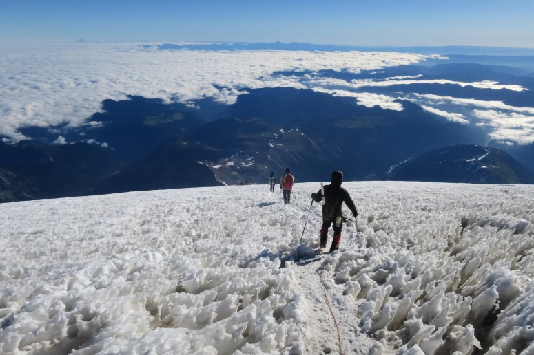
Then the warm day started to melt out some of the tenuous snow bridges over various crevasses around 12,000 feet. Snow bridges that felt comfortable on the way up seemed insanely risky on the way down. There was one crevasse in particular about 500 feet above Camp Sherman that we decided to create a new route around to the right (northeast). When we reached camp, the ranger who had been watching us gave us kudos for changing the route, and said that he planned to return shortly and set our route with markers for the next day’s climbers. We found Brad again at camp, and he informed us that his friend’s tent, and several others, had been blown into the crevasse next to camp while they were summiting!!! That’s a bad day.
When we returned to Camp Curtis at 12:45 PM, our tents were still there luckily. Tanya and Josh decided to stay back and nap while Craig and Vanessa continued on. We were out at 4:15 PM.
(Download the free Gaia GPS app on your phone to view tracks and then get a Gaia GPS membership if you want offline access. Discount below!)

More photos
Recommended brew: Cole Street Brewery Cascadian Rye
Gear Used:
- Backpacking tent
- Bear canister
- Gaiters
- Glacier glasses
- GPS
- Harness
- Helmet
- Locking carabiners
- Mountaineering boots
- Pickets
- Prusiks
- Rope
- Sleeping pad
- Steel crampons
- Steel ice axe
- Summer sleeping bag
- Stove
- Trekking poles
- Water drops/filter
Post may contain affiliated links