
Distance: 3.5 mi.
Elevation Gain: 1040 ft.
After our amazing ski of Mt. McLouglin and going on a Bender (lots of beers in Bend) we woke up with the intention of skinning up Mt. Bachelor before heading home. We actually drove up to the ski resort by about 8am, but their website said it was unlike that the summit chair lift would open that day due to maintenance and their policy is generally that you can only skin to the top when the summit lift is open. This was irritating, but we decided that we could do some sort of desert hike and drive up the east side of the mountains.
We drove back into Bend and got some more coffee and second breakfast at Strictly Organic (pretty good breakfast burrito). We spent some time looking at what little bumps were along the way, but we wanted to go up something with a name. I started to look at the topo map for this and what was the first named peak I scrolled across that was near our drive? …..FRIENDS PEAK! Now if you know Rodrigo you know why that is a great name for a peak that we would want to ascend. We quickly decided that we were definitely doing it and that it was a worthy alternative to Bachelor.
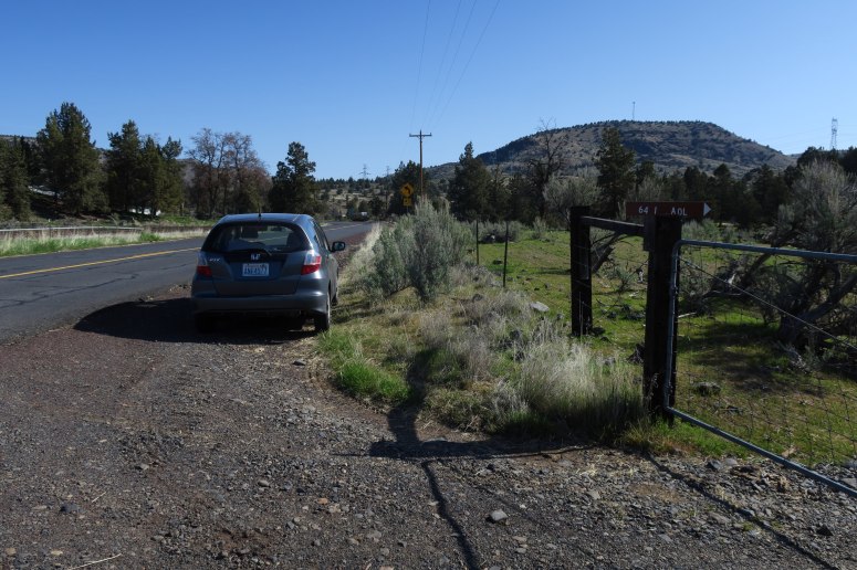
We drove north out of Bend on Hwy-97 for about an hour, just past the town of Willowdale, and turned right onto OR-293. The peak is just east of Hwy-97 here and on the topo map it shows a road on the right just before 293 turns due north. We couldn’t find this road at first, as there are only gated entrances off of this road and most of them are marked with private property signs. We did eventually find the road. It’s marked with 641 AOL and has an unlocked gate with no private property sign. After hemming and hawing we finally decided it was probably alright for us to go in there.
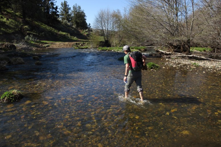
After going through the gate, the road turned left and parralelled Trout Creek for a little way until it turned right to cross the creek. The creek was really flowing this time of year and we had to do a knee deep wade to get across. It was very cold and upon exiting the water it was almost mandatory to step in one of the many cow pies. We put our shoes back on after carfully dodging the poo and briskly hiked up the road, It turns and follows the power lines eventually where it finally reaches the ridge to the west of Friends Peak!
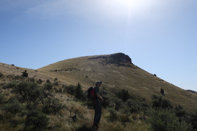
Heading up the west ridge of Friends Peak!
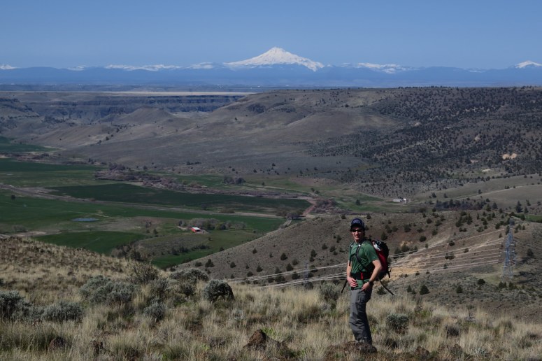
We strolled up through grass and sage to the summit where we enjoyed a beer and the views back to at least 9 major volcanoes.

View to Mt. Jefferson and the Sisters
We quickly made our way back down to the creek, made the cold wade once more, and were back at the car. We enjoyed the rest of the drive up the east side of the mountains and then stopped in Union Gap near Yakima for some amazing tamales at Los Hernandez Tamales. I definitely recommend a stop!
Rodrigo with Mt. Jefferson
(Download the free Gaia GPS app on your phone to view tracks and then get a Gaia GPS membership if you want offline access. Discount below!)

Recommended Brew: Crux Cruising Altitude
Gear:
- Skateboard shoes for Rodrigo
- Trailrunners for me
Post may contain affiliated links