Distance: 4.4 mi.
Elevation Gain: 2350 ft.
I hadn’t been out on more than just a hike yet this year. A lot of short hikes with the baby but I wanted to do something more exciting on this long weekend before the rain came in. I decided to get up bright and early and was on the road by 4:30 so that I could get back early and enjoy the rest of the day. The drive up the mountain loop was nice before anyone else was awake and the Deer Creek road was nice with a few areas of potholes with the exception of the main creek crossing. I had done this a few years ago in my Honda Fit, but it is a bit worse and I don’t think I could have gotten it through now. There was one small car parked hear that couldn’t. I was glad to have the CX-5 with the better clearance this time.
I found the Deer Pass trail just past the Kelcema Lake trail near the end of the road and was the only one to park there (2 trucks at Kelcema Lake). I started up the trail at about 5:45, the beginning of which was pretty muddy and had a few small streams. This trail is a bit rough but still pretty easy to cruise on. I was quickly at the pass where the old trail to the Helena Mine went off to the right. There were a few little pieces of flagging in a tree too.
The old trail was pretty easy to follow for the most part with it’s fair share of downed trees to go around or over. It did get a little harder to follow at times in the wetter areas where the brush had grown up more. It might get harder to follow later in the year with more growth but there was a lot of flagging when most needed as well. After a few creek crossings below some slabby rock, the trail switchbacked up the hill and then I got into consistent snow not too long later (just after a talus field where I could see the peak), at about 4400′. From here I just kind of headed the same direction toward where I could see the pass I needed to go to was.
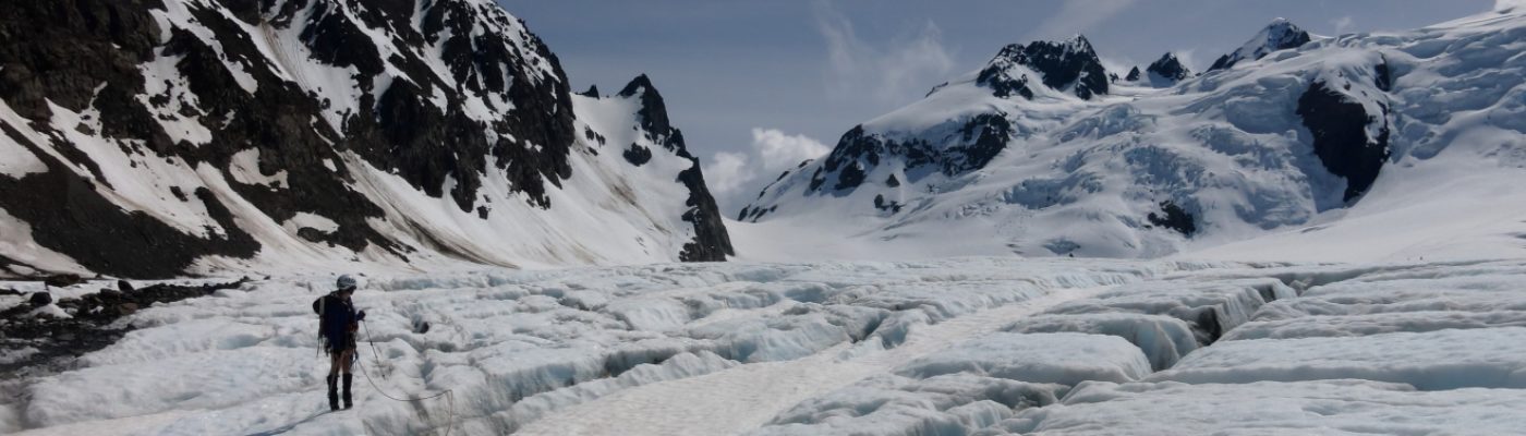
I was able to boot up the snow just fine without crampons and stayed on snow almost all the way to the pass. There is a decision to be made just before arriving at the ridge and I went right around a rock outcropping as it looked less steep than left. This worked well but I then had to do some careful scrambling and bushwhacking to get around the backside of this rock and back to the ridge. From there I tried to stay close to the ridge while traversing the east side. This worked well until I got onto the false summit where I found myself kind of stuck. It seemed like difficult scrambling down and another ledge I tried had some scary steep snow on the other side of it. I ended up going down a dirty gully probably 50 feet or so until I found another ledge I could carefully traverse to some snow. I needed to get my ice axe out for this to transition from the moat to the moderate slope on the other side which finally brought me to slabby rocks just below the summit gully. It was here that I manage to break my phone also and thus why there are no photos here. I recommend this nwhikers trip report for some photos. I had more snow though, which made getting around the false summit trickier
I didn’t go the best way through these slabs and wasted some time (did much better on way down) but did finally make it to the gully just below the summit where I skirted the right side where there was more solid rock and some trees to grab onto. I didn’t linger long on top as it had taken me longer than I expected. The summit register was completely full of water, so I dumped it and tried to place it the correct way so it wouldn’t fill again. I backtracked pretty much the same way I came up, minus the errors, and it was much quicker. I did stay a little lower to traverse some moderate snow rather than slabby rock and ended up taking the steeper gully down from the ridge. There was a handline someone had left in there and it was definitely steeper. It wasn’t too bad for me to get down but I would definitely recommend the way I took up.
I had broken my phone screen on the way up someone so I couldn’t take pictures unfortunately and I had a track loaded in it that showed me where the mine was, which I was hoping to explore. Without that track and the fact that it was likely mostly buried in snow meant I just booked it back to the car and was headed back home a little after 9:30. Not sure it would return to this one ever but it felt good to get out!
(Download the free Gaia GPS app on your phone to view tracks and then get a Gaia GPS membership if you want offline access. Discount below!)

Recommended brew: Founders Breakfast Stout (home before noon!)
Gear:
- Aluminum crampons (not used)
- Aluminum ice axe
- Day pack
- Glacier glasses
- GPS
- Helmet
- Mountaineering boots
- Trekking poles
Post may contain affiliated links