
Distance: 32.9 mi.
Elevation Gain: 11000 ft.
Although Craig completed all of the Washington volcanoes ages ago, I still had Glacier Peak to tick off of my list. After eloping on Green Mountain, we decided to do a Glacier Peak Honeymoon! (Peakmooning? Honeybagging?) We camped at Bedal Campground on Saturday night, which thankfully had one remaining walk up campsite available for $16 (amenities included and were limited to free toilet paper).
We arrived at the trailhead by 9 AM on Sunday. As we hiked along the 6-ish miles of mostly flat trail toward Mackinaw Shelter, we saw dozens of climbers who were descending from Glacier Peak. We asked for some beta and heard that there was plenty of camping and that snow conditions were great. When we arrived at the shelter, we saw that it unfortunately seems to have been crushed by a tree 🙁

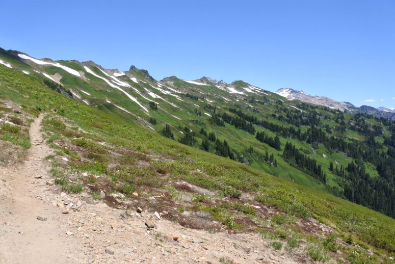
The 2,800 foot climb to White Pass was brutally warm. Bugs weren’t too bad on the climb but there were some biting flies. There were several small streams flowing. The trail itself was in great shape after some recent trail work in anticipation of major trail renovations along the PCT later this year.
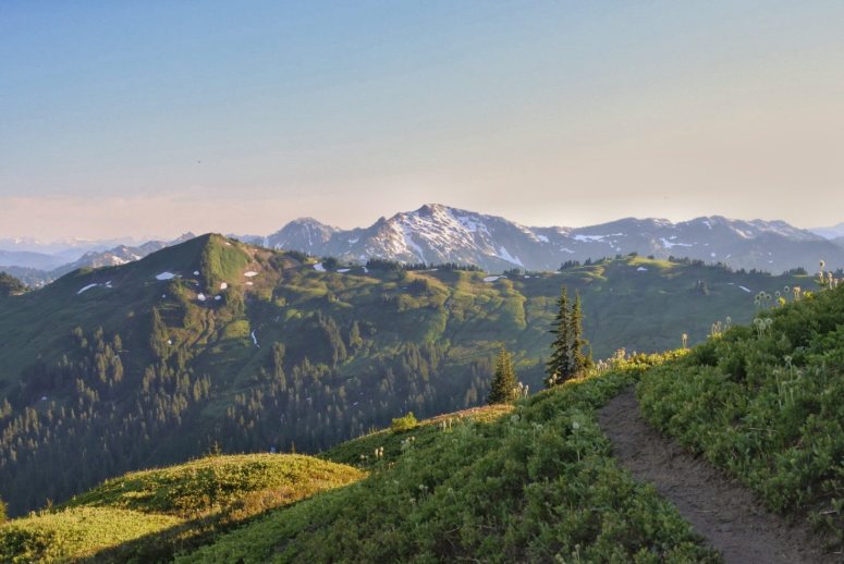
From White Pass, we took the obvious climber’s trail to the left toward Glacier Peak. The climber’s trail AKA “Foam Creek trail” sports some absolutely breathtaking views into the Foam Creek basin. There were several patches of snow hanging on in the gullies along the basin, but each had a flat, well packed bootpath to walk on due to the abundance of weekend climbers. We were able to cross them easily in trail runners.
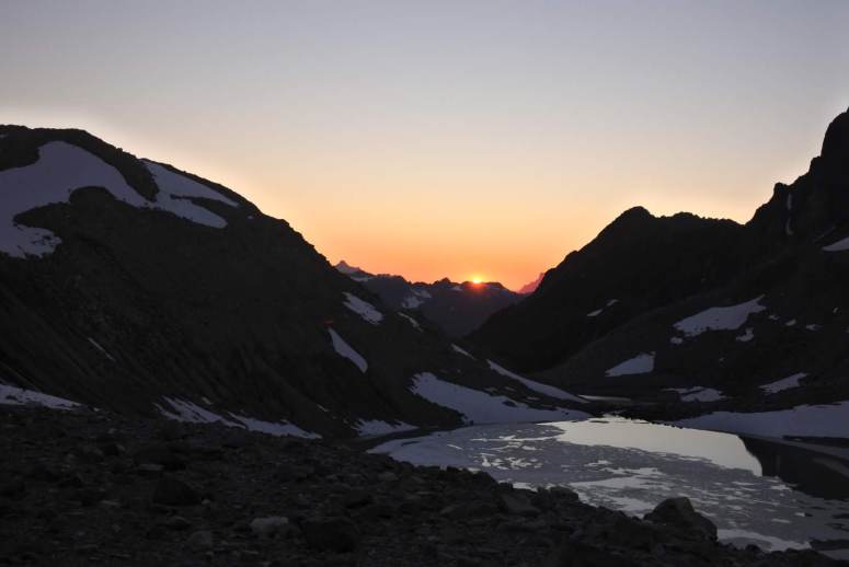
We missed the cairn telling us to take a narrow snow field left toward the next pass, but found another faint boot path heading up in the right direction. From the pass we descended a bit but mostly did a level traverse toward the north. Once again, there was an easy bootpath to follow on both the snowy and rocky portions. From here we started looking for a campsite. There wasn’t anything too obvious along the trail, but we did see what looked like a cleared, flat area on a bump between two lakes in the White Chuck basin. When we arrived we saw that there were several established campsites complete with rock walls. We set up camp and enjoyed the lovely sunset. If anything, we were a bit too warm overnight.
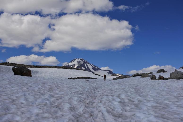
We got started at 6 in the morning on Day 2. We returned to the climber’s trail which took us up and to climber’s right (north). The bootpath remained easy to follow. We reached Glacier Gap just before 7 AM, and saw some primo campsites up there. The climbers in those tents had already gotten started for the morning as evidenced by their crampon tracks. There was another couple we also criss-crossed on the climb, but just us three groups total for the day.
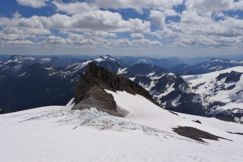
We did a brief climb, followed by a brief downclimb, toward the south ridge of Glacier Peak. We were able to climb on dry trail for about a 10th mile, and then dropped in to the right (east) on some flat snow. We roped up and then continued left (north) on snow. We climbed Gerdine Glacier, which didn’t have any crevasses but did have some rockfall exposure so we moved through quickly. From the notch below Disappointment Peak we turned left (west) onto Cool Glacier, which did have a few easily avoidable crevasses. We reached the final ridge to the summit where we were again able to climb on dirt, so we unroped. The steep scree slope had about thirty teeny tiny switchbacks to follow until we reached a final snow patch. This was the steepest and firmest snow slope we encountered all day so we did finally put crampons on. We followed the snow around to the left and found ourselves at the summit just before 11 AM! The views from the heart of the North Cascades made our hearts sing! Honeybag!
The snow remained in good condition for our descent, which was a relief that it didn’t get too sloppy since it was a really steamy day. We returned to camp at 2:30 PM. We napped for a couple hours until it got a bit cooler, and then packed up camp and retraced our steps to White Pass. We found a campsite just below the pass and set up camp again. That evening was surprisingly cool, since there was a gusting wind and cool air sinking into the valley.
The view from this campsite toilet is pretty fantastic. You should check it out even if you don’t need to. We got started at 7 AM the third morning and retraced our steps to the trailhead. We saw somewhere between five and ten climbers headed toward Glacier Peak. It didn’t seem like we were racing down the trail, but we did manage to get out before 11 AM. I had never hiked into this area before and it was just so incredibly beautiful!
(Download the free Gaia GPS app on your phone to view tracks and then get a Gaia GPS membership if you want offline access. Discount below!)

Recommended brew: Melvin Brewing Chuck Morris Double IPA
Gear Used:
- Aluminum crampons
- Aluminum ice axe
- ATC device
- Backpacking tent
- Gaiters
- Glacier glasses
- GPS
- Harness
- Helmet
- Locking carabiners
- Mountaineering boots
- Picket
- Prusiks
- 30 m half rope
- Sleeping pad
- Summer sleeping bag
- Stove
- Trail runners
- Trekking poles
- Water drops/filter
Post may contain affiliated links