
Distance: 14.8 mi.
Elevation Gain: 6750 ft.
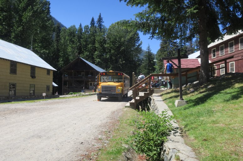
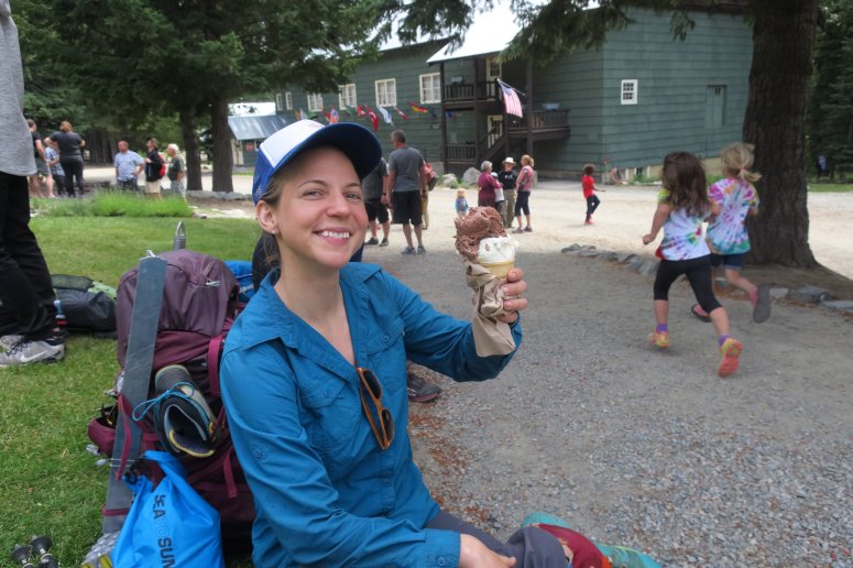
This is probably the most planning we have done for a peak in Washington. First we reserved a roundtrip ferry ride on Lady of the Lake II from Fields Point Landing to Lucerne ($35.75 pp for the ferry plus $7/night parking in Fieldspoint). Then we booked a bus shuttle from Lucerne to Holden for $15 pp rount trip (accomplished by contacting Holden Village directly). There is only one ferry per day, which also complicates the trip planning, forcing most people to do it as a 3-day trip. BY THE WAY, when you arrive in Holden Village the entire town will surround the bus and give you a standing ovation. I only tell you this so that you’re not as surprised as I was. (Also, they have their own money and ice cream costs $1. Important things.)
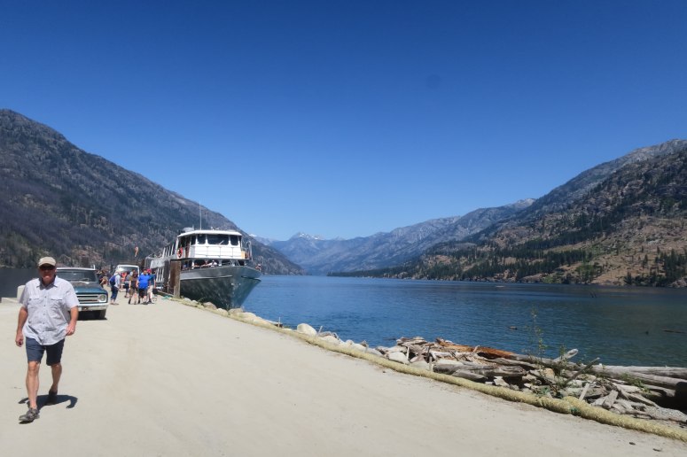
We arrived at 1 PM but it was disgustingly hot and we didn’t have much distance to cover, so we hung out in town until 3. It was still super hot when we got started, especially the open slopes below Holden Lake. We reached Holden Lake around 5:20, where the bugs were picking up.
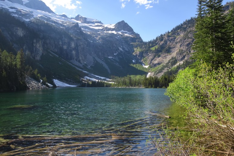
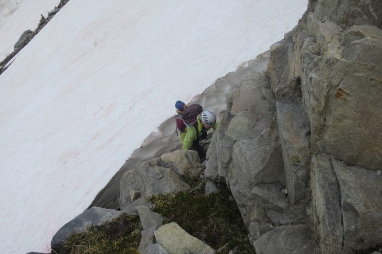
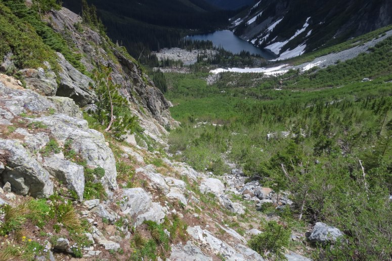
From there, we curved around the right (east) side of the lake, following an obvious trail. Craig had advice from a previous trip report saying to stay to the right, so we started climbing up the treed slope to our right. All of a sudden, we were being mauled by mosquitoes. We each had about 50 mosquitoes hovering around us, which is the worst I’ve personally experience in Washington. I avoid DEET as much as possible because it smells yucky and can melt your tent, but once Craig pulled the bottle of DEET out of his pack I immediately sprayed myself four times directly in the face. I find it kind of hard to think clearly in an extreme cloud of bugs, so I just kept moving up the brushy slope, trying to get away from the bugs and caring not that the climber’s trail was nowhere to be found. We finally reached a small clearing completely surrounded by slide alder, and just as I was hitting the pit of despair, Craig remembered that he had downloaded two previous hikers’ GPS tracks from this trip on his phone. (This is why we make our tracks available for you lovely people!!!)
So we headed back down the slide alder and pine tree mangles until we reached the actual climber’s trail, and from there were able to move a little bit more quickly. We dove through a few more slide alder branches before reaching a clearing with large boulders and intermittent snow patches. We climbed steeply up the boulder field until we reached Holden Pass, where we found two other climbers, Jon and Nancy, also hoping to attempt Bonanza that weekend. We searched around for a bit and found a decent, dry campsite a bit west from the pass. Bugs were pretty bad at camp, but nothing like below.
We gave ourselves a buffer day for this trip in case the weather was iffy, and indeed we did have a tricky weather window. The forecast called for rain after 11 AM Day 2 and thunderstorms later in the afternoon, with rain continuing through the following morning. So we either had to get up early and try to be down by early afternoon on Day 2, or wait until the rain stopped and rocks dried on Day 3. We opted to make an attempt early the following morning.
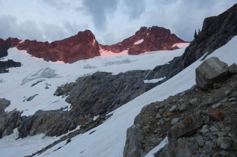
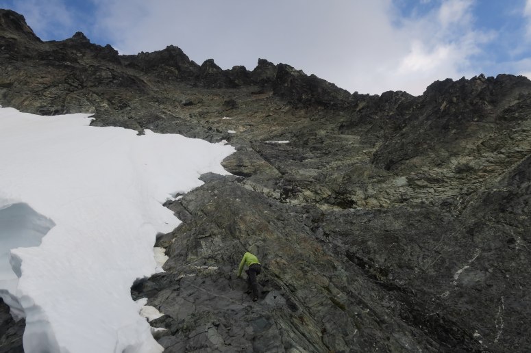
Sunrise on Bonanza as we approach the waterfall slabs
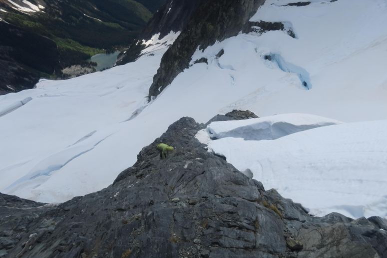
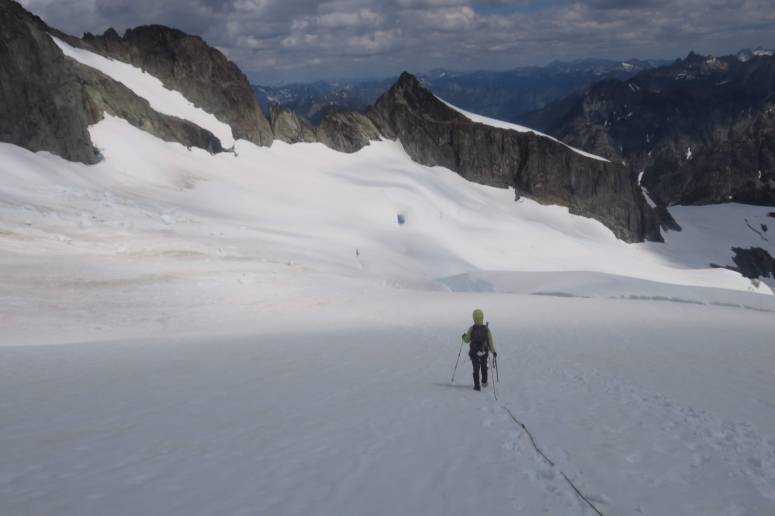
We got up at 4 AM and after a hearty breakfast we got started around 4:45. By that time, there was enough dim light that we didn’t need headlamps. We climbed the steep hill above camp on intermittent snow, then headed left (southwest) across a boulder field toward the “waterfall slabs” at the base of Mary Green glacier. We found a reasonable looking spot to step across a short moat and scramble up the slab in one of the drier areas. It was a damp but not unreasonable climb. There was a flat snowfield above here to regroup and rope up for the glacier.
Jon and Nancy had left before us, so we had their tracks to follow most of the way. The snow was fairly firm in places and I was glad to have crampons. The glacier itself was easy to navigate and avoid the open crevasses. The snow connected all the way to the final scramble, although there was a tricky downclimb to get from the snow onto the rock.
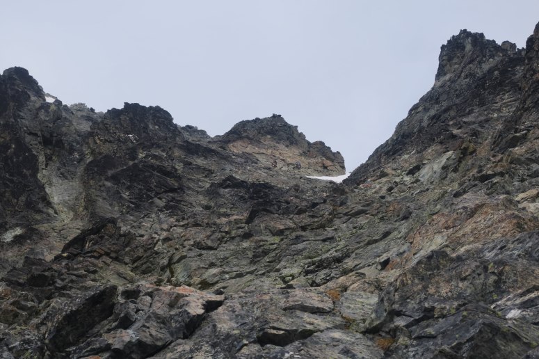
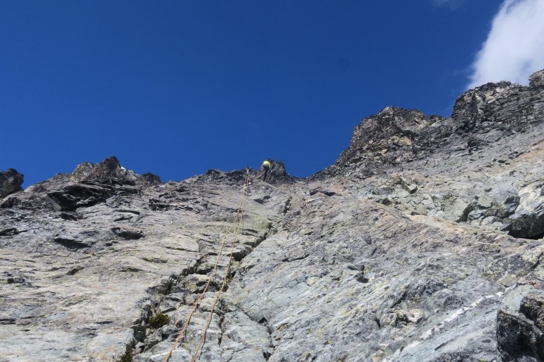
The climbing route was not that obvious and there weren’t very many large ledges to relax on, so it was very taxing mentally if not physically. We worked our way up slowly by carefully choosing each hand and foot placement. Any fall would have been highly consequential. We finally reached the rappel station just below the summit at 9:30 AM, where Nancy and Jon were just beginning their descent. From here, the remaining bit to the summit wasn’t difficult but it did look super improbable and I had zero confidence in the rock up there. The summit had some very pretty views in all directions.
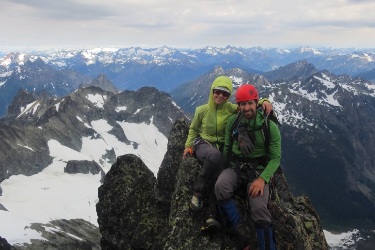
Considering that the clouds had been somewhat ominous all day and that I saw 3 tiny balls of hail on my way up, we didn’t spend too much time dilly-dallying at the top. We were pretty much one rappel behind the first team the whole way down, with some tricky downclimbs between the rappel stations. We did five rappels total on a 60 m half rope and Craig added new sling to two of the stations. We caused some scattered rockfall on the way down due to the rope knocking things loose, which was scary also.
We made it back to the ledge we had climbed onto from the snow. We roped back up and got the snow gear back out. The snow was notably softer but crampons were still helpful. We retraced our steps until we reached the waterfall slab again. There were two rappel options down this face and they were both terrible: rappel off two nuts in the same crack off the face, or rappel off of several dead trees. Pick your poison. We chose the dead tree, and Craig added another sling to connect it to a nearby, also dead, tree. The rappel was super challenging in and of itself because the wall was completely wet and somehow slimy? I ended up doing the splits at one point.

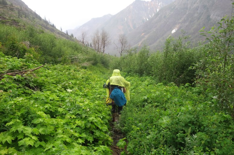
Once we were back on snow, the remainder of the descent back to camp was straightforward. We got to camp at 1:30 PM and all the mosquitoes had mysteriously disappeared. It still hadn’t rained yet, but it was a bit more breezy. We could have stayed at camp another two days if we wanted, be we decided to seize our opportunity to get back past Holden Lake while the bugs had died down. We did a much better job following the climber’s trail on the way out, and the mosquitoes were only a minor nuisance.
As we were hiking down from the lake, the rain finally started. It was mostly drizzling but there was some thunder and there were some heavy bouts from which we hid out under tree cover. We made it to Holden’s Ballpark Campground, just outside of town, and set up camp. The mosquitoes were around but bearable. As predicted it rained on and off all night.
We packed up the next morning, hoping that our ferry tickets would be honored a day early. We relaxed in town until the shuttle arrived at 1:45 and hung out with Jon and Nancy, who had come down from the high camp that morning. We got some tasty ice cream before leaving (cash or Holden dollars only) and were able to get on the ferry after all.
Craig has been wanting to do this climb for at least 5 years, and now we hope we never have to go back! 😉 Good luck, though! And download our GPS track!!
(Download the free Gaia GPS app on your phone to view tracks and then get a Gaia GPS membership if you want offline access. Discount below!)

Recommended brew: Wallace Brewing Vindicator IPA (available on the ferry!)
Gear Used:
- ATC device
- Backpacking tent
- Extra sling material (used 3 times!)
- Gaiters
- Glacier glasses
- GPS
- Harness
- Helmet
- Locking carabiners
- Mountaineering boots
- Pickets x2
- Prusiks
- 60 m half Rope
- Sleeping pad
- Steel crampons
- Steel ice axe
- Summer sleeping bag
- Stove
- Trad gear (a few nuts and tricams – not used)
- Trail runners
- Trekking poles
- Water drops/filter
Post may contain affiliated links
Great report! Just.got back. Found your track useful… But I have ONE critique/beta revision…
Below the waterfall slabs… It looks like you went to the edge of the ledge, looked out at the slabs proper and decided to ascend the smaller waterfalls above the snow against the cliffs to the right, presumably the rap route as well….
We found a way across the slabs from exactly where your gpx track turns around… With only 1 real class 3 move with minor exposure, the rest was a 2-3 mix on both wet and dry rock up to the snowfields. No raps needed on the way down. I scrambled up a way possibly close to yours and found it more complex and a rap would have been required.
Thanks for a great TR!!
Thanks for your comment!! I’m sure that will help others!