
Distance: 40 mi.
Elevation Gain: 10,000 ft.
We left Seattle early in order to get to the Marblemount Ranger Station right when they opened. We got there just in time at 7 AM…and were number 16 in line. After waiting 45 minutes, we were able to get a permit for the campsite we wanted – Skagit Queen along the Thunder Creek Trail.
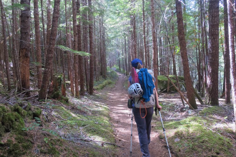
We weren’t in a huge rush, so we stopped at Mondo’s Restaurant in Marblemount for a satisfying diner breakfast and got to the Thunder Creek Trailhead at Colonial Creek Campground around 9:30 AM. We set out with loaded packs and Vanessa immediately said, “I feel like I’m missing something…” I started listing, “Tent, sleeping bag, sleeping pad…” and she groaned. “I forgot my sleeping pad.”
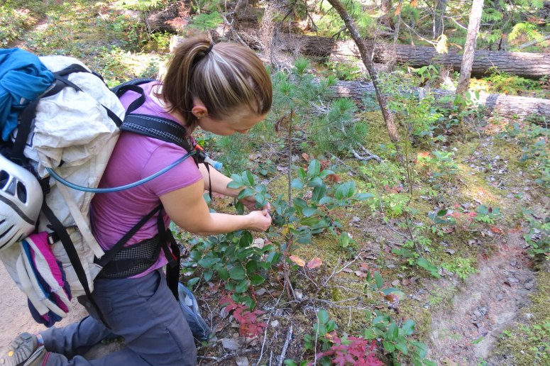
We usually go over a digital list every time we pack for a trip, but we were both too out of it the night before to remember that there even is a list. We figured we would survive with one sleeping pad and forged ahead. Before long the trail crossed Thunder Creek on a long bridge, and then we started our long, mostly flat, southward hike toward camp. There was one sizeable climb in the middle of the hike, but sadly we lost most of the elevation again. We did have fun munching on berries while we went, and even trying a couple new ones (after some serious research).
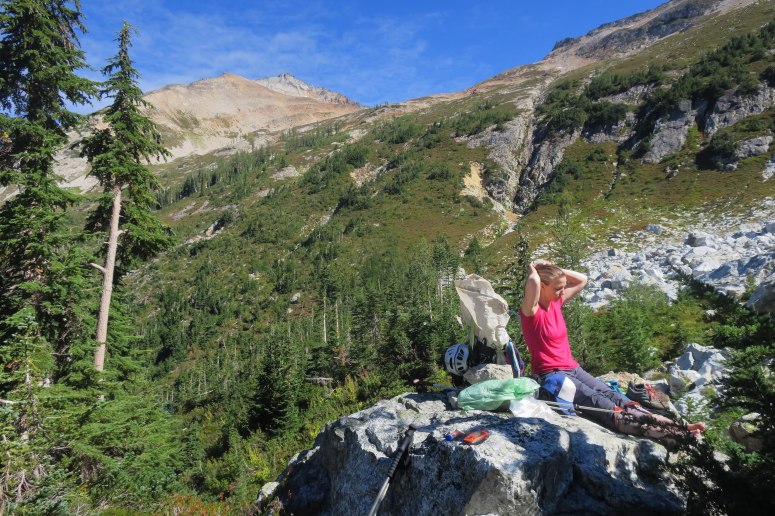
We reached camp at 4:15 PM and chose a large site with a nice coating of pine needles. I had offered to let Vanessa use my sleeping pad, so I needed those needles for cushioning! Luckily it was a warm night and I never felt too cold.
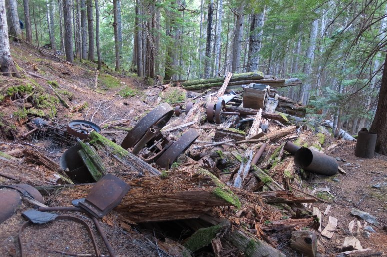
The next morning we left camp around 7:30, later than we had hoped. We almost immediately reached a large abandoned mine with much of the old gear left behind. We decided to leave this curiosity for later exploration. The climb ahead was steep, with many of the switchbacks crossing an old penstock pipe that goes to the mine. We had several small stream crossings but eventually we did have to cross Thunder Creek, which required a ford. We took off our shoes and Vanessa soon regretted her choice, sliding on a slippery rock and getting half-submerged in water. Soon after, we were both thoroughly soaked by the brush along the trial, loaded in morning dew.
After passing the Thunder Basin Hiker Camp, the trail switchbacks up to Park Creek Pass. At the last switchback before the trail traverses over to the pass, we were able to find the climber’s trail toward Logan that heads back to the North. We stopped here for lunch and to dry off a bit, and then followed the climber’s trail.
It wasn’t so easy to keep track of, and we frequently lost it completely. We continued a climbing traverse over mostly scree and low brush. At one point Vanessa rolled her left ankle and yelled out, but she was able to continue walking on it so we went ahead.
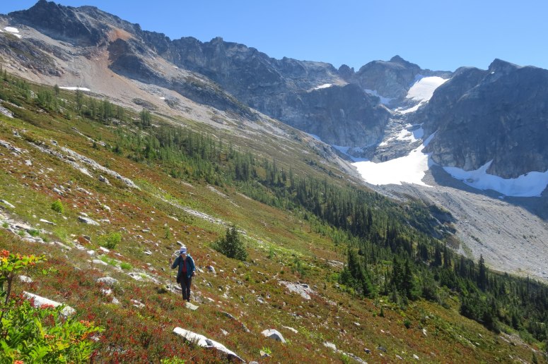
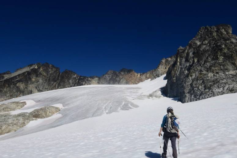
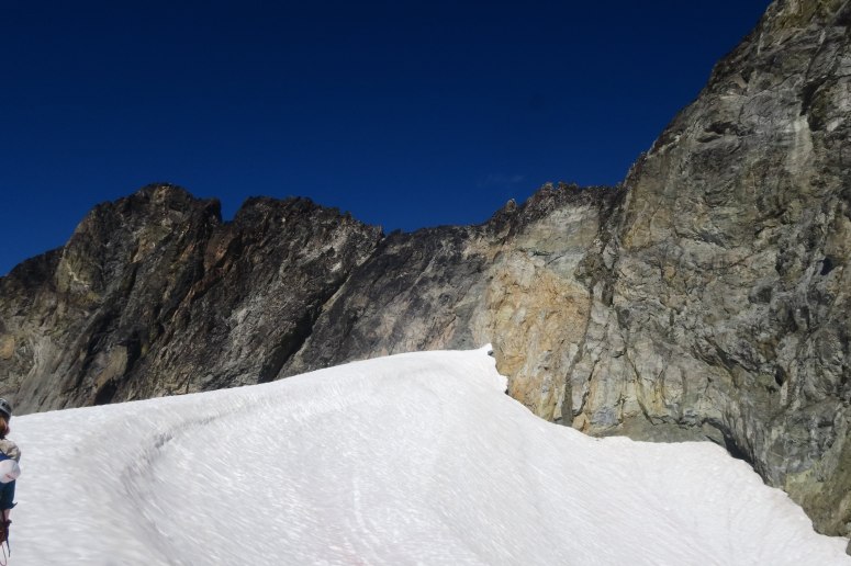
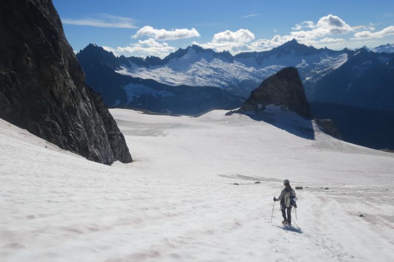
As we reached the southwest basin below Logan, we crossed several large boulder fields and a couple of brief snow fields. We climbed the steep scree just below the ridge, losing our footing on loose rocks, until we were able to cross over to the moraine to get onto the glacier, where we roped up. The Fremont Glacier was in rough shape this time of year, with lots of bare ice showing, but the few small crevasses that exist were easy to spot and avoid.
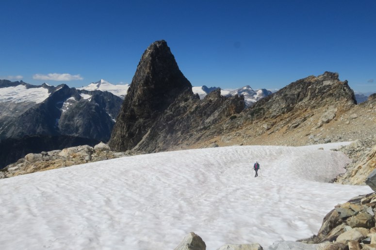
We quickly got to the Hogsback snow finger at the base of the scramble. The snow was melted way down from many photos I’ve seen and there was a large moat almost everywhere. It was already 3 PM and we were definitely going to be hiking in the dark at this point, so Vanessa told me she would belay me across the moat and up the first pitch, and then stay behind so she could belay me again on the way back. I didn’t want to finish without her, but she insisted that she didn’t want to continue.

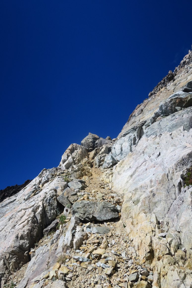
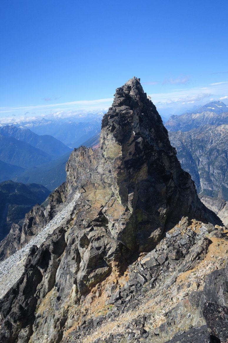
Once across the moat I had to briefly scramble some slabby 4th class rock with some loose rocks on it to get to the easier 3rd class ramp that the snow finger sometimes reaches. I placed 3 nuts on my way up until I reached the end of our 30 meter rope. I placed a final nut, unclipped the rope from my harness and clipped it to the nut until I would return. After this the scramble to the ridge was quite easy. I crossed over to the east side where the rocks were pretty solid but covered in a lot of black lichen. There are a series of really exposed ledges to traverse to get to easier ground below the false summit. I got off track once or twice, which I could tell because of the increase in lichen on the rocks. Nothing was harder than 3rd class but I had to be careful. Then there is some easier terrain to get to the false summit, with a little bit more 3rd class (all on the east side).
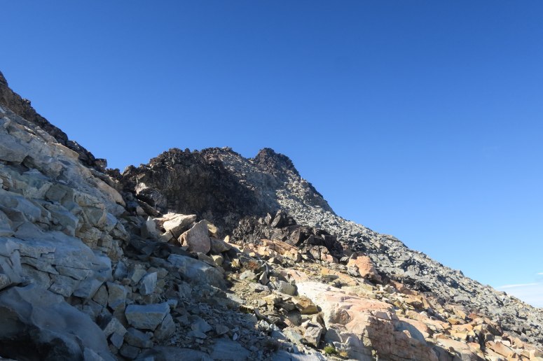
From the false summit I had to do a little bit of 3rd class scrambling down the ridge to the north to get to the easy walk to the base of the true summit. It looks quite steep but the scrambling was pretty easy with one last tricky class 3 move to get onto the summit.
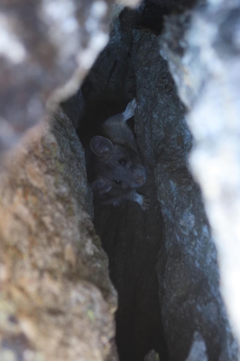
I briefly enjoyed the views and looked for a summit register. I didn’t find one but I did find a pretty big pack rat staring out of a crack in the summit rocks at me….what the heck does that guy eat up there?
I then back tracked all the way to the rope as fast and as carefully as I could. I clipped in and had Vanessa backwards lead belay me back to the moat. Getting back onto the snow required a bit of a lunge, but nothing too bad.
Once back on the snow, where Vanessa was sitting at our snow anchor, I said, “You totally could have done that climb!” She said, “There’s something I didn’t tell you… I’m pretty sure I sprained my ankle.” I said, “WHAT?!” She said that since she had to hike another 20 miles on a sprained ankle, she figured she might as well hike 23. And she wanted to help me do this climb safely. The best wife a peakbagger could have…
We retraced our steps back down the glacier and through the boulder fields. We found a set of cairns to follow that was a bit higher up the slope than our ascent route, but it wasn’t really much better of a route. We were happy that we made it back to the main trail before dark, but we immediately turned our headlamps on as we began our descent toward camp. After several long miles and a dead headlamp (backed up by the phone flashlight because the back up batteries were in the tent), we made it back to camp after 10 PM.
The next morning we took it easy, and actually went back up the trail for a bit so that we could check out the mine remnants. They were pretty awesome! Then we packed up camp and retraced our steps back to the car, not without picking a few handfuls of salal berries! Overall a pretty fun trip despite a fair number of hiccups.
(Download the free Gaia GPS app on your phone to view tracks and then get a Gaia GPS membership if you want offline access. Discount below!)

Recommended brew: Bale Breaker Topcutter IPA
Gear Used:
- Aluminum crampons
- Aluminum ice axe
- Approach shoes (Vanessa)
- ATC device
- Backpacking tent
- Glacier glasses
- GPS
- Harness
- Helmet
- Locking carabiners
- Mountaineering boots (Craig)
- Picket x1
- Prusiks
- 30 m half Rope
- Sleeping pad (only one) 🙁
- Summer sleeping bag
- Stove
- Trad gear (half a set of nuts and a few slings)
- Trail runners (Craig)
- Trekking poles
- Water drops/filter
Post may contain affiliated links