
Distance: 14 mi.
Elevation Gain: 5500 ft.
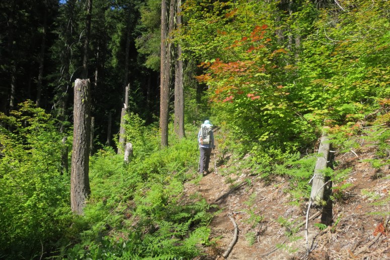
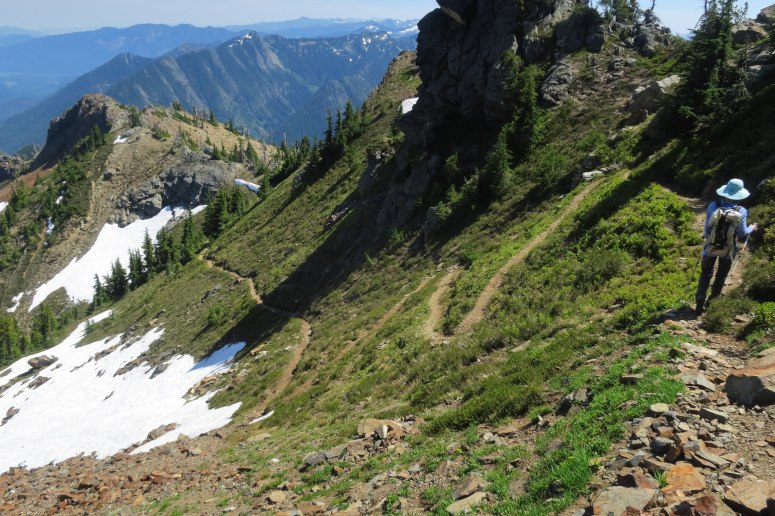
I’ve had my eye on this hike for several years (and even tried one other time but the road was closed due to fires). We started hiking at 9 AM with light packs filled with almost nothing but water. We crossed the bridge over the White River just out of the parking lot and turned left, hiking relatively flat trail for the first mile or so. We continued straight past the trail to the White River Falls viewpoint, and then continued straight past where the old Panther Creek trail splits off (it is very faint but there are signs). From here we made a very steady ascent. It was tough in hot weather, but at least we were able to get into a good rhythm. This trail could use some love – there were a bunch of trees down and about a 10th mile section with head to toe brush. The long climb required many snack and water breaks!
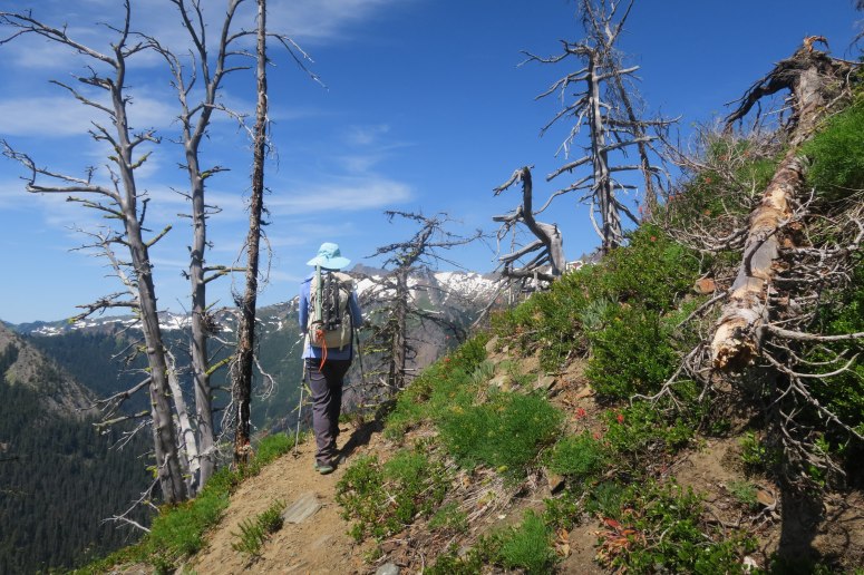
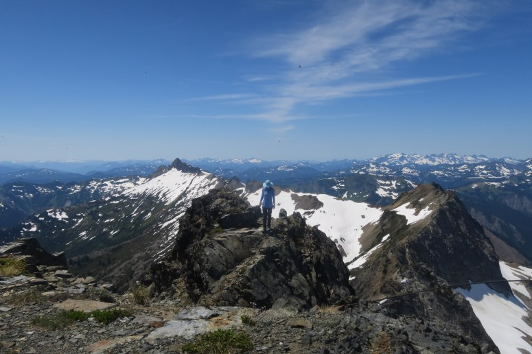
We reached the ridge to Mount David around 11:15 AM. The trail from the ridge looks super improbable, but I was impressed how nice the trail was most of the way. Although it could certainly trigger a fear of heights in a few areas.
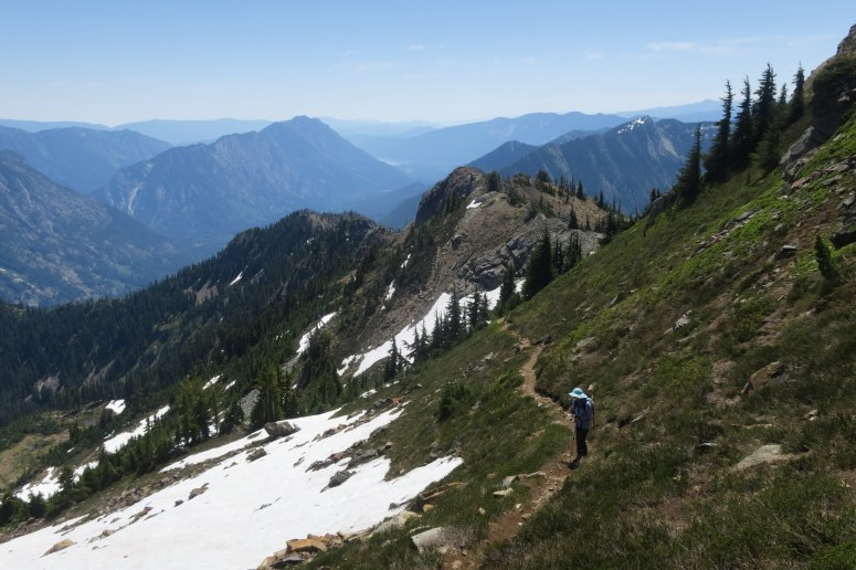
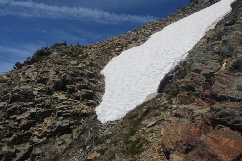
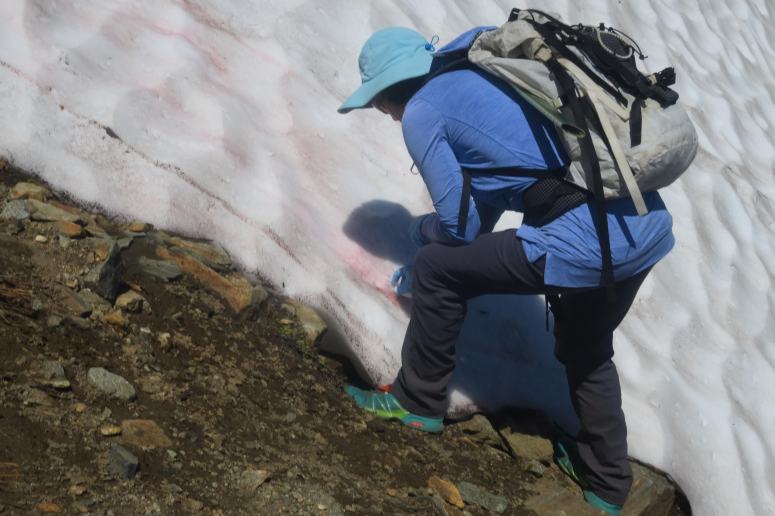
We only hit tiny snow patches until about 7,000 feet, where we traversed four large snow patches that warranted bringing out the ice axes. The snow was soft so we didn’t use our microspikes. After the snow fields we rejoined the trail, then crossed left (southwest) to the other side of the ridge.
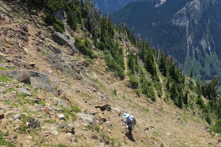
Here we crossed a very steep snow gully that hadn’t fully melted out, so we had to do a brief tricky downclimb on loose debris. It wouldn’t have been pleasant to cross the snow, so this might be the crux of the climb any earlier in the year.
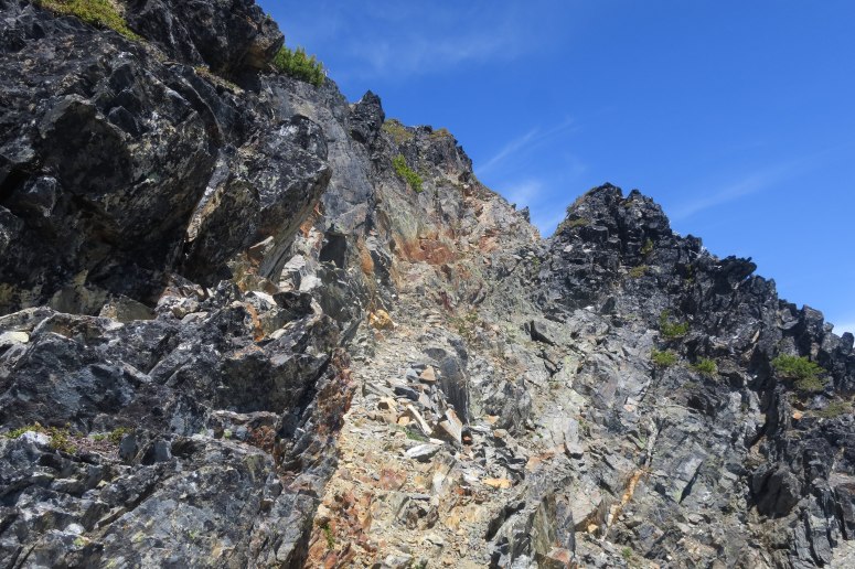
From here there was a short scree slope with a few climbers paths winding up, and then the final ridge to the summit! We reached the summit at 1:30 PM and it sported some amazing views on this beautiful bluebird day!
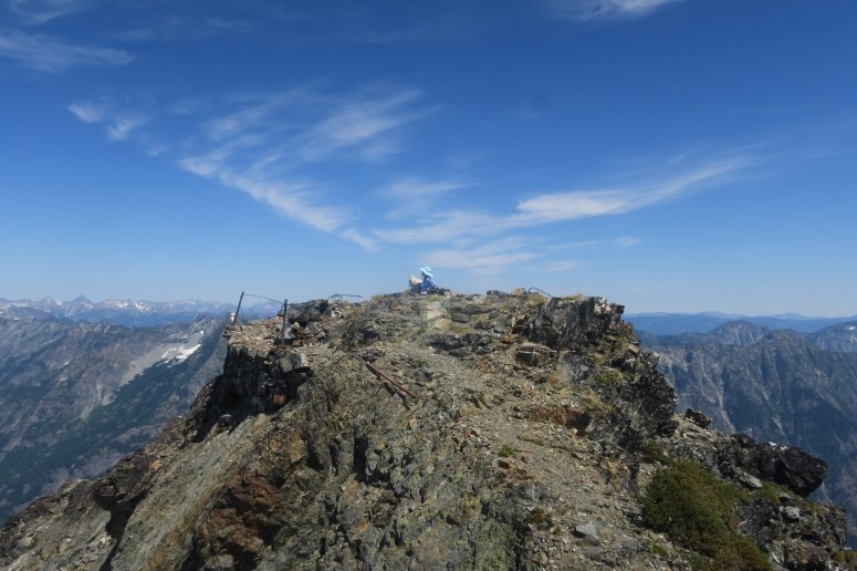
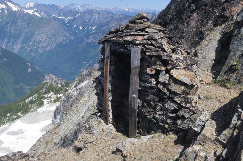
There was a register tube but it didn’t have a pad of paper in it (just some loose scraps in a bag). If you take the time to walk across to the smaller block right next to the summit (to the southwest), you will see the old stone toilet which is still in amazing condition. Some jerk left a plastic water bottle in there and we weren’t brave enough to pull it out 🙁
On the way down, Craig cleared a bunch of debris off the trail. We wished we had our machete though! There were a few mosquitoes but nothing too bad. The hike down basically felt like eternity. We were back out at 6 PM.
(Download the free Gaia GPS app on your phone to view tracks and then get a Gaia GPS membership if you want offline access. Discount below!)

Recommended brew: Trillium Double Dry Hopped Sleeper Street IPA (if you can get your hands on it)
Gear Used:
- Aluminum ice axe
- GPS
- Hiking boots (Craig)/trail runners (Vanessa) – boots were better for kicking steps
- Microspikes (not used)
- Trekking poles
Post may contain affiliated links