
Distance: 6.5 mi.
Elevation Gain: 4000 ft.
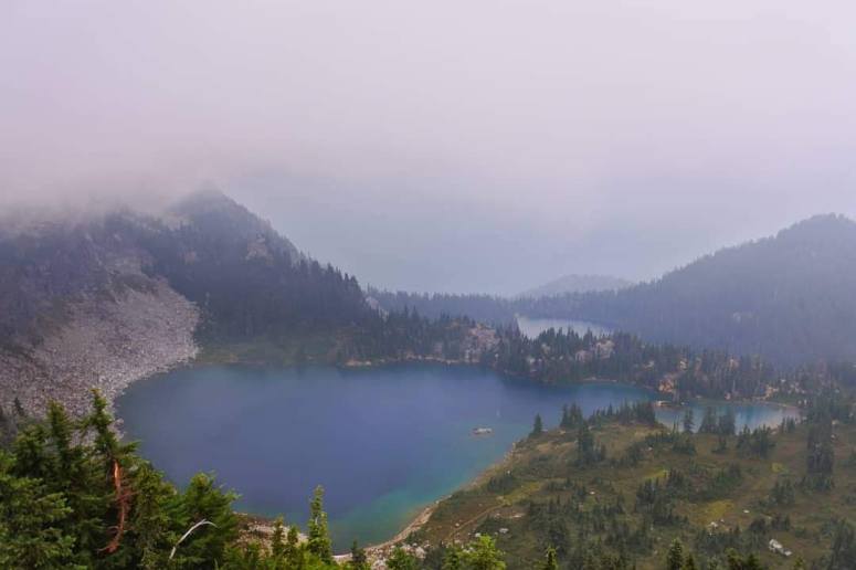
After significantly downsizing our plans due to rain and smoke forecasts, we landed on this hike near Lake Wenatchee. The hike up to Minotaur Lake was pretty steep and dusty, but equally quick. We were only slowed down by the oodles of delicious blueberries that kept making us stop in our tracks.
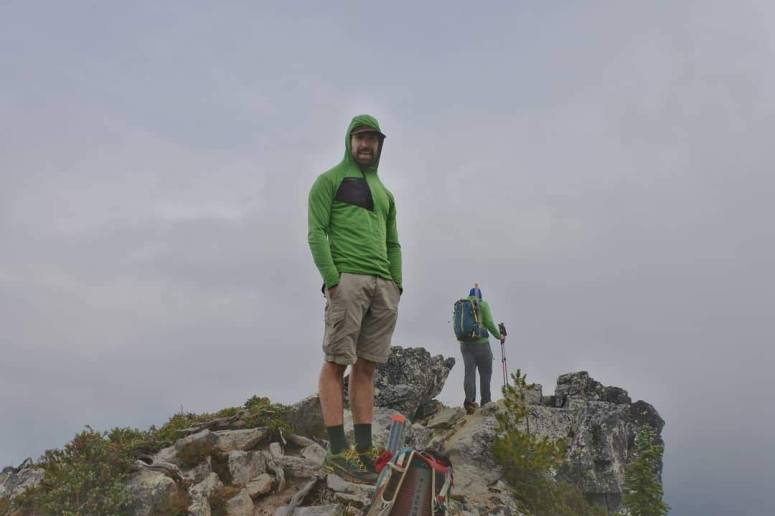
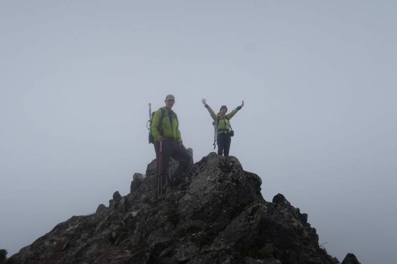
When we reached the lake, we continued around the right (northeast) side of the lake on a pretty obvious trail toward Labyrinth Mountain. There were some confusing criss-crossing trails but we basically stayed low and to the right (north). The climber’s trail had a couple big steps but no major scrambling. There was a little register at the top, but no views! That said, the low fog settling over the lakes below was pretty appropriate for the mystically named peak.
We tried getting to Minotaur via a high route along the ridge between Labyrinth and Minotaur, but we couldn’t see an obvious route along the ragged ridge. I think it’s been done before? But we just decided to go back down to Minotaur Lake and curve around the south edge toward Minotaur. On our way back down we stopped for lunch and started getting rained on, which continued on and off for the rest of the day. Our fingers were getting pretty frozen, too – unexpected for an August hike.
When we got to the outlet of the lake, we followed a couple thin trails toward the southwest which we eventually lost, so we continued toward the left (south) side of the ridge up Minotaur. There was a nasty scree field we had to climb, but nothing too tricky. The ridge had some brief, low 3rd class scrambling. This summit didn’t have a register, and we still didn’t have any views.
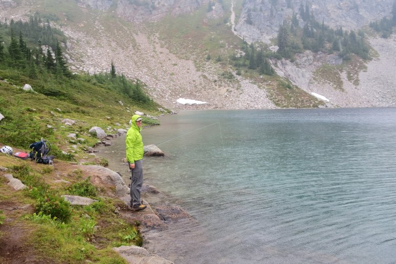
On the way back down we tried following a couple climber’s trails on the ridge past the scree field and managed to find a more established trail back to the lake, which we had missed on the way up. We hung out at the lake for a bit so that Brian and Craig could fish. I read my book under tree cover and tried to ignore the hastily buried human poos everywhere (I didn’t have the courage to pack them out but I did bury a couple piles a little better). Fish weren’t biting and the rain was getting worse, so we quickly returned to the trail back out. Our return trip was straightforward and filled with berries. Unfortunately, no unicorn sightings ALL DAY 🙁
(Download the free Gaia GPS app on your phone to view tracks and then get a Gaia GPS membership if you want offline access. Discount below!)

Recommended brew: Mac & Jack’s Jitterbug Coffee Porter
Gear Used:
- GPS
- Helmet
- Trail runners
- Trekking poles
Post may contain affiliated links