Distance: 15.1 mi.
Elevation Gain: 6100 ft.
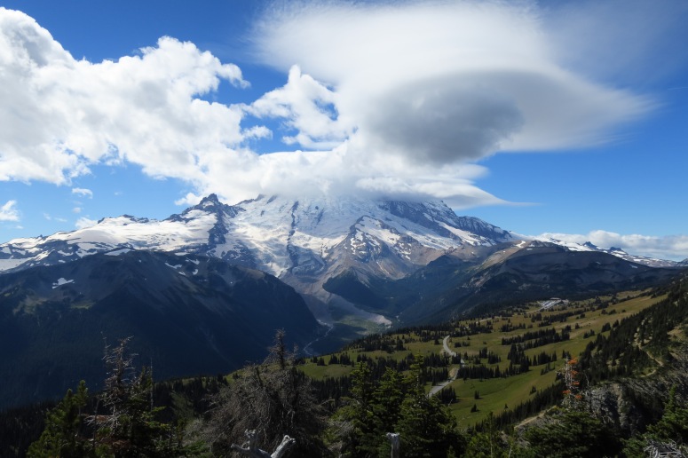
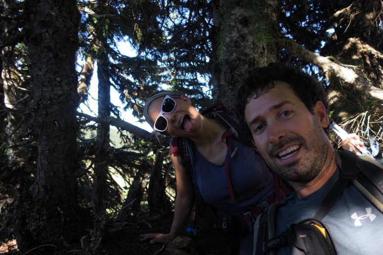
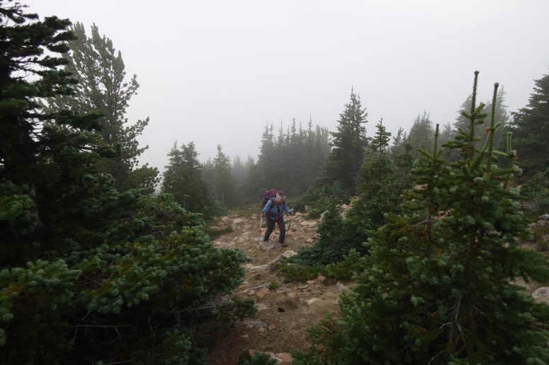
We got it in our heads that we wanted to spend the weekend on a peakbagging spree in Mount Rainier National Park, but by time we got to the ranger station our backcountry camping options were limited. We landed on the Dick’s Lake campground, which was surrounded by several peaks. Unfortunately, since we hadn’t planned on doing any scrambling, we didn’t bring our helmets. We got off lucky this time, but we learned our lesson that when in doubt, we should throw our helmets in the car. We started off by parking at the upper Sunrise Point parking lot and climbing up Dege Peak. It’s a short hike from the parking lot and offers stunning views of The Mountain. In our case, Rainier was surrounded by sweet lenticular clouds. From here, we went off the northeast side of the peak for a “shortcut” to our campground. In retrospect, I think this was a really dumb decision. Not only did it probably take longer than just going back down the trail and through the parking lot, but we ended up trampling a bunch of alpine vegetation 🙁 Okay, so at least two lessons were learned on this trip.
We did eventually make it to camp after passing the west side of Clover Lake on the Palisades Lake Trail, crossing over to the north side of a small ridge, and then set up our tent near Dick’s Lake. Then we headed north toward Upper Palisades Lake, where we went off trail to the right (east) toward Brown Peak and Slide Mountain.
There was a well-defined climber’s trail most of the way. At one point, Craig’s GPS told us to go up to the top of “Brown Peak”, which was about 50 feet above the ridge. We literally dove into bushes to reach the “summit”. There was even a tiny cairn inside the bushes. It was pretty hilarious. Don’t bother with this peak unless you’re a high-level shameless peakbagger like us.
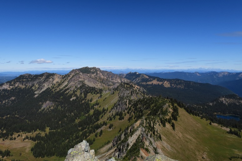
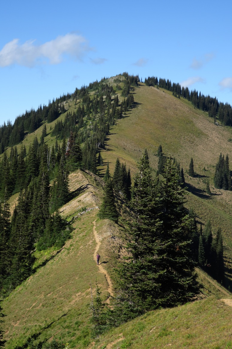
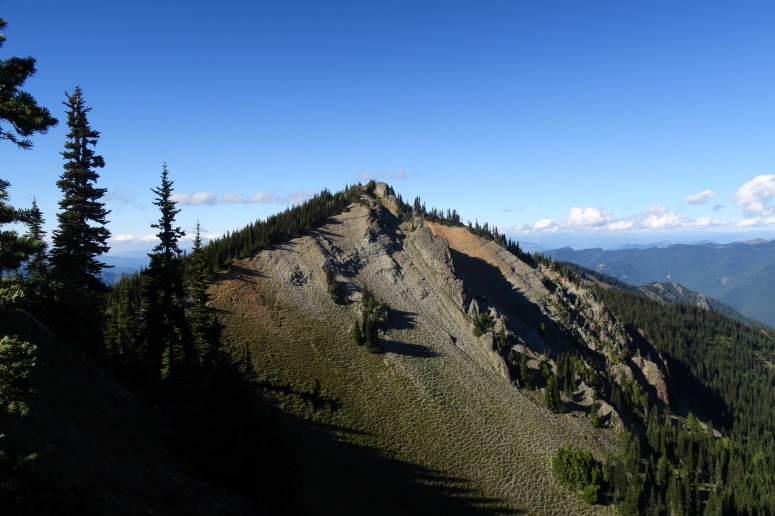
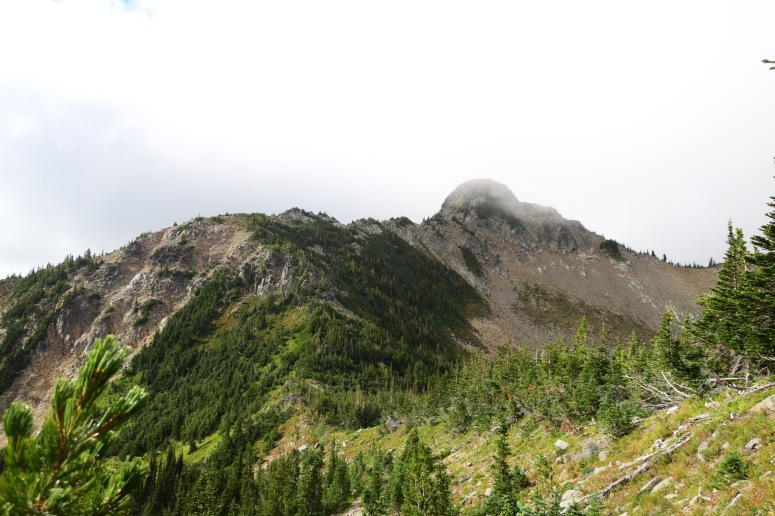
We got back on the climber’s trail and continued northeast. (South) Slide Mountain was very cool looking, and must be covered in elk certain times of year because there were droppings everywhere. Sadly, we didn’t see any. We did see a few other hikers, though. We eventually made it to the summit of South Slide Mountain and then retraced our way back to the campsite.
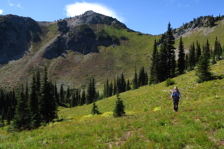
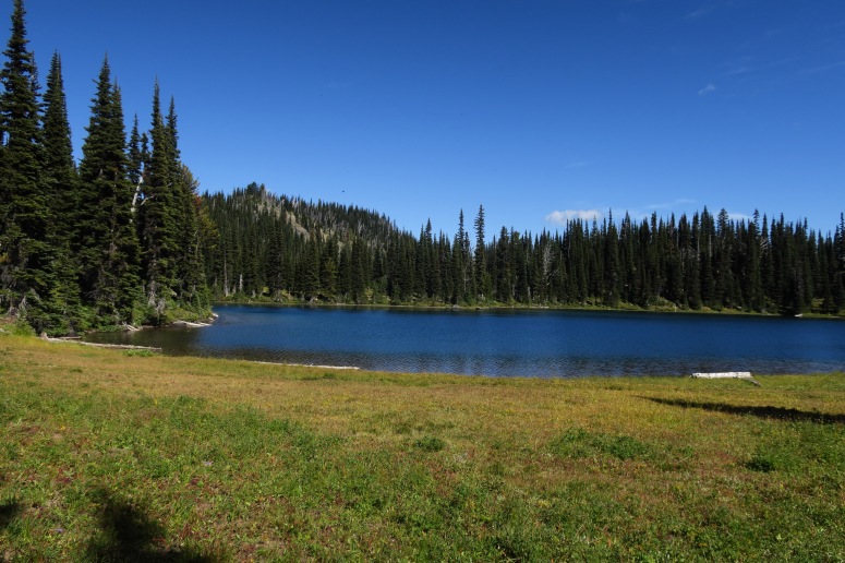
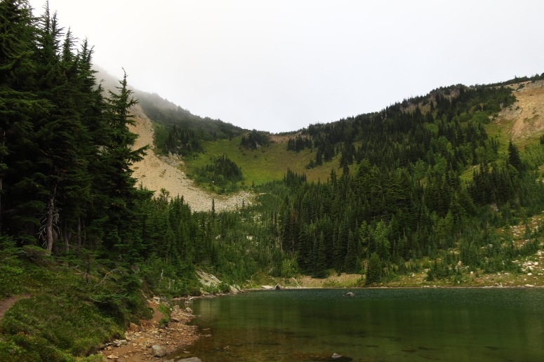
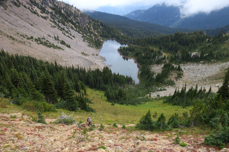
After listening to eerie elk bugles all night long, we got up and made our way slightly south on the trial to the Hidden Lake Spur. Hidden Lake was a small alpine lake surrounded by dense pine and a low mist, making it look like the quintessential Pacific Northwest spot. We hiked around the south side of the lake and then continued west on an obvious climber’s trail. Even though the climber’s trail was well-used, there were some low, dense bushes making it a bit challenging to pass through. When we reached the notch between Marcus and Palisades Peaks, we turned right onto the west side of Palisades Peak.
We traveled confusedly through the clouds on a high plateau until we eventually went right (east) toward the summit. We climbed a steep slope on various elk trails until we reached the ridge, and then hiked south along the surprisingly simple ridge to the true summit. We essentially followed the same route back down, although we got a bit lost in that confusing plateau again.
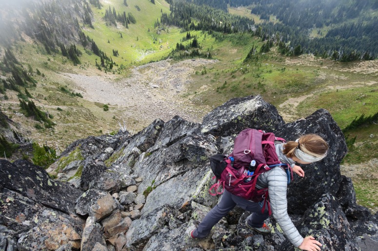
We returned to the notch and this time went south toward Marcus Peak. We followed the bushy ridge south toward the summit, and then turned right (southwest) for the final scramble. It was really inappropriate to do this scramble without helmets, but the rock was solid. On the way back down, we decided to go along the northern bowl below the peak rather than back down the bushy ridge, and that was a little more straightforward.
We went back down the climber’s trail to Hidden Lake, and then returned to the campsite to pack up camp at 11:45. We followed the trail back to the car and were out just before 2.
(Download the free Gaia GPS app on your phone to view tracks and then get a Gaia GPS membership if you want offline access. Discount below!)

Recommended brew: Mule & Elk Winter Ale
Gear Used:
- Backpacking tent
- GPS
- Sleeping pad
- Summer sleeping bag
- Stove
- Trail runners
- Trekking poles
- Water drops/filter
Post may contain affiliated links