
Distance: 5.4 mi.
Elevation Gain: 1500 ft.
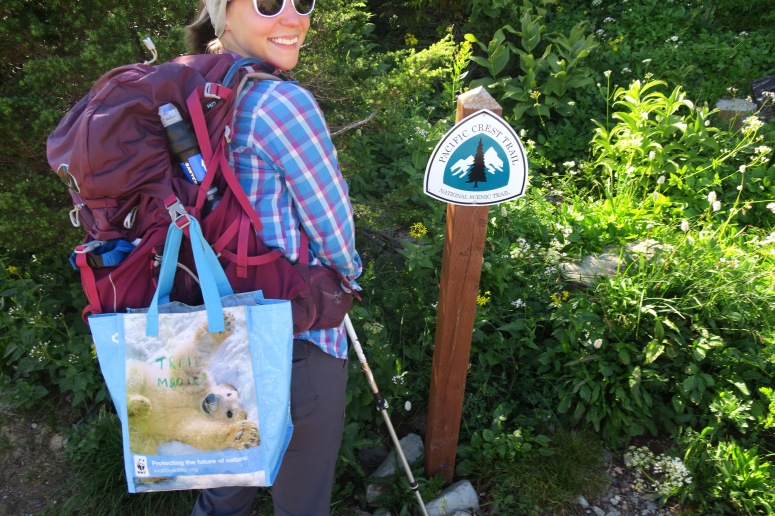
After backpacking inside Mount Rainier National Park the night before, we were poised to do another short hike before heading back to Seattle. We drove from Sunrise Visitor Center to Chinook Pass, where we again parked the car. The Pacific Crest Trail goes through Chinook Pass, so I was prepared with a bag full of goodies for the thru-hikers, who are typically hiking through Washington this time of year. We handed out candy and chips to the thru-hikers we saw on our way to Naches Peak.
Soon after crossing 410 on the PCT, we went off trail to the right (southeast) along a climber’s trail. The trail continued southeast but we eventually had to break off to the left (east) for the summit of Naches and we couldn’t find a climber’s trail for that. We climbed up a heavily treed slope until we reached the scree field below the peak. We found a decent climber’s trail again, which took us directly to a nice entry point for the scramble to the summit. We forgot to bring our helmets from home, and this scramble definitely should have included helmets.
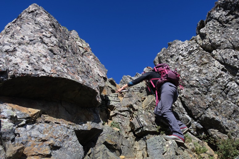
We continued along a scramble route that was clearly used frequently, until suddenly there was a huge drop-off in every direction except the way we came. We could see the summit less than 50 feet in front of us, but the trail had come to a dead end. We looked at each other bewilderedly, and then decided that we must have followed an incorrect path. We we went back down to the bottom of the scramble and tried traversing on the scree field below the summit to the west, looking for another scramble route. But the steep scree field was exceedingly difficult to travel across and we didn’t see any other plausible routes. Craig suggested, “Maybe we were supposed to cross that big drop-off to get to the summit.” I stared at him long and hard. It seemed so unlikely that anyone in their right mind would scramble across that gap. But I hesitantly returned to the spot with him.
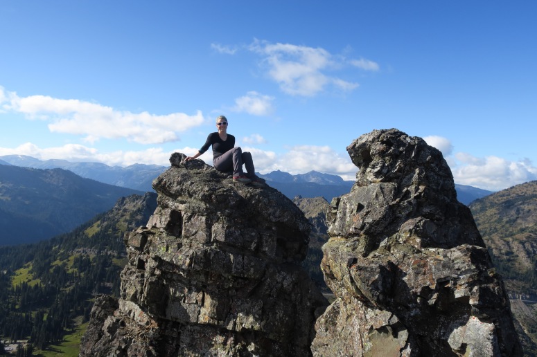
We peered down into the gap, and there was a human-sized rock about four feet down, improbably perched along the ridge with a deadly drop-off on either side. We hadn’t brought any climbing gear, but it would have been impossible to properly protect anyway. Craig slowly lowered to the rock below, found that it held his weight, and then continued southwest toward the summit. This required him to bear-hug another large rock while inching along a thin ledge. After that, it got easier. He came back to me and said, “It goes.” He patiently coached me onto the rock below me, and then we finished the remainder of the route to the summit. The rest was easy, but that one scrambling move was the scariest I have done before or since.
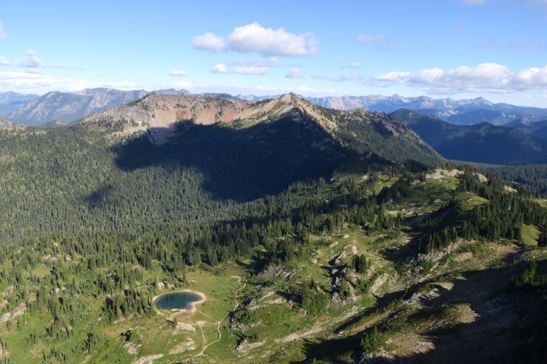
The scramble back across the ridge was still scary, but less so in this direction. We essentially retraced our steps to the PCT, and then handed out the rest of our goodies before returning to the car! If you’ve never done “trail magic” (handing out snacks to thru-hikers), I highly recommend giving it a try for a major dopamine boost. Having been a thru-hiker on the Appalachian Trail, it’s pretty spectacular on the receiving end, too!
(Download the free Gaia GPS app on your phone to view tracks and then get a Gaia GPS membership if you want offline access. Discount below!)

Recommended brew: Perihelion Galactic Drift IPA
Gear Used:
- GPS
- Trail magic
- Trail runners
- Trekking poles
Post may contain affiliated links