
Distance: 40.8 mi.
Elevation Gain: 8600 ft.
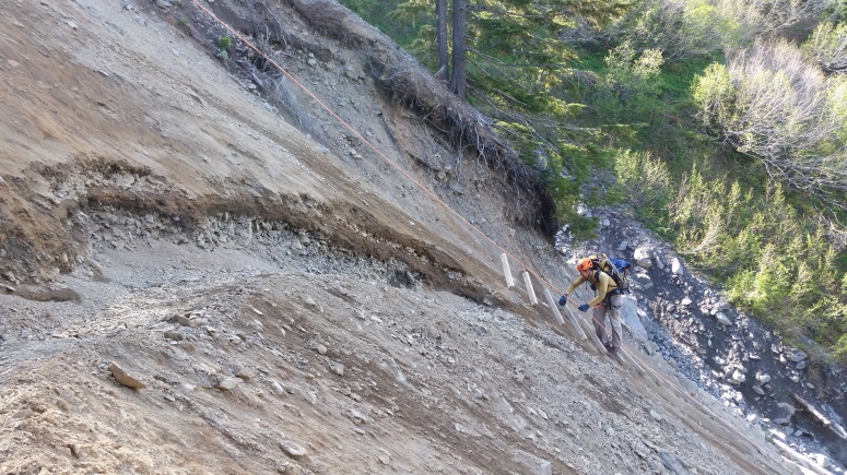
Due to the low snow year, conditions were appropriate for a Mount Olympus attempt over Memorial Day. We weren’t the only ones with this idea and had quite a few companions on the trip. We hiked in from the Hoh River Trailhead on Saturday and reached Glacier Meadows, where we had our camping permit for both Saturday and Sunday nights, at dusk after a very long (~18 mile) day of hiking. Crossing the large washout area just before camp with waning daylight was exciting, but we were forced to wait out while a large group of hikers ahead crossed the ladder one by one.
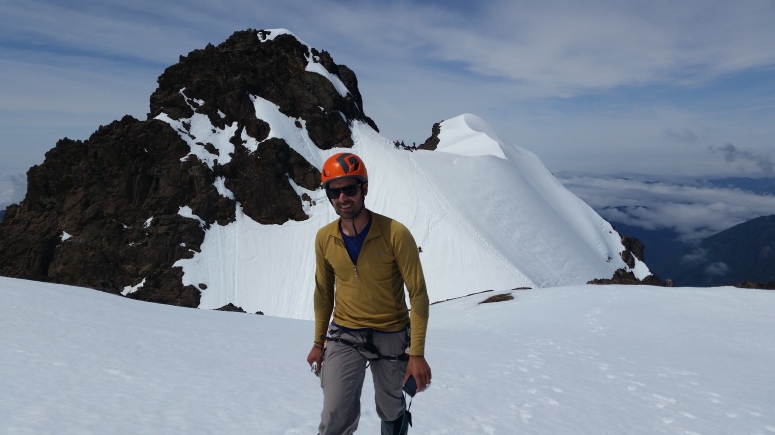
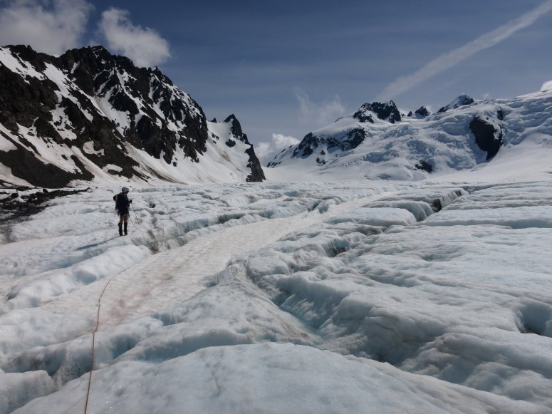
We got started early-ish on Day 2 and reached the terminal moraine at 7:30 AM. The terminal moraine didn’t have much snow on it so it was very challenging to cross (loose boulders would roll onto our feet as we walked on other loose boulders). We roped up on the Blue Glacier at 8:30 AM and started climbing north toward snow dome. From Snow Dome we took the typical Crystal Pass Route. Crevasse conditions were easily navigable, which was good considering we had a 2 person rope team. We reached the false summit at 12 PM and realized that the summit conditions weren’t ideal. There was too much snow on the normal 5.4 climbing route, but not enough snow covering the scramble route to climb entirely on snow. There were many, many other climbers below the summit trying to figure things out, so we knew we would have several hours waiting to climb and then belay if we did make a successful attempt. We watched as another 2 person team tried climbing the scramble route, and the higher climber nearly took out his partner with several large rocks dislodging from the recently melted snow. After much hemming and hawing, we decided to turn around at the false summit and save the true summit for another day.
We returned to camp in the early afternoon and went to bed early. Then on Day 3 we had the long, mostly-flat hike back out along the Hoh River, luckily with less food in our packs this time around.
(Download the free Gaia GPS app on your phone to view tracks and then get a Gaia GPS membership if you want offline access. Discount below!)

Gear Used:
- 60 m half rope
- Helmet
- Steel ice axe (Craig had aluminum)
- Steel crampons
- Harness + prusiks + carabiners + ATC
- Mountaineering boots
- Trail runners
- 3 Pickets
- Backpacking tent
- Stove
- Water filter
- Trekking poles
Post may contain affiliated links