
Distance: 12.4 mi.
Elevation Gain: 6700 ft.
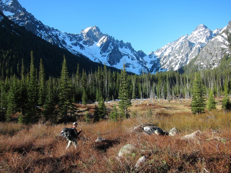
Favorable spring conditions and a recently opened Eightmile Road led Jim and I to try to get into the Enchantments area for some steep snow climbing. He had wanted to climb this route for a little while and I was easily persuaded. We hiked mostly snow free up the trail to past the Colchuck Lake trail split and then to where we could see up the Mountaineer Creek basin to Argonaut and Sherpa. We picked a route we thought would be least brushy, but unfortunately things started to get a bit swampy on us. In retrospect it might have been better to stay on the trail a bit longer and stay on the west side of the creek, but we made it work with one particular creek crossing requiring great balance and concentration.
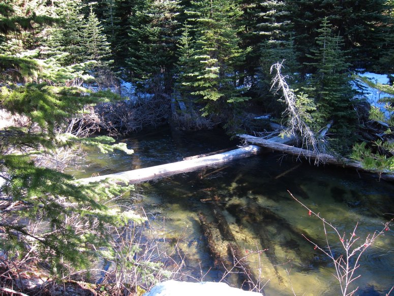
We crossed this log to get across Mountaineers Creek in the swampy area…definitely good balance beam practice, as there was nothing to brace poles against.
Once across the swampy area we had easy travel under tree cover and we reached consistent snow at around 4,700′. We followed the easternmost branch of Mountaineers creek up toward the north face of Argonaut. The creeks were all well under snow at this point, but some alder was poking through and troublesome at times. this area would be very unpleasant later in the year. We donned snowshoes for much of this ascent to the base of the couloir. We took a break here for some snacks and decided the snow conditions were set up perfectly to just solo up the couloir in our crampons.
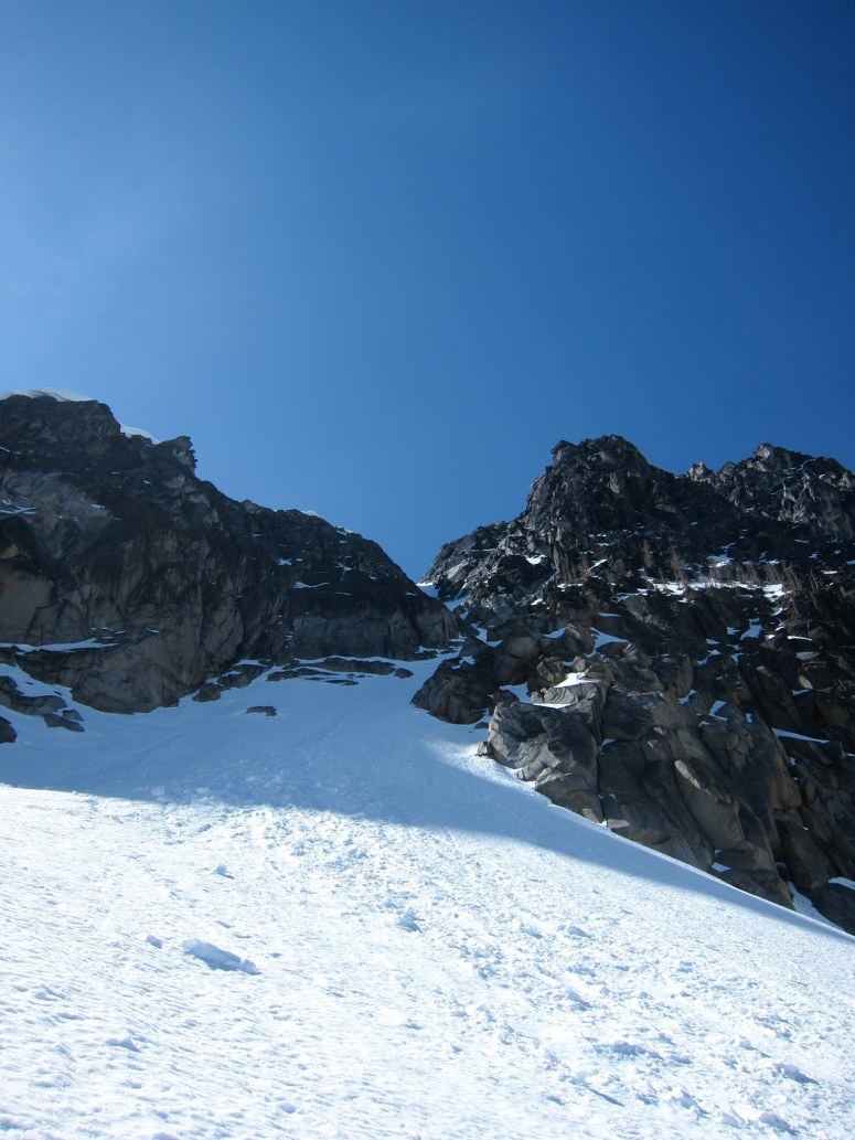
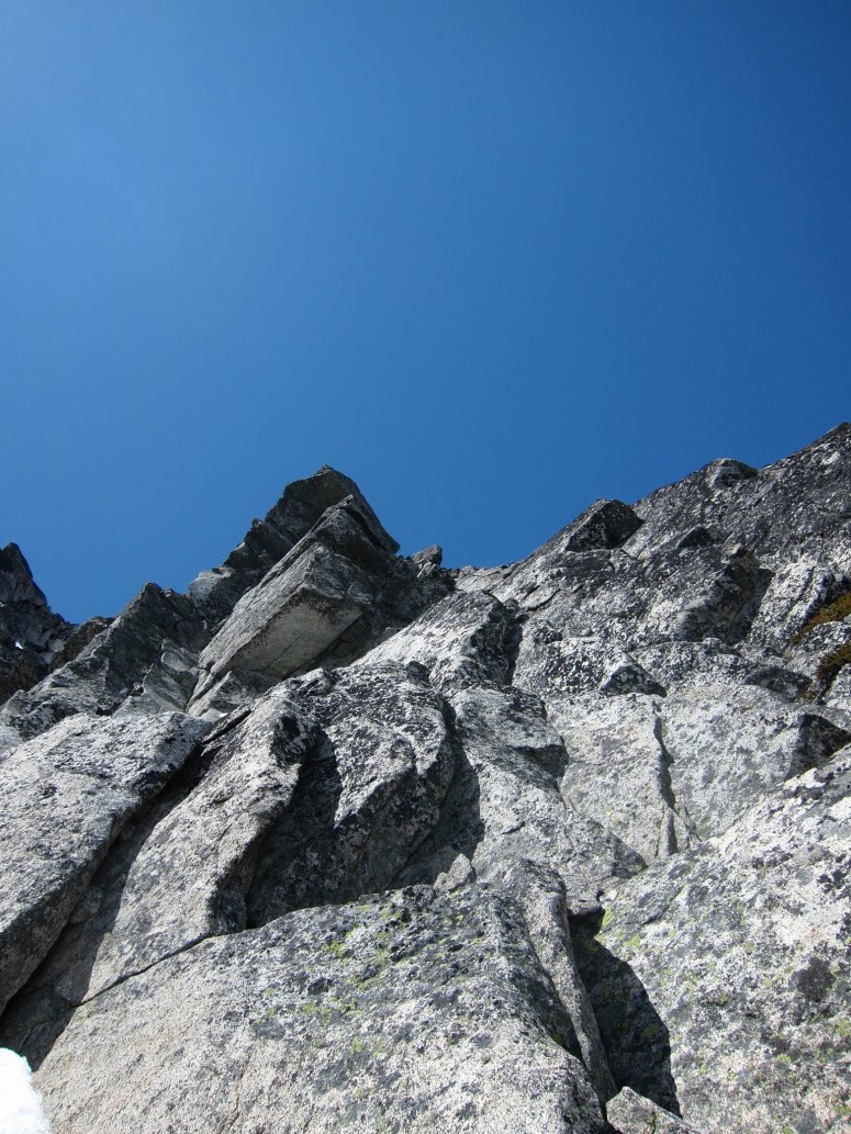
The start of the NE couloir
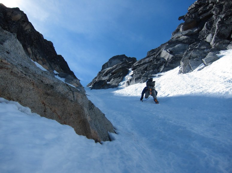
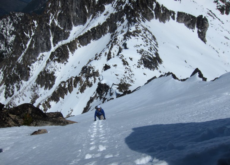
Jim part way up the couloir. The snow conditions were fantastic so we decided to climb unroped.
This was the correct choice, as we were able to make ‘hero steps’ the whole way up and save some time. This climbing was spectacular, with consistent snow between 35 and 50 degrees and getting as narrow as 5 feet at one point. We eventually topped out on a rock ledge where we had to rope up and climb one pitch of easy rock climbing. We decided to keep the snowshoes on our backs since we didn’t really know what the snow conditions would be above. The climbing was pretty easy but required some exploration as there wasn’t a most obvious route. I led it and ended up topping out right next to some rappel slings…so I must have done it right. We were a little surprised how steep the upper snowfield looked from here and after testing the snow a bit decided to leave our snowshoes at this rappel station.
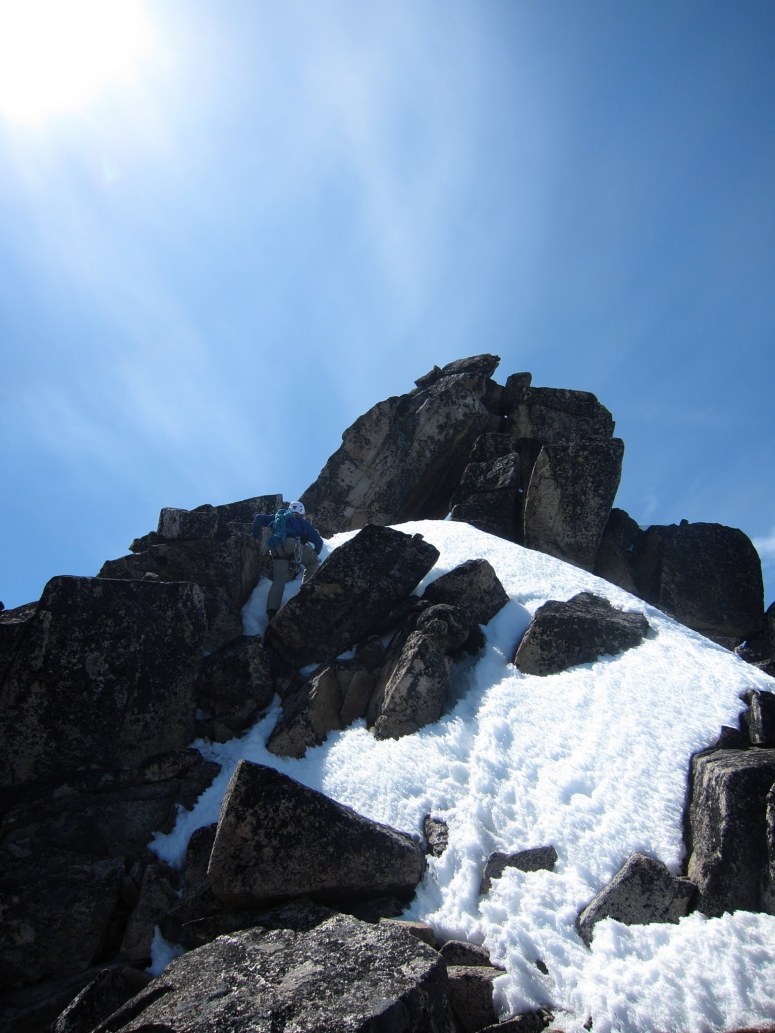
At the top of the couloir we had to climb a pitch of rock to get to the upper snow field. It was the first time I had led rock with snowshoes on my back.
I led out from here on an upward traverse to the ridgeline above. I went to the first obvious notch above me only to find that traversing the ridge higher would likely be quite difficult and I probably should have just traversed further west on the snowfield. We did some careful downclimbing around some rocks and then back up and west to the next notch brought us to where we wanted to be.
Jim on the upper snowfield. This snow was firmer up here and the exposure below made this part scarier than the couloir.
There was however a brief rock traverse that we decided we should probably rope up for. Jim led this and stayed mostly on the ridge except for a traverse around the right side of a tower. This brought us to the final summit scramble that we could do unroped. A bit of 3rd class scrambling and easy snow travel brought us to the base of the summit rocks. The summit itself is the top of a big slab that is leaning on some other rocks. The easiest way to the summit is to go through a tunnel under the leaning slab and to ascend rocks on the west side to the top.
Jim on the final scramble. We went through the hole to the right of Jim under the leaning summit block to finish up the other side.
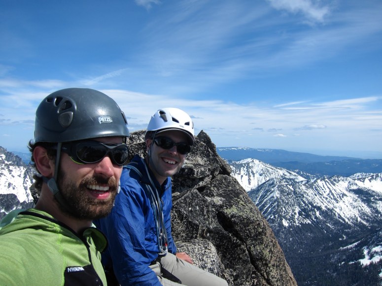
Happy to be on top!
After enjoying the summit for a bit we retraced our steps back to where we left the snowshoes. We did one rappel back down to the ledge at the top of the NE couloir. We walked the ledge to the south until we were able to get onto snow in a gully that would take us down to easy terrain in the Porcupine Creek Basin. This gully wasn’t quite as steep as the NE couloir and it wasn’t all that far down to easy terrain, but we had to do some careful down climbing. It was pretty uneventful except for the ice chunks that rained down the gully 10 minutes after we were out of it. I’m not sure where they came from, as nothing looked particularly threatening, but I was glad to be out of there.
From there we had to decide if we wanted to try to cross over the ridge and back into the Mountaineers Creek basin or to go around Colchuck Peak and down to Colchuck Lake. We ultimately decided to go the Colchuck route and I am sure glad we did. This required dropping a bit more elevation to get around Colchuck Peak, but the going was very easy and we enjoyed a perfect glissade from the col almost all of the way to the lake.
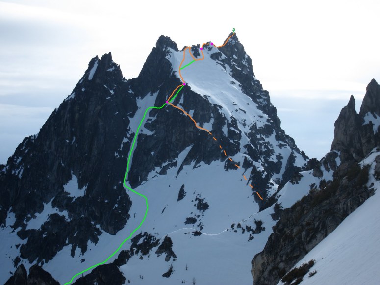
Our route viewed from the south side of Colchuck (orange up, green down, pink dots belays)
From Colchuck Lake we enjoyed the long but familiar trail hike back to the car. We were quite tired and grateful the Cole’s Corner gas station was open late so we could get some snacks and caffeine. This was definitely one of my favorite snow climbs I have ever done!
(Download the free Gaia GPS app on your phone to view tracks and then get a Gaia GPS membership if you want offline access. Discount below!)

Recommended brew: NW Peaks Alpenglow Triple IPA
Gear Used:
- Mountaineering boots
- Steel crampons
- Snowshoes
- 2 ice tools (Petzl Aztarex)
- 60m half rope
- Light rack (nuts and tricams)
- Glacier glasses
- GPS
- Helmet
- Trekking poles
Post may contain affiliated links