Distance: 36.4 (16.4 on bike) mi.
Elevation Gain: ~10k (2k on bike) ft. – GPS said 13,640′ but I think that is exaggerated
I had originally planned a longer hiker in the mountain loop area but the weather wasn’t working out. The forecast looked decent to the east and south in the Cascades, but it also looked pretty decent in the northern Olympics. I had wanted to get in and check out the Elwa River for a while and wanted a long day so I figured I would give a go at the long off trail lollipop from Appleton Pass to Boulder Lake.
I left home around 3 am and did the long drive around through Tacoma arriving at the end of the gated road just before first light. I geared up my bike and rolled down the short stretch of road to the washout bypass where I donned my headlamp to head into the still somewhat dark trees at 6am. The bypass is annoying gaining almost 200′ over about a mile of bike pushing to get back to the road. My friend later informed me there is a shorter bypass trail near the river that is accessible in late season, but I didn’t know that.

Back on the road I slowly pedaled my way up past the old dam and then on the increasingly steep road to the real trailhead at Deer Creek. There were a handful of other bikes locked up here but I still hadn’t seen a soul. The trailhead sign says no bikes but I could see plenty of bike tracks in the dirt along the trail (old road). It was about a 2.5 mile walk to the hot springs. I decided to continue on and check them out on my way out. I then passed through the campground where I saw three tents and passed one person. I was shortly at the trail split for Appleton Pass and headed up that trail which was in very good shape. There was some minor brush, which was still wet in various meadows between 3000 and 4000 feet.


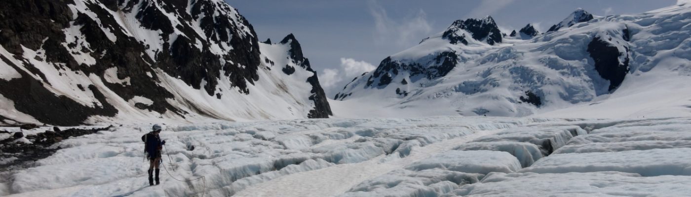
I reached Appleton Pass at 10:30 and was rewarded with no view, a damp cloud and high winds. I found the climbers trail toward South Appleton and followed it up the ridge. It was pretty easy to follow and veered just to the north of the ridge when there were obstacles which was nice because of the wind out of the south. Atop South Appleton I had to throw on my gloves and puffy and was a bit worried about heading to Appleton proper (smaller). While snacking the clouds did lift briefly and give me an idea of a route. I directly descended the north ridge and the traversed the east side of of a steep buttress to climb up the south face of Appleton.


Descending Appleton to the north was the crux of the route. I followed the ridge back to the west where I could get down to scree heading into the north basin down toward a pretty large lake at 5100′ that doesn’t show up on any maps. The scree surfing turned briefly to carefully making my way down a pretty steep washout gully until I finally get to snow and easier travel to the lake. This route would be much better with snow cover (June maybe). From the mystery lake I easily made my way northward toward Blue Lake, which was quite beautiful.


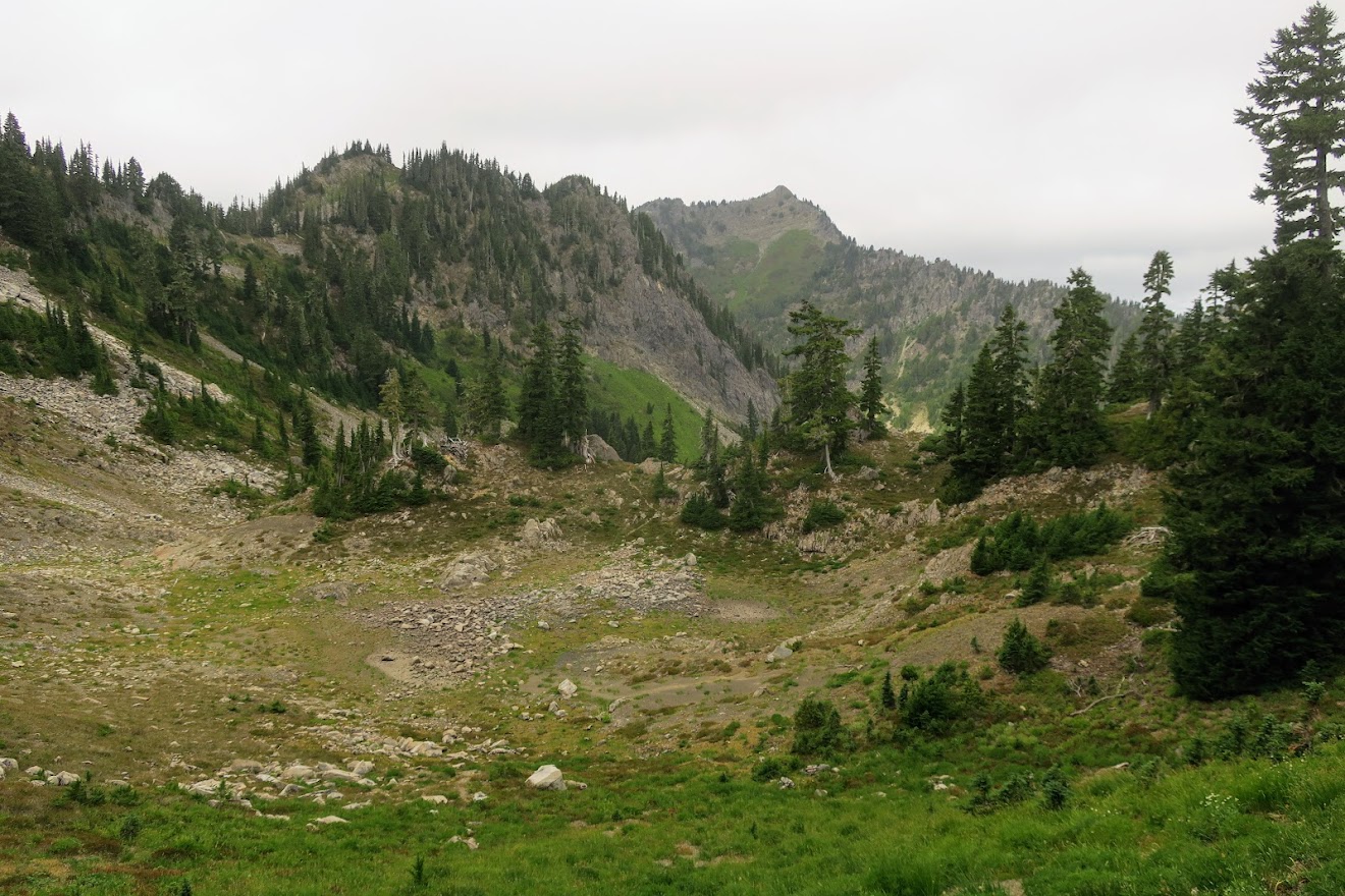
I found a nice climber trail here which I followed for a while but I lost is in brush below the pass to the southwest of Everett Peak. It eventually opened to nicer meadows that I followed to the pass. A quick trip up Everett and the lunch on top where the views were improving (1:30). After eating I headed back to the pass and found a climbers trail that I was able to follow all the way down to Three Horse Lake. From here I headed up the ridge to the north following occassional game trails until the top of the steep bit at 4500 where I could follow a much more obvious climbers trail northwest toward Boulder Lake. Once I crested the ridge and could see the lake there was a very obvious trail split. I follow the other trail back to the south up toward the east ridge of Boulder Peak. I lost the path a few times trying to get up on the ridge but eventually it became more obvious and generally stuck to the north side of the ridge.


Once in the upper northeast basin I lost trail but the terrain became more open. I eventually just traversed over to the north ridge where I suspected there would be a climbers trail. I found a very faint one and elected to drop my pack and make the quick ascend. This trail was actually quite steep and the top was very steep hard dirt. I had some pretty good views from here but it seemed rainy to the south. I didn’t linger long, headed back to my pack and followed some deer down the north ridge, being forced off to the east a few times when it got steep. I eventually dropped to the west in open forest directly to the lake on various game trails.

I didn’t even go to the lake, as I met the trail right at the trail split for the Happy Lake Trail. I was tired and worried about time so I just headed right down the trail to make it to the hot springs at around 5:30. I crossed the bridge and checked out the springs. I didn’t see any signs of the old building but maybe there are remnants. The springs seemed like a good temperature but the water didn’t look that inviting to me. After a brief looksie I headed back and walked the flat agonizing miles back to my bike.

The bike ride down was super fun, with only brief pedaling (really glad to be off my feet too). I made it all the way back to the washout in about 25 minutes. Walking the bypass was unpleasant but also uneventful. The last short roll brought be back to the car at 7:15. It was a very long day but very rewarding. Beers with friends in PA and just missing a ferry meant I didn’t get home until about 11, but it was totally worth it.
(Download the free Gaia GPS app on your phone to view tracks and then get a Gaia GPS membership if you want offline access. Discount below!)

Recommended brew: Reubens Crikey….unfortunately I brought a White Claw Lime with me (drank half)
Gear:
- Day pack
- GPS
- Harness
- Helmet
- Mountain bike
- Trail runners
- Trekking poles
Post may contain affiliated links