
Distance: 10.2 mi.
Elevation Gain: 3200 ft.
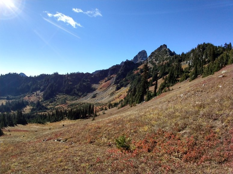
I reached the Owyhigh Lakes Trailhead (en route to Sunrise Visitor Center) at 8:45 AM and got started up the gradual incline toward Owyhigh Lakes. I reached the lakes around 10:15 and continued south a little ways until I saw the obvious climber’s trail off to the right (a bit after a small creek bed) which continued up a grassy field. The trail was steep and rutted, but generally easy to follow. Before long I could see views of Adams and even Hood to the south on this clear day.
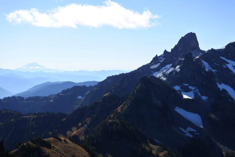
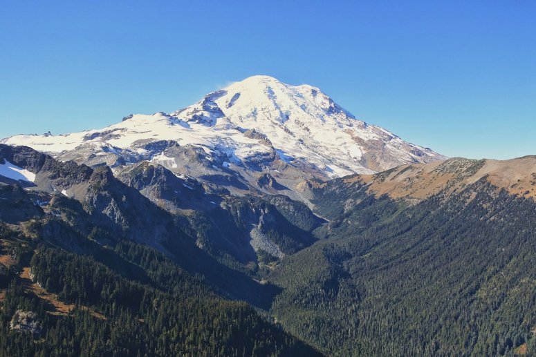
I finally reached the south ridge of Tamanos and turned right (north). I could also see the climber’s trail toward Cowlitz Chimneys to the left. The ridge toward Tamanos was jagged, with several false summits. The route had only 3 or 4 3rd class moves, so if you find yourself wanting to do a 4th class move up and to the right, you’re probably getting off route (…speaking from experience). I was on the left (west) side of the ridge almost the whole way, and did have to do one brief descent between two high points in the ridge. The view of Rainier from the summit was pretty awesome!
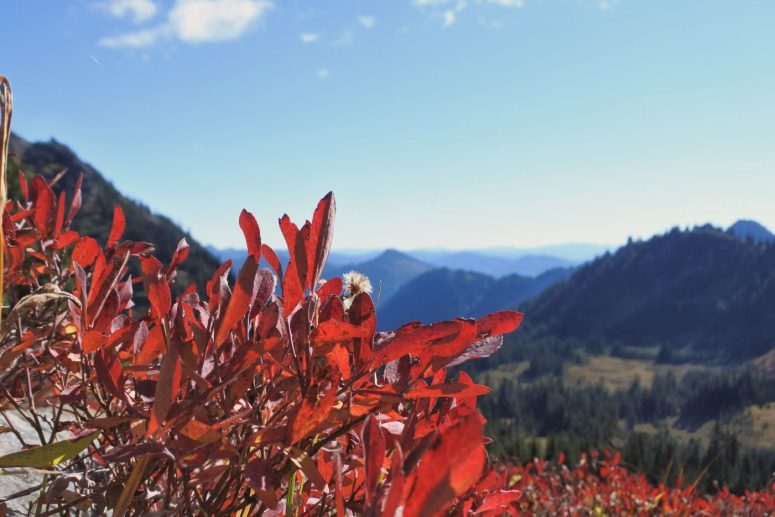
I had a long lunch in the sun, and then reversed course (finding a better route along the ridge on my way back). For the most part the fall colors were past their prime, but there were still some pretty blueberry bushes along the way.
When I reached the main trail, the rest was a nice downhill cruise. I finished up just before 3 PM.
(Download the free Gaia GPS app on your phone to view tracks and then get a Gaia GPS membership if you want offline access. Discount below!)

Gear Used:
- GPS
- Helmet (brought but not used)
- Trail runners
- Trekking poles
Post may contain affiliated links