Distance: 11.7 mi.Elevation Gain: 4525 ft. Since we all have Nexus passes, providing us slightly easier access to Canada Melissa, Jim and I were excited to explore…… Read more “2017-04-22-23 Skiing Frosty Mountain, BC”
Tag: backpacking
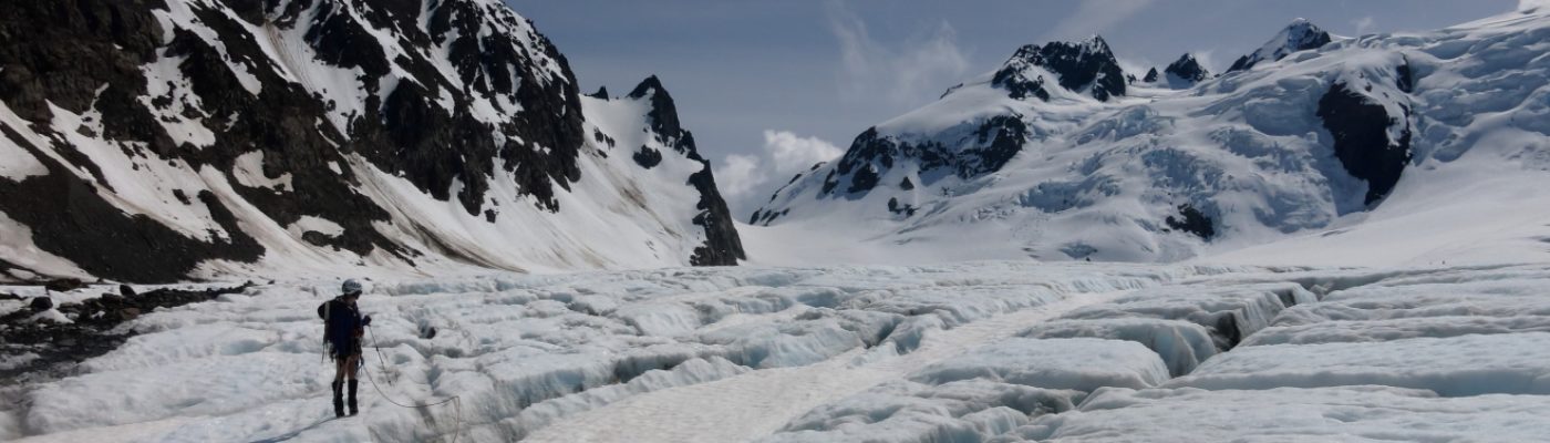
2017-08-26-27 Seven Lakes Basin Loop and Mount Carrie
Distance: 28.7 mi.Elevation Gain: 10,802 ft. We waited a bit too long to reserve any of the popular campsites along the Seven Lakes Basin loop, but we…… Read more “2017-08-26-27 Seven Lakes Basin Loop and Mount Carrie”
2017-05-06-07 The Brothers Attempt
Distance: 15.2 mi.Elevation Gain: 8097 ft. It seemed like we would have a good weather window for a spring attempt of the South Brother summit, so we…… Read more “2017-05-06-07 The Brothers Attempt”
2017-07-15-16 Mount Constance
Distance: 18.7 mi.Elevation Gain: 10,200 ft. Due to the road washout we brought mountain bikes and walked/biked the 4.5 miles to the trailhead. We started biking at…… Read more “2017-07-15-16 Mount Constance”
2017-09-04-20 John Muir Trail Thru-Hike
Distance: 172 mi.Elevation Gain/Loss: 42353 ft./-42641 ft. Download GPS trackMore Photos (Download the free Gaia GPS app on your phone to view tracks and then get a…… Read more “2017-09-04-20 John Muir Trail Thru-Hike”
2018-03-10-11 Mauna Loa
Distance: 16.8 mi.Elevation Gain: 3328 ft. We started this trip the day before at the Backcountry Office in Volcano National Park , where we paid $10 for…… Read more “2018-03-10-11 Mauna Loa”