Distance: 11.7 mi.
Elevation Gain: 4525 ft.
Since we all have Nexus passes, providing us slightly easier access to Canada Melissa, Jim and I were excited to explore the Manning Park area of British Columbia. I had seen a recent trip report of some skiing up at Frosty Peak that looked amazing. It is an area of the Cascades that I had very little knowledge of, a bit of a rarity these days. Once across the border the drive to the trailhead was pretty straightforward. We had some confusion about what permits we needed but we went into the Manning Park Lodge just as you turn toward Lighting and were able to secure the overnight permits we needed. We had to use their ATM to get $5 Canadian per person per night, but then we were ready to go. We got to the parking lot at the north end of Lighting Lake and did some repacking. I managed to pop one of the canned beers I had in my pack and had to do a bit of trailhead drinking to salvage what was left. We started up the Frosty Mountain trail around 10:15.
The trail switchbacks up some pretty steep north facing slopes to get on the ridge. Some of the snow was pretty icy in here and we elected to carry our skis for a bit to avoid falling down the steep slope. After the steep bit, it was pretty easy going up the ridge until it gets almost completely flat at 1,830m (6,000′). Here the snow was starting to really soften in the sun and I was having some trouble with snow balling up on my skins. Of course I had forgotten the skin wax. I powered through as we followed the flat ridge to the south. It did eventually turn back into an uphill slope until we got to 2,070m (6,800′). We followed this flat part of the ridge to the southwest and made camp before the final uphill portion that takes you into the upper bowls of Frosty (at about 5PM)
We enjoyed a very frosty night out!
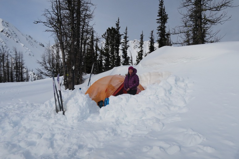
A lovely place to camp
The next morning we got a leisurely 8 am start, continuing up the ridge to the south. It eventually took us into the north facing bowl on the east peak of Frosty Mountain.
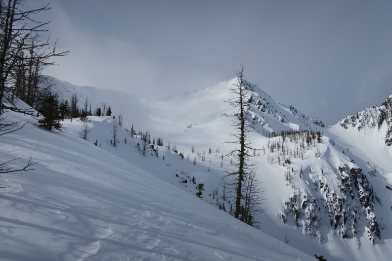
First views up to our destination
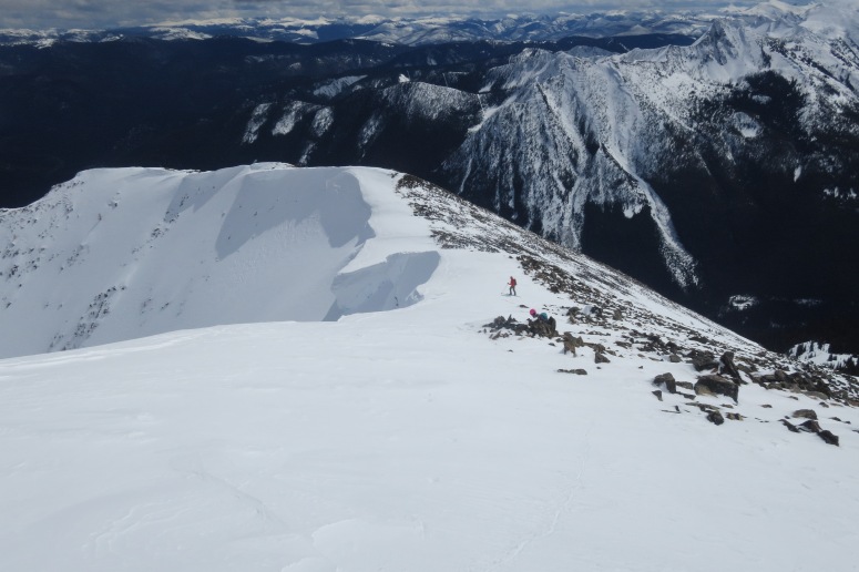
Once in that bowl there were large cornices hanging on almost all of the ridge line except for the easternmost ridge where the summer trail ascends. The snow was icy here again and thin in places so we ended up booting up the steepest portion until on the ridge top. From here we were able to traverse some steeper slopes until it was easy travel up the ridge with rocks to our left and huge cornices on our right.
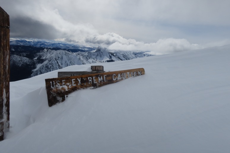
Upon gaining the ridge there was a sign that was perfectly covered to emphasize that we should be careful
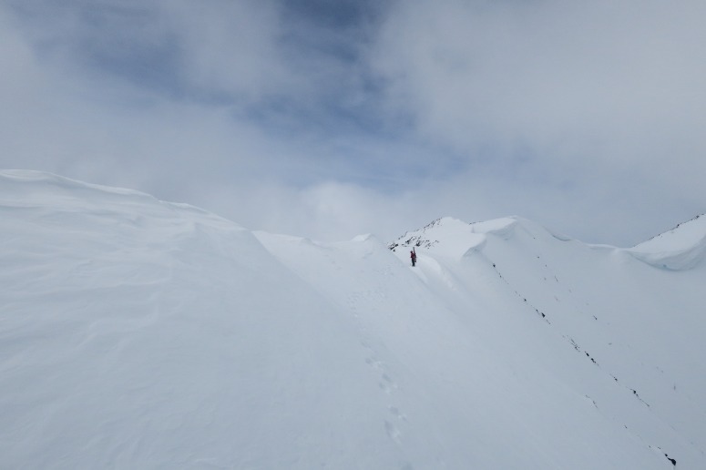
Carrying skis a little farther until we could skin along above cornices
The clouds had been building as we approached the ridge top and we had briefly considered turning back, but our decision was rewarded as the clouds started to disperse as we reached the top (around 11), treating us beautiful views back into the US toward Castle Peak and the Pasayten Wilderness.
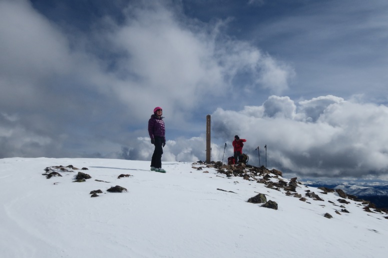
On top of East Frosty where the sun greeted us
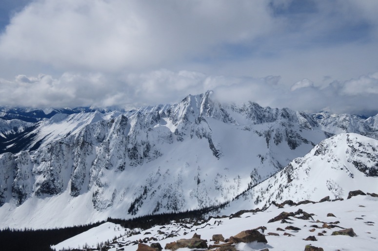
Castle Peak
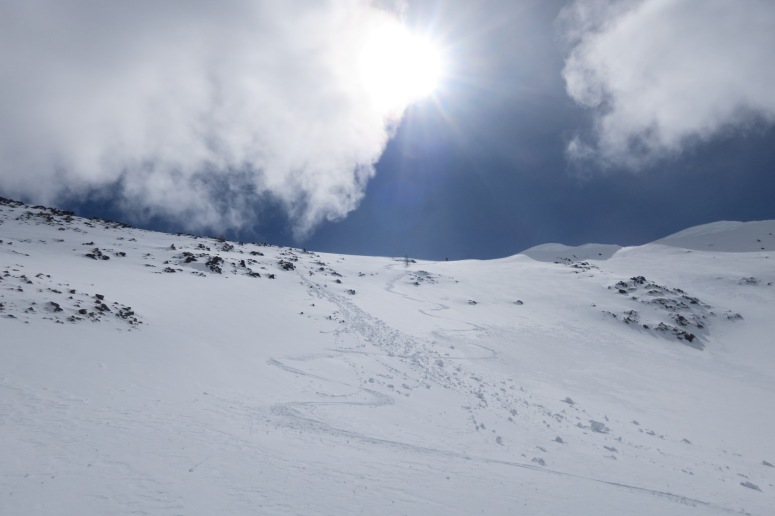
After basking in the sun for a while we elected to just carefully ski back down the corniced ridge rather than skiing into the bowl below all of the cornices. It was pretty easy until we got back to the steep slopes we had booted up earlier in the day. These north facing slopes were softening in the sun but still quite slick just below the surface. We did some side slipping and then had a lot of fun making turns down to the lower angle terrain.
Jim and Melissa skiing back down the ridge
Jim and Melissa above. I got a few good turns in there.
We had a lot of fun gliding down the low angle slopes back to our tent by noon. We packed up and ate lunch. On our way down from the peak we noticed some west facing slopes that we could take to get into the Frosty Creek drainage, which we followed all the way down to south end of Lightning Lake. Skiing the open slopes down into this drainage were so much fun with perfect corn at this part of the day. We entered the trees at about 5,500′ and the drainage started to tighten up as we went down. We had to stop often, strategically taking various snow bridges across the creek and had to even hike back up some slopes to avoid downed trees or openings in the creek that we couldn’t cross. This was very tedious and even scary at times. This descent would probably be enjoyable earlier in the year with a lot more snow. Once back on the trail around the lake, we were back to easy skinning and had a few patches of almost no snow, but we managed to make it all the way to the car continuously.
We arrived back at the car around 4:30 and cruised back to the US, only to get stopped at the border because of some confusion with Jim’s Nexus pass that needed clearing up inside their office for almost and hour. Despite this deterrent we were all very excited to get back to Canada for similar adventures in the future.

(Download the free Gaia GPS app on your phone to view tracks and then get a Gaia GPS membership if you want offline access. Discount below!)
Recommended brew: On Fleek Imperial Stout by Stillwater Artisanal Ales
Gear Used:
- Avalanche beacon/shovel/probe
- Backcountry boots/skis/skins
- Glacier glasses
- GPS
- Helmet
- Steel Crampons
- Trekking poles
- Whippet
- Tent / Sleeping bag / Pad
Post may contain affiliated links