Distance: 172 mi.Elevation Gain/Loss: 42353 ft./-42641 ft. Download GPS trackMore Photos (Download the free Gaia GPS app on your phone to view tracks and then get a…… Read more “2017-09-04-20 John Muir Trail Thru-Hike”
Author: mountainflamingo
Entering Avalanche-Prone Terrain
Many of the trip reports on this site enter avalanche-prone terrain. If you’re planning to adventure in Washington State between the months of November and June, it’s…… Read more “Entering Avalanche-Prone Terrain”
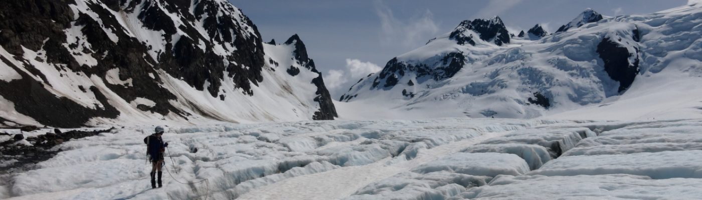
2018-02-10 West Granite and Granite
Distance: 8.59 miElevation Gain: 4512 ft. It was very melted out down low; we first hit snow on the trail around 3,500′ and were on continuous at…… Read more “2018-02-10 West Granite and Granite”
2018-01-14 Skiing Smithbrook
Distance: 6.8 mi.Elevation Gain: 1421 ft. We never took off our skins… Try snowshoes? More photosDownload GPS Track (Download the free Gaia GPS app on your phone…… Read more “2018-01-14 Skiing Smithbrook”
2018-01-20 Skiing Kendall Stump
Distance: 5.22 mi.Elevation Gain: 2791 ft. We arrived at the Snoqualmie Ski Area Summit West parking lot at 8 AM and reached the Kendall Katwalk trailhead across…… Read more “2018-01-20 Skiing Kendall Stump”
2018-03-17-18 Garibaldi Provincial Park
Distance: 18.5 mi.Elevation Gain: 5600 ft. Our original plans to attempt the Garibaldi Neve Traverse were thwarted by a faulty phone alarm, but we still wanted to…… Read more “2018-03-17-18 Garibaldi Provincial Park”
2018-03-03 Skiing Hex Mountain
Distance: 7.56 mi.Elevation Gain: 3118 ft. We left Seattle by 6:30 AM and arrived at the winter trailhead by 8:30 AM, only to realize that the small…… Read more “2018-03-03 Skiing Hex Mountain”
Why Mountain Flamingo???
It all started on a breezy day in July 2008. Craig was making his first attempt at Mount Rainier and was off to a shaky start. Literally.…… Read more “Why Mountain Flamingo???”
2018-03-09 Mauna Kea
Distance: 6.68 mi.Elevation Gain: 4826 ft. We stayed at the Namakanipaio Campground in Volcano National Park the night before our climb for $10 + park entrance ($25…… Read more “2018-03-09 Mauna Kea”
2018-03-10-11 Mauna Loa
Distance: 16.8 mi.Elevation Gain: 3328 ft. We started this trip the day before at the Backcountry Office in Volcano National Park , where we paid $10 for…… Read more “2018-03-10-11 Mauna Loa”