
Distance: 7.7 mi.
Elevation Gain: 3400 ft.
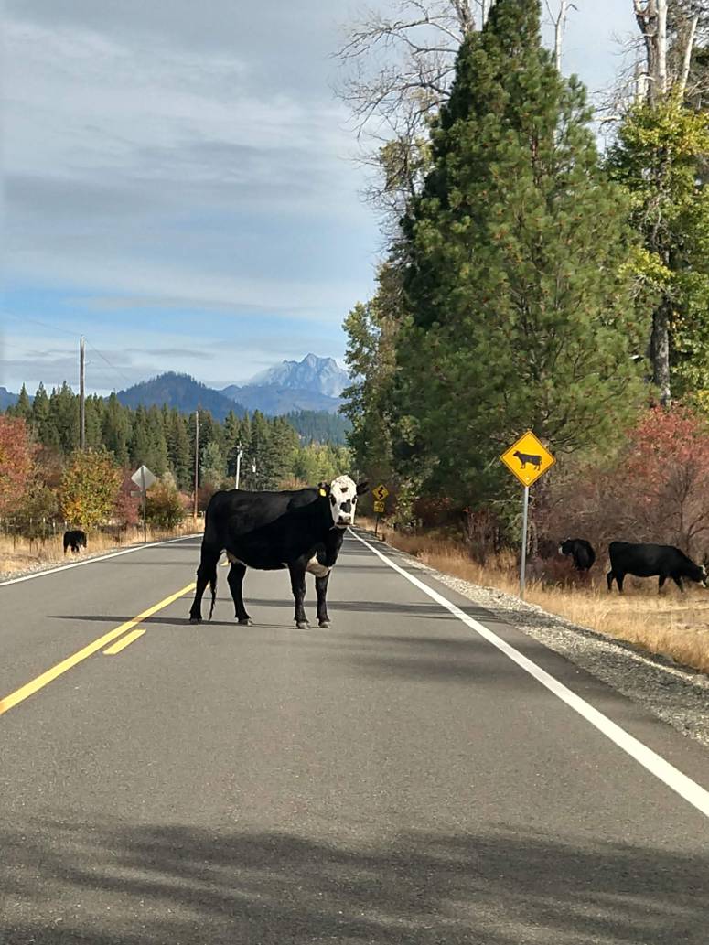
I was spending a couple days in Wenatchee, so I decided to take advantage of a great hiking day and go into the Teanaway Range. Besides some cows in the road and a few deep ruts, I was able to make it to the trailhead in our Honda Fit without much trouble. There weren’t any other cars in the parking lot, and indeed I didn’t see any other hikers all day.
I signed in at the trail register around 11 AM, crossed the bridge over Beverly Creek and then continued along the trail. I continued straight (left) at the first trail crossing and continued a slow, steady uphill until I reached a flat campsite. Here a couple GPS tracks I had downloaded went right, but I didn’t realize that there was a trail for me to follow so I totally missed it even though there’s a sign and everything. I found it on my down track.
I climbed a sparsely vegetated slope until I reached the southeast ridge of Bills Peak, then I turned left (northeast) up a steep scree slope (here’s the part where you actually have to go off trail). I found a few decent boot paths but it was a pretty slow slog up the scree field. On the way down I went farther skier’s left (east) where it’s more vegetated, and it’s probably a bit easier to go this way in both directions. It might have been a good scree field to plunge step down, but I wanted to preserve my new trail runners!
I eventually reached the scramble below the peak. There were multitudes of light trails to follow, but I tried following the most worn trails in hopes of choosing the best route. It worked out pretty well, but there were one or two 3rd class moves that I was able to avoid on the way down. The summit itself was on a rock outcrop above a large plateau. I took a kind of sketchy slab route up the east side of the rock outcrop, but there were better scramble routes on the southwest side. The route I took down was only a 2nd-low 3rd class scramble along a ramp, so keep an eye out for it. There were a few tiny patches of fresh snow that were easily avoidable.
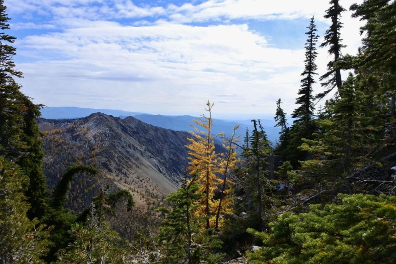
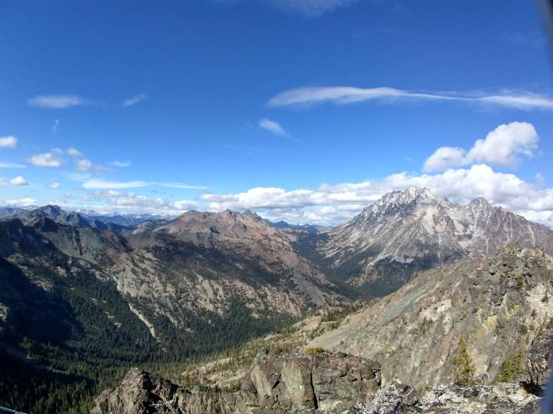
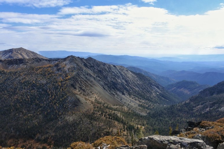
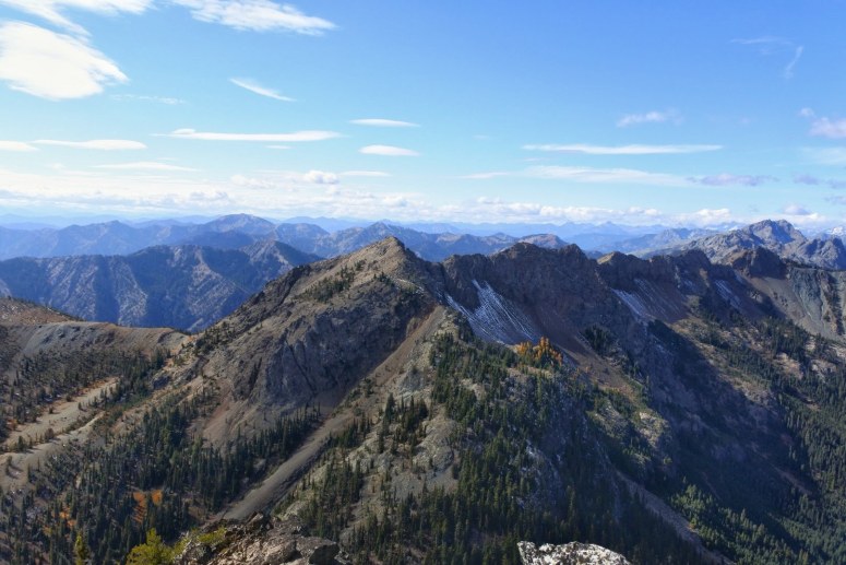
The views from the top were spectacular!!! Some of the best I have ever seen. There were a few larches in various directions, but only one that I saw on Bills Peak itself.
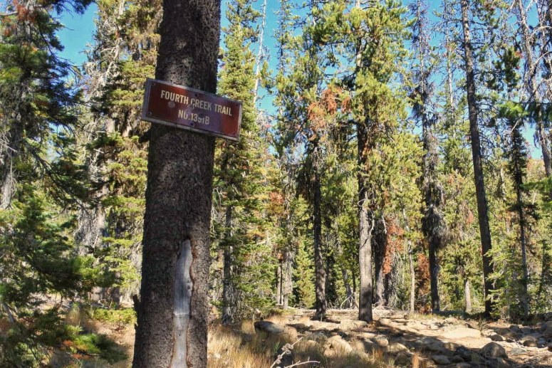
As I mentioned earlier, I took a slightly different route on the way down that was better overall. I found my way to the Fourth Creek Trail that I had missed earlier, which consisted of lots of dusty switchbacks. I reached Beverly Creek Trail and made my way back to the trailhead. I finished up around 4 PM.
(Download the free Gaia GPS app on your phone to view tracks and then get a Gaia GPS membership if you want offline access. Discount below!)

Gear Used:
- GPS
- Trail runners
- Trekking poles
Post may contain affiliated links